Sunday, April 5th
Sunday morning dawned clear and brisk. Not too chilly for us outdoor types, but enough to make me find a jacket. I’m a morning person, always waking with the first light of dawn, wide-eyed and bushy-tailed.

We had a simple breakfast and packed up our gear. It didn’t take us long to decide to ride back up to the ridge and explore the next part of the Little Shephard Trail. We did stop at the office on the ridgetop and took advantage of the flat pavement there to lube our chains. Mine had loosened somewhat, so I adjusted it. First time in 4,000 miles I had to do that. It was also the first time in that many miles that I had ridden it this hard, which really wasn’t that hard at all.
The next few miles of the trail were also paved and dropped quickly downhill to a gap. This was Highway 160, the route we planned to take back into VA. As we headed up the road, I caught a glimpse of the continuation of Little Shephard Trail on the other side. It appeared to be unpaved. Later research at home indicates this “trail” is 38 miles long, with only 18 miles paved. Definitely something to come back and explore on another trip.
We soon came to the top of the mountain ridge again and Brian pulled over at a small parking lot. He had told me that Black Mountain was nearby. It is the highest point in Kentucky, so of course we’d have to stop and bag another high point. He headed up the old paved road that followed the ridgeline into the trees, and I followed him. This road was wider than the “trail”, but it was older and less maintained, so we dodged a lot of potholes as we slowly climbed along the ridge.
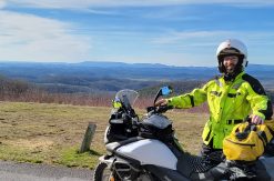
Eventually we popped out at a clearing beside a radar installation at the end of the pavement. We could see the towers over on the real summit, about two hundred yards away. There was a huge water-filled pothole across the dirt road and then a rocky road up to the towers. Brian was about to park and walk up, because he knew there was a gate across the road. He had been here before to install some anemometers on the tower. But I was in front and could see that the gate was open. Over the hum of the bikes, we hand-signaled a decision to go for it, and I took off. I skirted the edge of the water as best as I could and then headed up the rocky road. This piece of road was much rougher than any other riding I’d done on the V-Strom so far, but it went just fine and within a minute I was parking it on the highest spot in Kentucky. Cool! We took a few pictures and had a snack before hitting the road again.

Back on the road we dropped down the mountain and went through two towns. The first was dirty and depressing, like the stereotypical coal mining town, but the second was well taken care of and very pleasant to ride through [insert picture here]. It was still early on Sunday morning, so no one was out and about.
Then we rode into VA and through Appalachia. From here we chose to stick to faster roads and just make some time. I still had to get all the way back to Cary that day. In Damascus, we stopped at the second-slowest Wendy’s in the US and had lunch. I had to go with a vanilla Frosty, as they were out of chocolate. Blasphemy.
From there we rode through Abingdon and decided we should have come here for lunch. Seemed like a neat little town, with the VA Creeper rail trail running through it, and lots of people out and about.
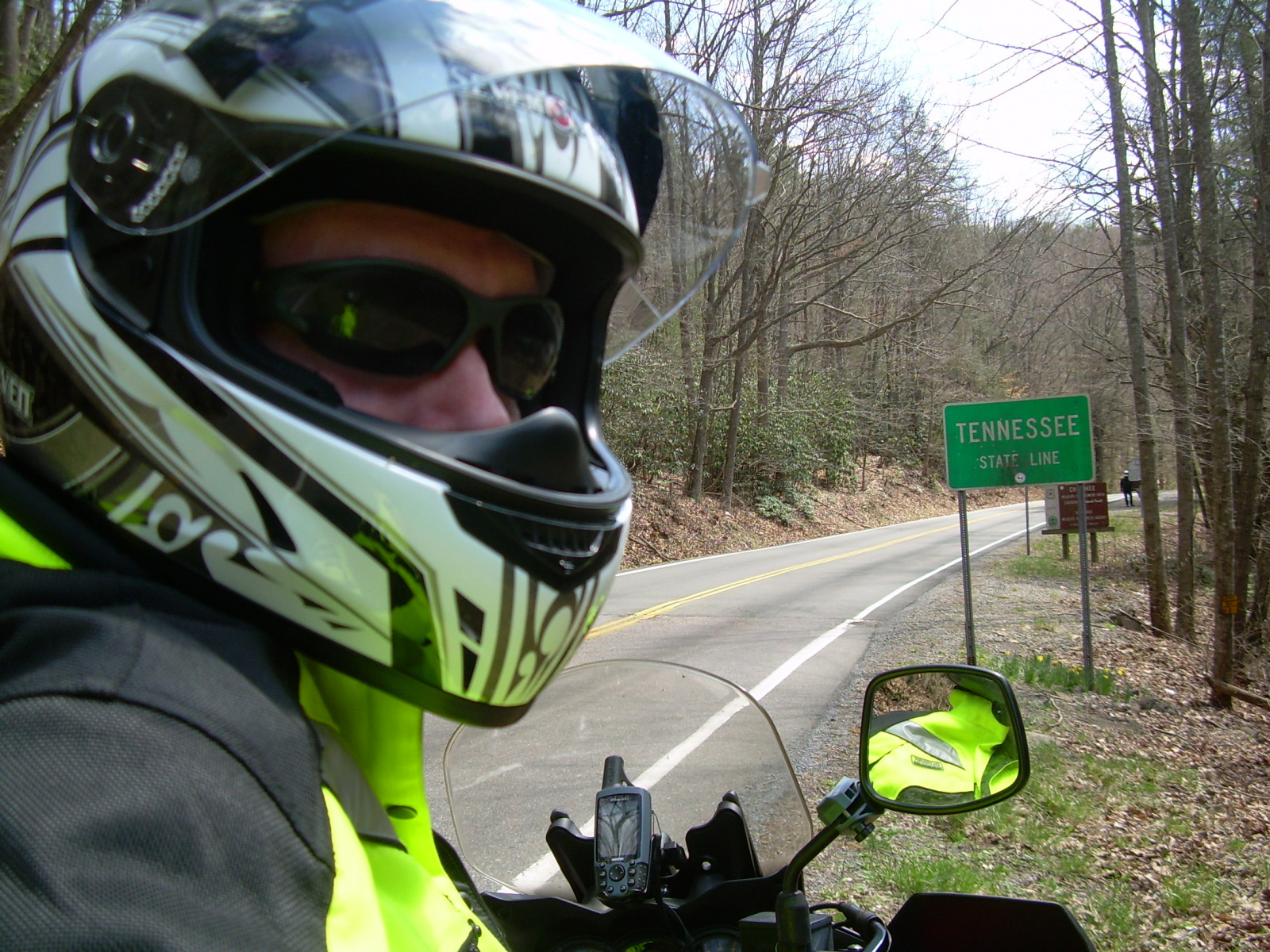
A few miles south of Abingdon we crossed into Tennessee, the sixth state I’ve ridden the motorcycle in.
We cut through Mountain City and then followed 421 back to Boone. I only stopped for a little while at Brian’s house before hitting the road for home. It’s a 3-hour trip by car on the four-lane highways. I had ridden up on smaller roads because of the winds and that took me 4 hours. I started out the return trip on 421 with the intention of making good time, but the winds were back up and pushing me around again, so I jumped over to 64. I wasn’t paying enough attention in that section and ended up visiting another county that I had not been to before. I finally made it home at 8:30 pm, which was four and half hours riding from Boone, but at least I was finally home.
Mileage for the day: 362 miles
Trip mileage: 818 miles
It was a bit rainy the following week, so I ended up not riding to work like I usually do. When I got around to checking on the bike, I discovered the noise with the chain was due to a roller seal in one link that was blown, causing the link to climb up on the gear tooth and “pop” when it slid off. I ordered a new chain, a chain tool, and both sprockets, and taught myself how to change those.
Overall, the trip was a success. I learned a bit more about what I need to moto camp. I learned a bit more about riding. I just need more time to get out and do it! Hopefully, we can get things to work out so that we can ride out to the Four Corners area this summer. I’ll keep my fingers crossed!