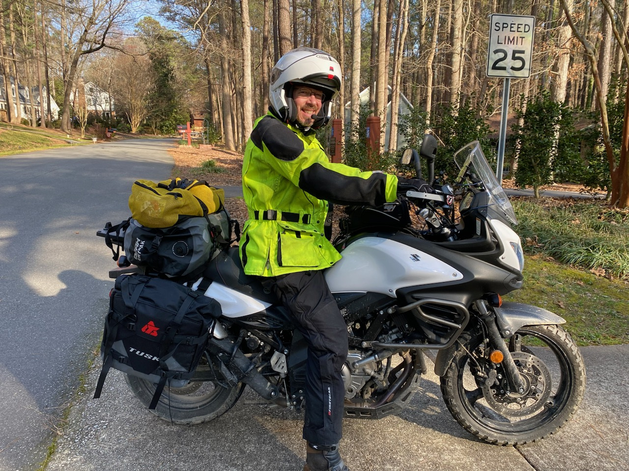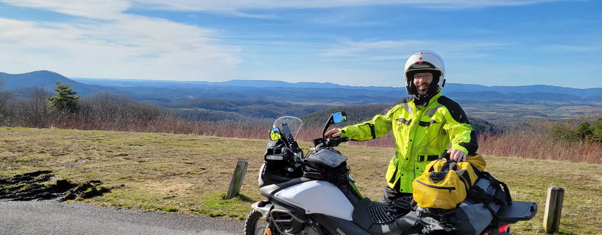
Brian and I made a last-minute decision to spend a couple of days taking advantage of the above-average February temperatures and squeeze in a moto trip. By last-minute, I mean we gave ourselves less than a week to prepare for this three-day trip.
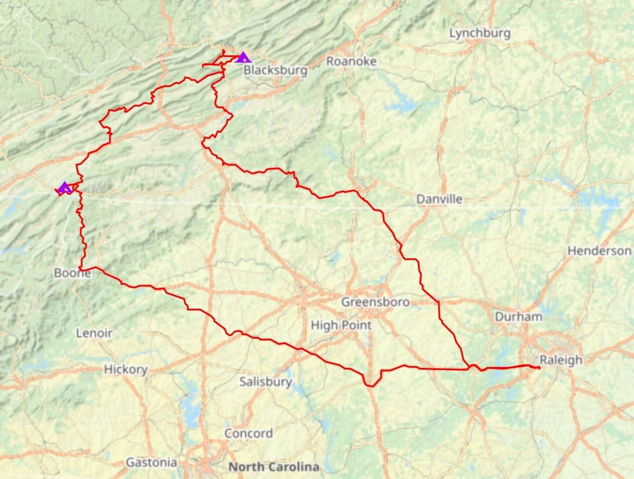
Our primary goal was to ride part of the Mid-Atlantic Backcountry Discovery Route (MABDR). The MABDR is a 1,000-mile-long route through the Appalachian Mountains that mostly follows rural and gravel public roads. There are BDR routes in other areas, but this one runs from Damascus, VA to the PA/NY state line. We were only going to ride a little bit of it at the southern end on this trip.
To make our trip more of a loop, we decided to also follow part of the TransVirginia Valley route (TransVA) which roughly parallels the MABDR through Virginia. We bikepacked this route a few years ago. The TransVA also follows as many gravel and dirt roads as possible, so both routes are very similar in nature.
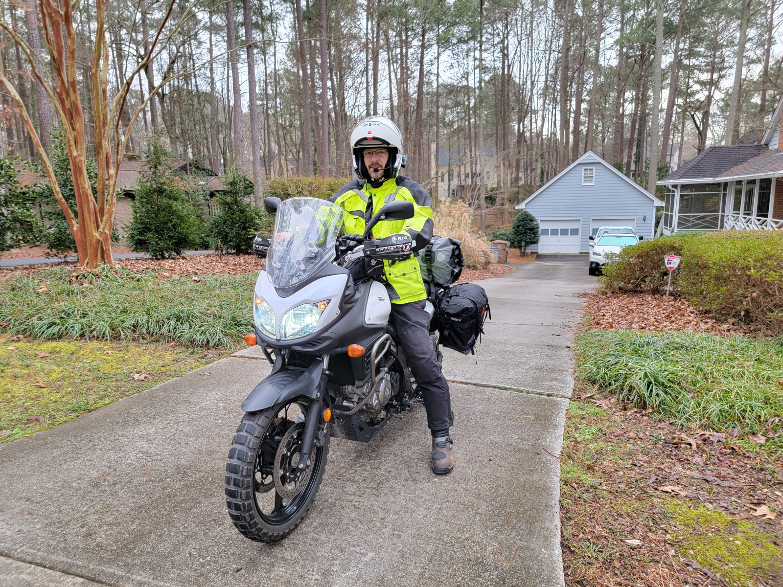
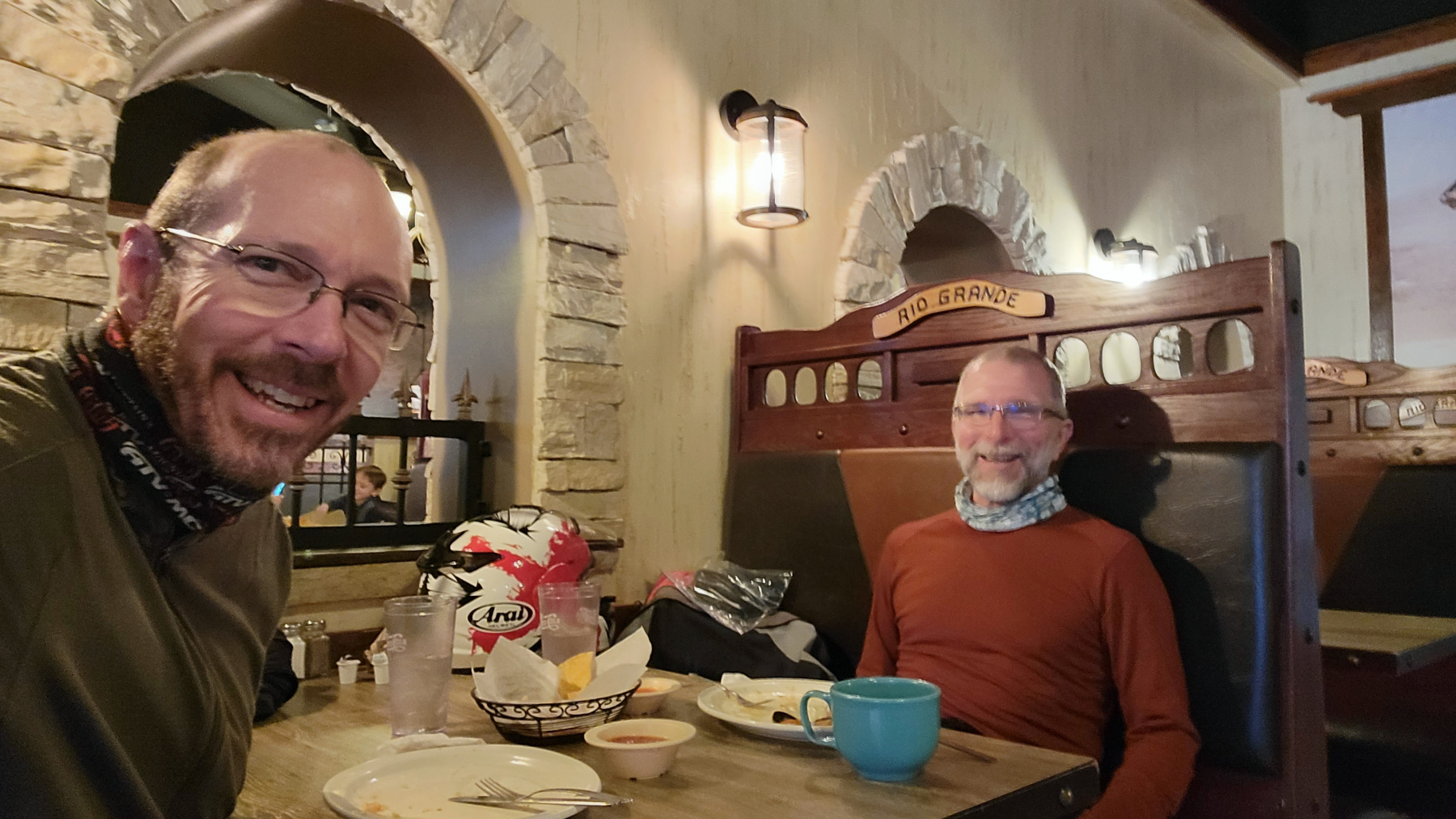
We met for lunch at a Mexican restaurant in Hillsville, VA. Hillsville is on a direct line from where I live to the closest point on our planned loop. I just had twice as far to ride to get there as Brian did. That’s one cost I pay for living where winter is mild (and summers are broiling).
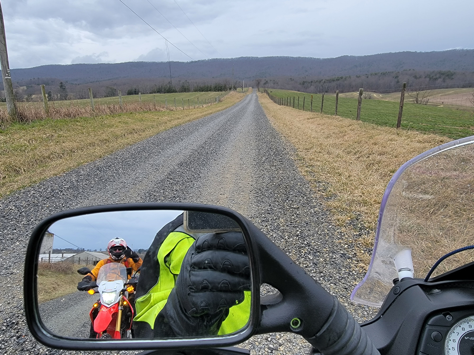
From Hillsville, we rode to the Jackson Ferry Shot Tower on the New River and then headed northeast. Because the TransVA is a route for bicycles, it actually uses the New River Trail State Park path in this area, which we could not ride with motorcycles. We just paralleled it on country roads until we reached Pulaski. North of Pulaski, the TransVA route follows public roads, so we were able to follow it exactly.
Not too far north of Pulaski, the TransVA route follows Alum Springs Road over one of southwest Virginia’s numerous ridges. The geography in this part of the world is a series of parallel ridges and valleys.
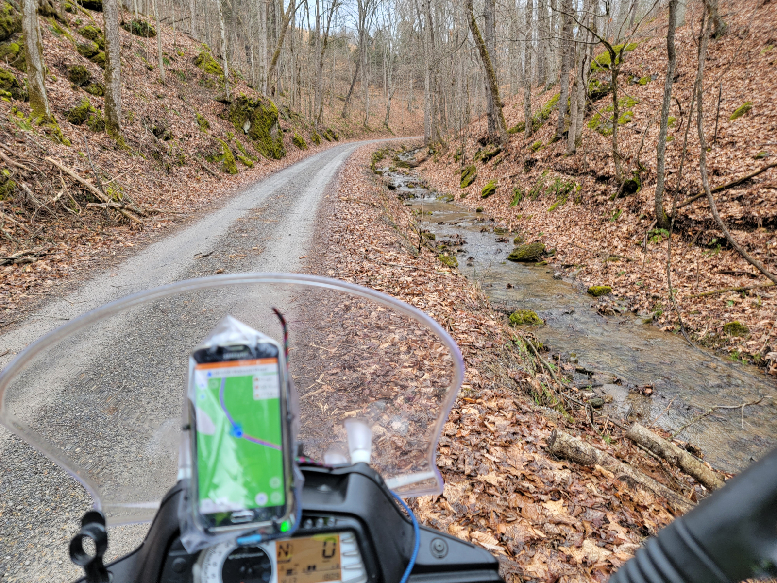
When we bikepacked the route, all three of our group ended up pushing our bikes up this steep dirt road. I remember it as the roughest section of road on the whole trip. On a motorcycle, it was a little easier going up but was still challenging. It just required a different set of muscles and skills!
Going down the west side of the ridge was even more challenging. That side of the ridge was muddier, with piles of wet leaves on the road. My motorcycle’s ABS system released my brakes every time it detected a wheel sliding, which happened a lot!! And it was always when I needed to stop or at least slow down. Fortunately, I managed to keep the bike upright and on the road. I breathed a big sigh of relief at the bottom!
Even though I found myself at a dead stop several times during the descent, it never occurred to me to pull out the camera and grab a pic of the mess we were riding on. I guess self-preservation was occupying all of my mental capacities at the time!!
The rest of the route to Pembroke was uneventful. We enjoyed riding several nice mountain roads.
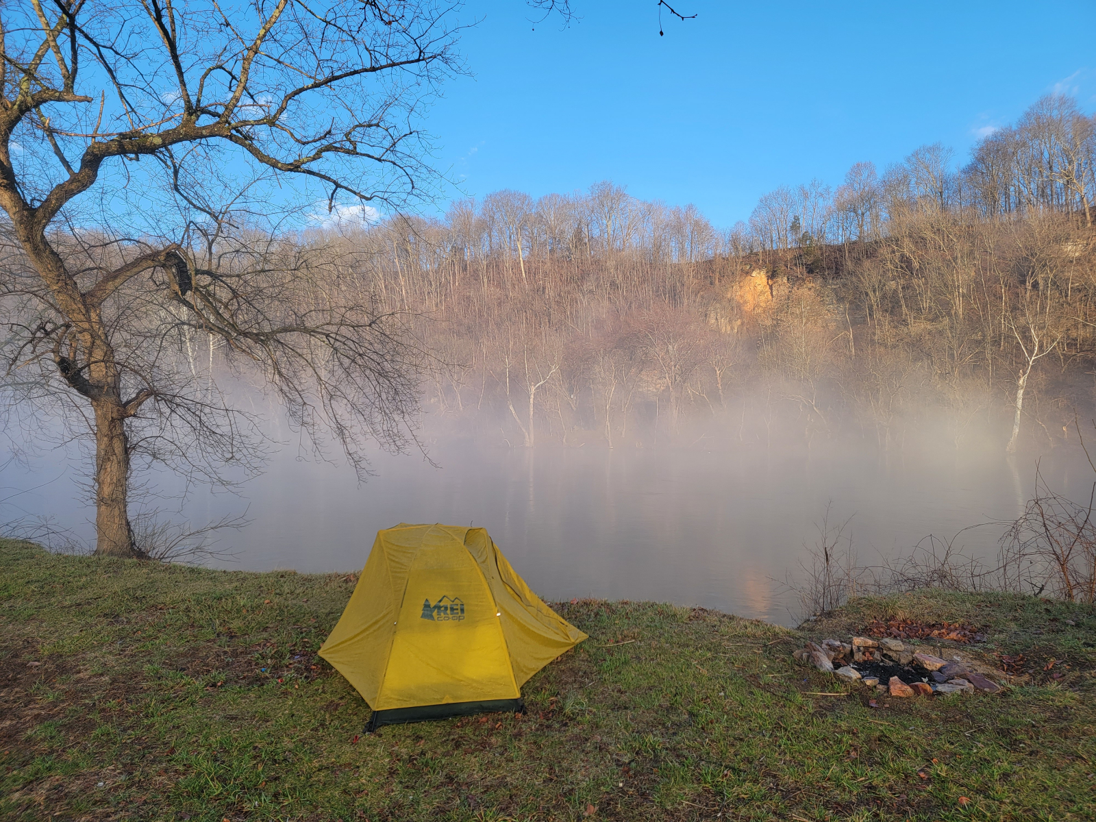
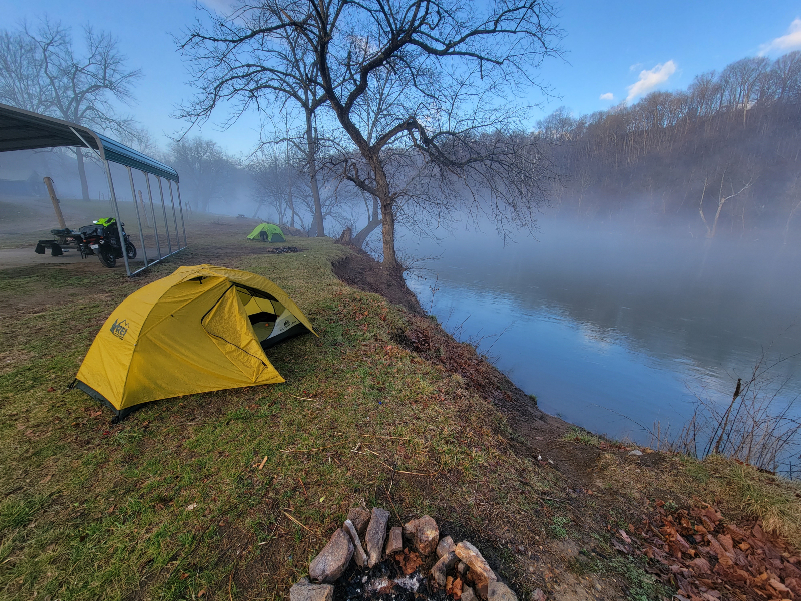
Brian had made a reservation for us at the Eggleston Springs Campground. The tent sites were all empty, surprise surprise. The host said we could park and camp under the picnic shelter if we wanted since more rain was expected. We did park under it and pulled a picnic table under it, but we chose to pitch our tents on the grass at the edge of the river bank.
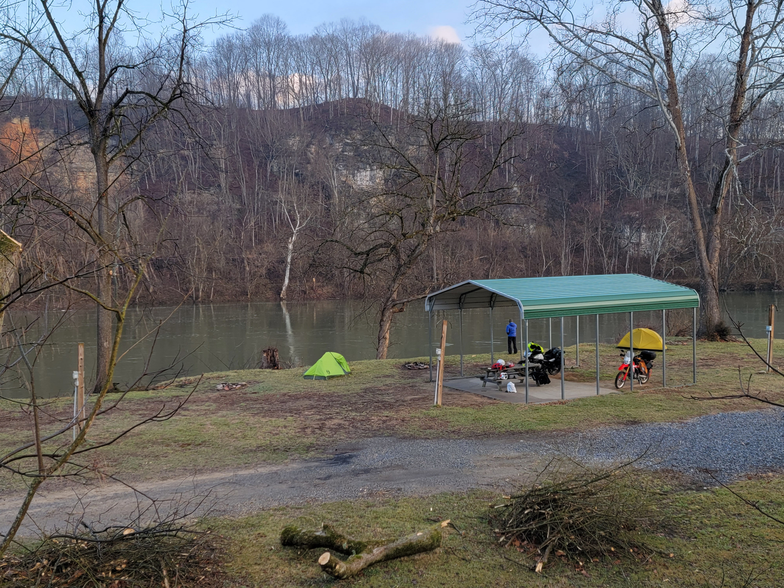
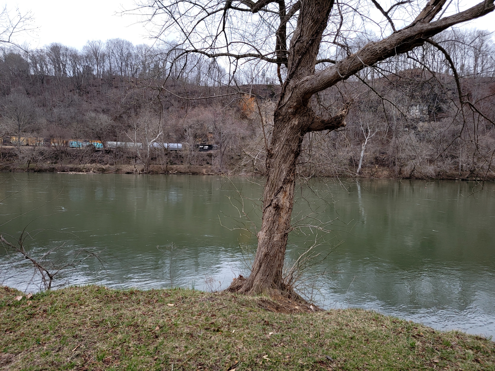
The campground’s website mentions there active train tracks on both sides of the campground. The tracks on the far side of the river entered a tunnel directly across from us. Watching the train, and the noise, disappear into the tunnel was neat. The other trains just made a ground-shaking screech all the way past us. At least the trains did not run all night long!
We had a little rain overnight, but the morning treated us with blue sky and shifting fog in the river valley. It was quite scenic.
The two routes, TransVA and MABDR, actually used the same roads for a couple of miles before we reached the campground the day before. When we left the campground, we backtracked until we could detour into Pearisburg to gas up.
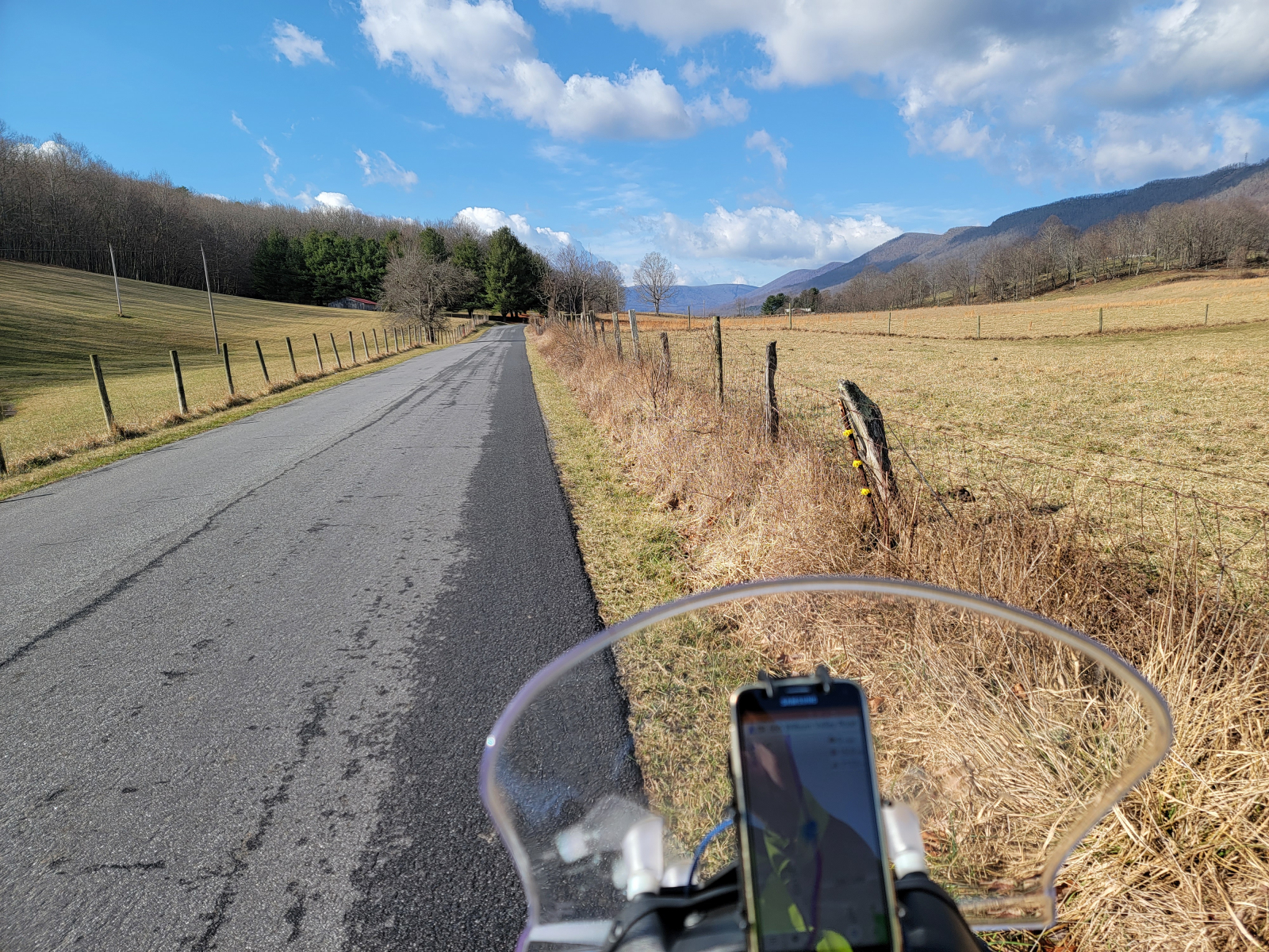
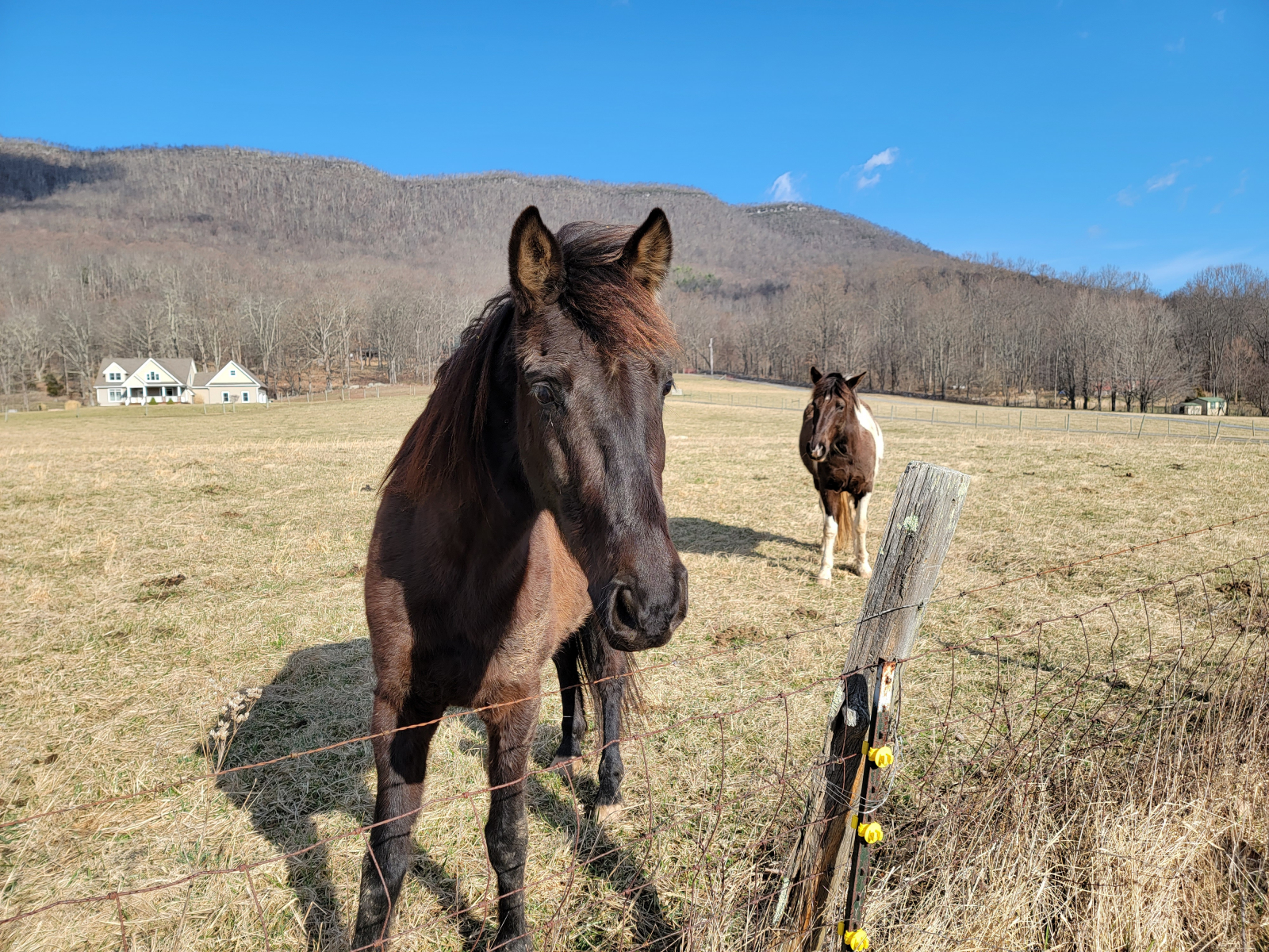
Once we returned to the MABDR we headed southward on Wilburn Valley Road. The sky was blue, the sun was shining, and we were riding through a farm valley with forested ridges on either side. It was so pretty I had to stop and take a few pictures. The locals greeted us.
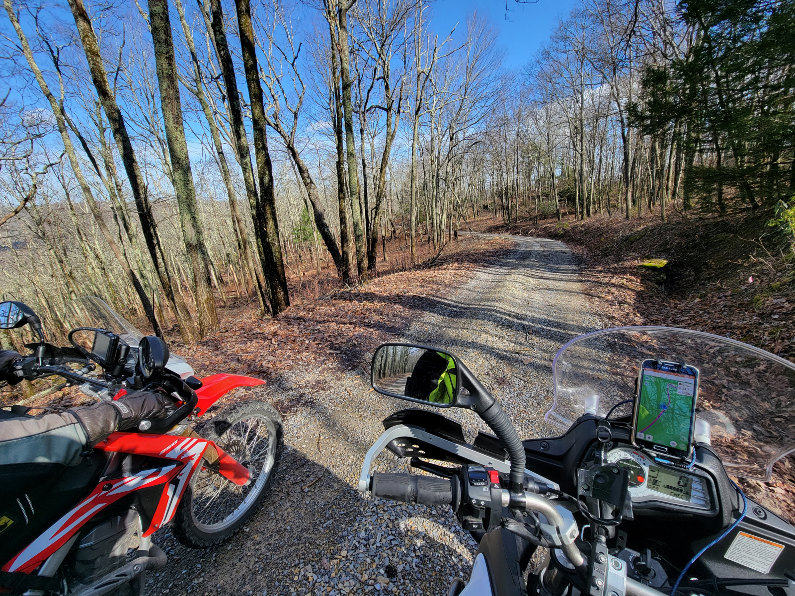
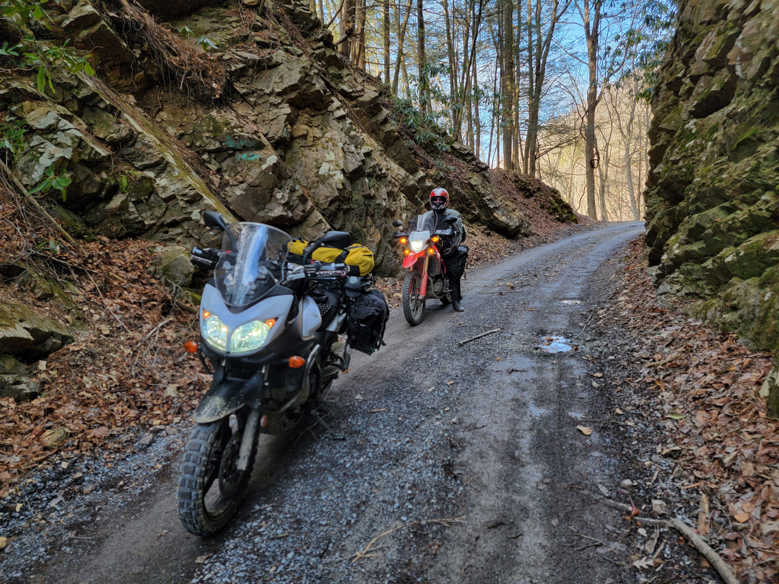
We soon found ourselves climbing up another ridge on a gravel road – perfect! That’s what we came here for. There were some small fallen limbs lying on the road, but nothing we could not ride over.
As we reached Big Horse Gap, we encountered a closed gate. Yikes! We didn’t realize the Forest Service closed a number of its roads for the winter months. This was a painful reminder that I should have checked the rideBDR.com website for route updates before we left. And brought along the paper route map. I left it sitting on my desk at home.
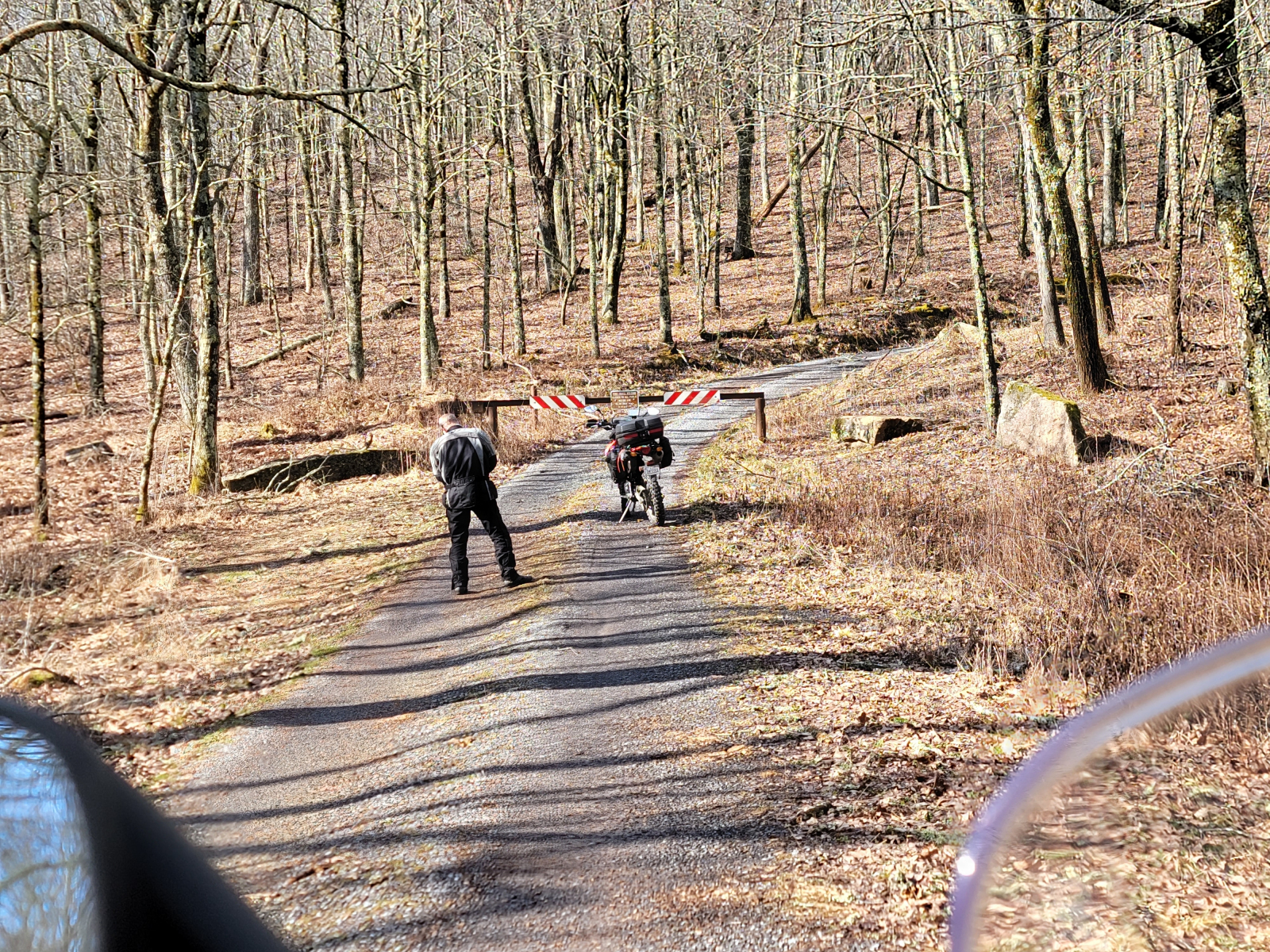
Fortunately, we were able to figure out a bypass route pretty easily. It added about 20 miles to our day, but that was ok since about half of it was on other gravel roads, some of which we had ridden the day before.
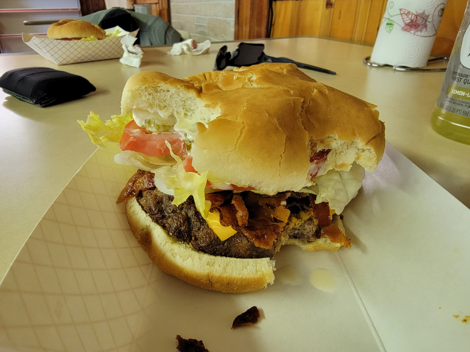
When we reached US 52, I spotted the Brushy Mountain Outpost and it appeared to be open. This little store is one of the few stores right on the route. I had seen mention of it online several times. At this spot, the Appalachian Trail follows the same road as the MABDR, so this is a popular stop for hikers too.
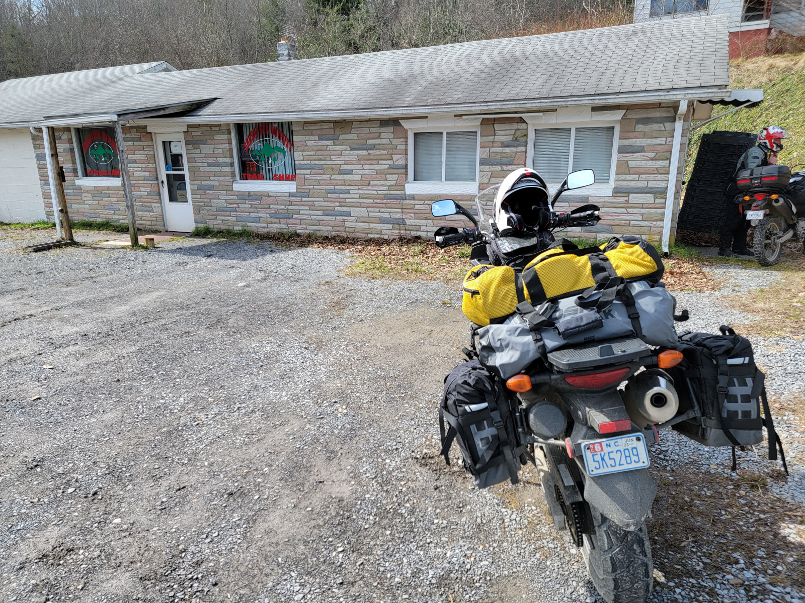
We weren’t planning to have lunch here, but it was after 11:30 am. Their grill was open, so we had Barbara cook us a couple of cheeseburgers. They were huge. Great decision!!
After lunch, we followed the route as it went up and over a ridge into Poor Valley. I traveled these roads a lot back when I was active with the Piedmont Appalachian Trail Hikers. The section of AT that we maintained runs through this area.
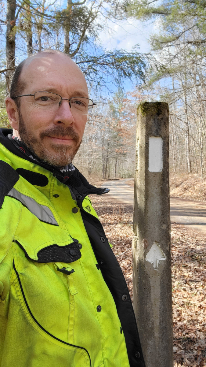
We stopped at a pull-off where the AT crosses the road and I noticed a tall concrete post with an AT blaze and the letters AT inset into it. I remember helping set that post in place back in the early 1990s!! Pretty cool that my path has circled back around to this spot!
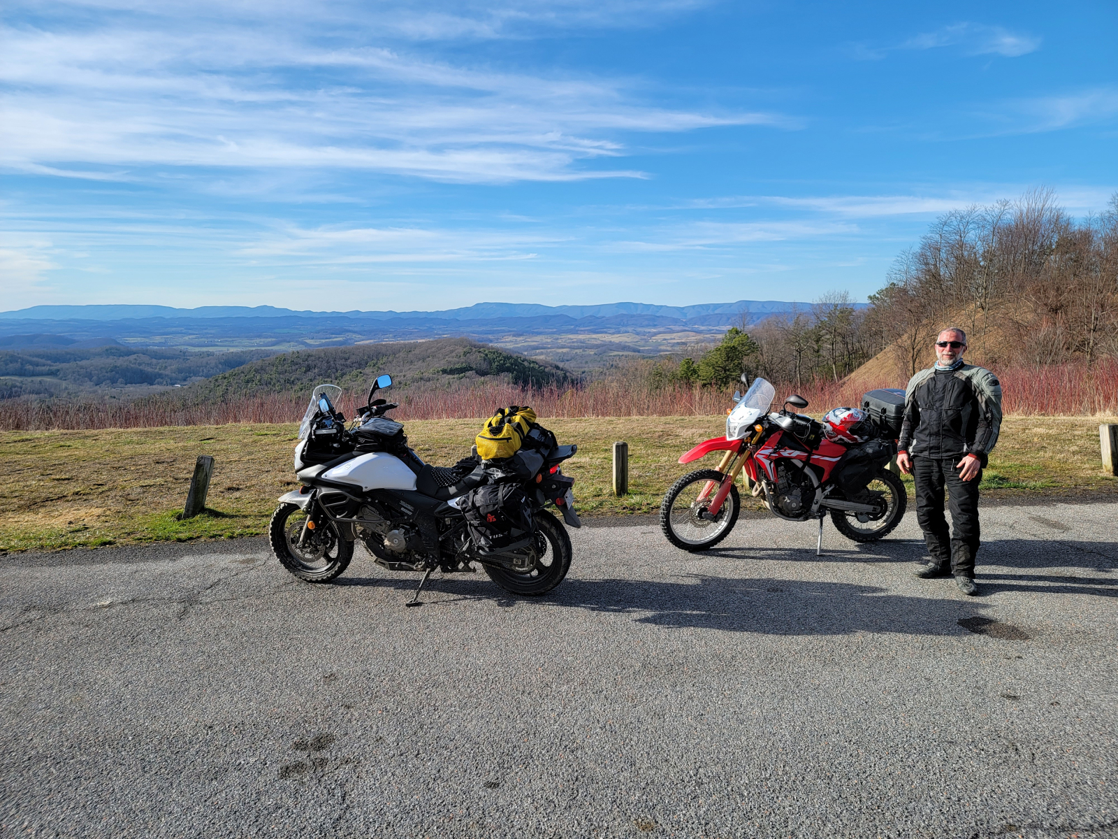
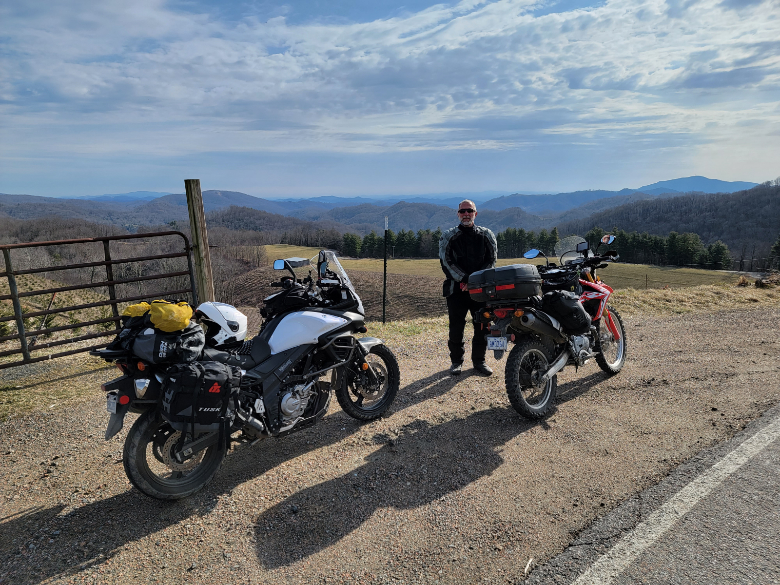
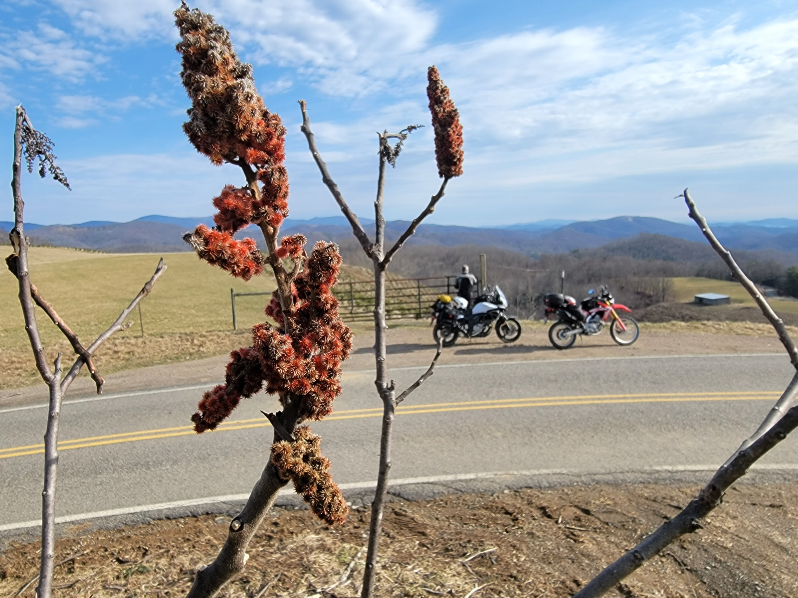
South of Marion, VA we crossed over the Iron Mountains. We stopped at Skulls Gap Overlook and enjoyed the views there for a few minutes.
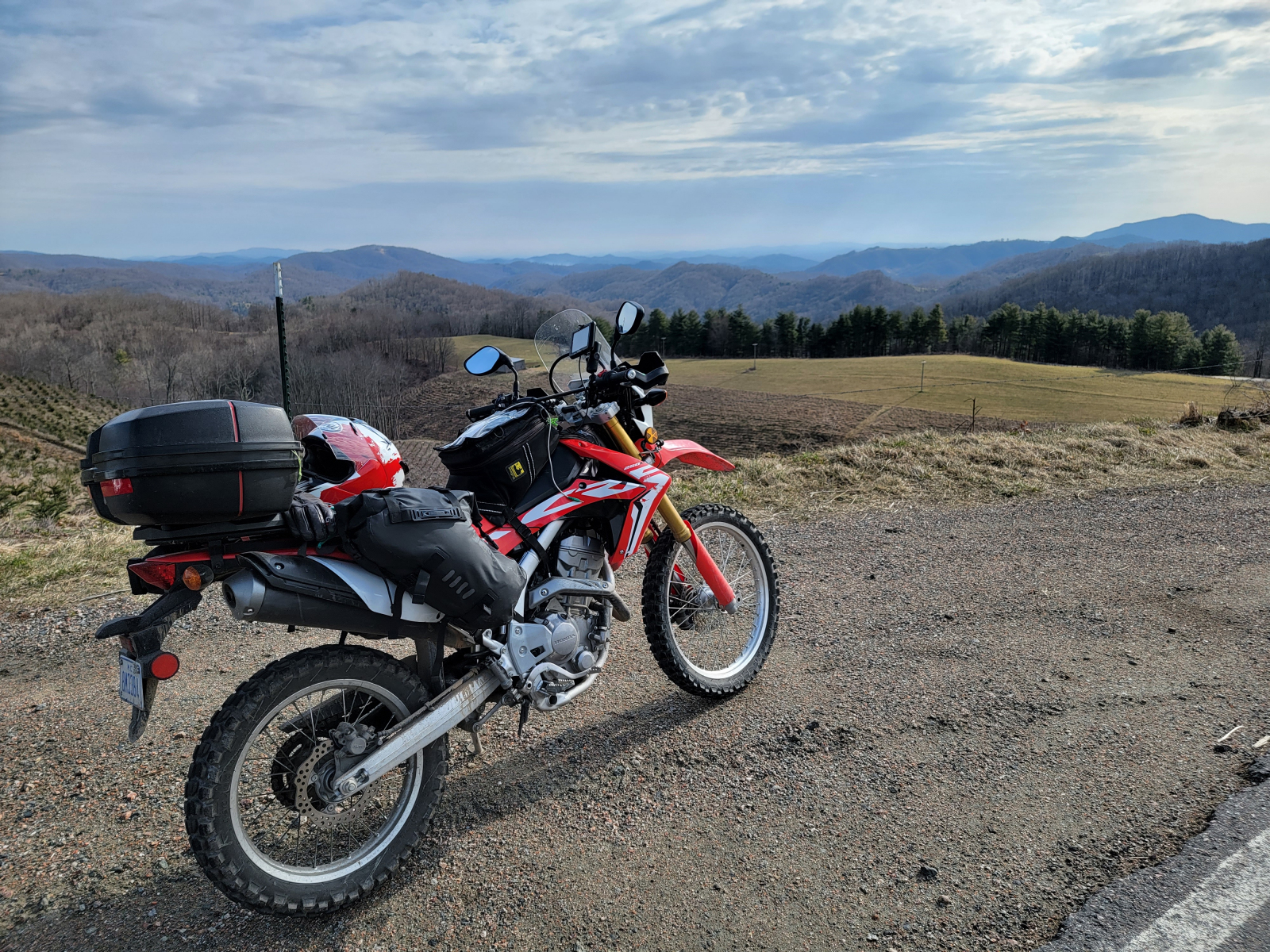
After crossing south of US 58, the route took us along Grassy Ridge Road. This gravel road was once a railroad bed. I had to stop at the deep rock cut and take more pictures. It was a tight squeeze when I drove my truck through here a couple of years ago!
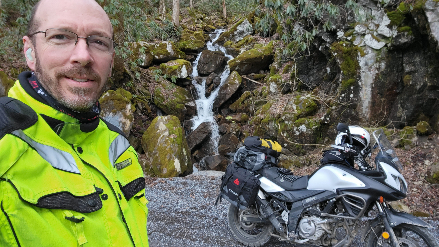
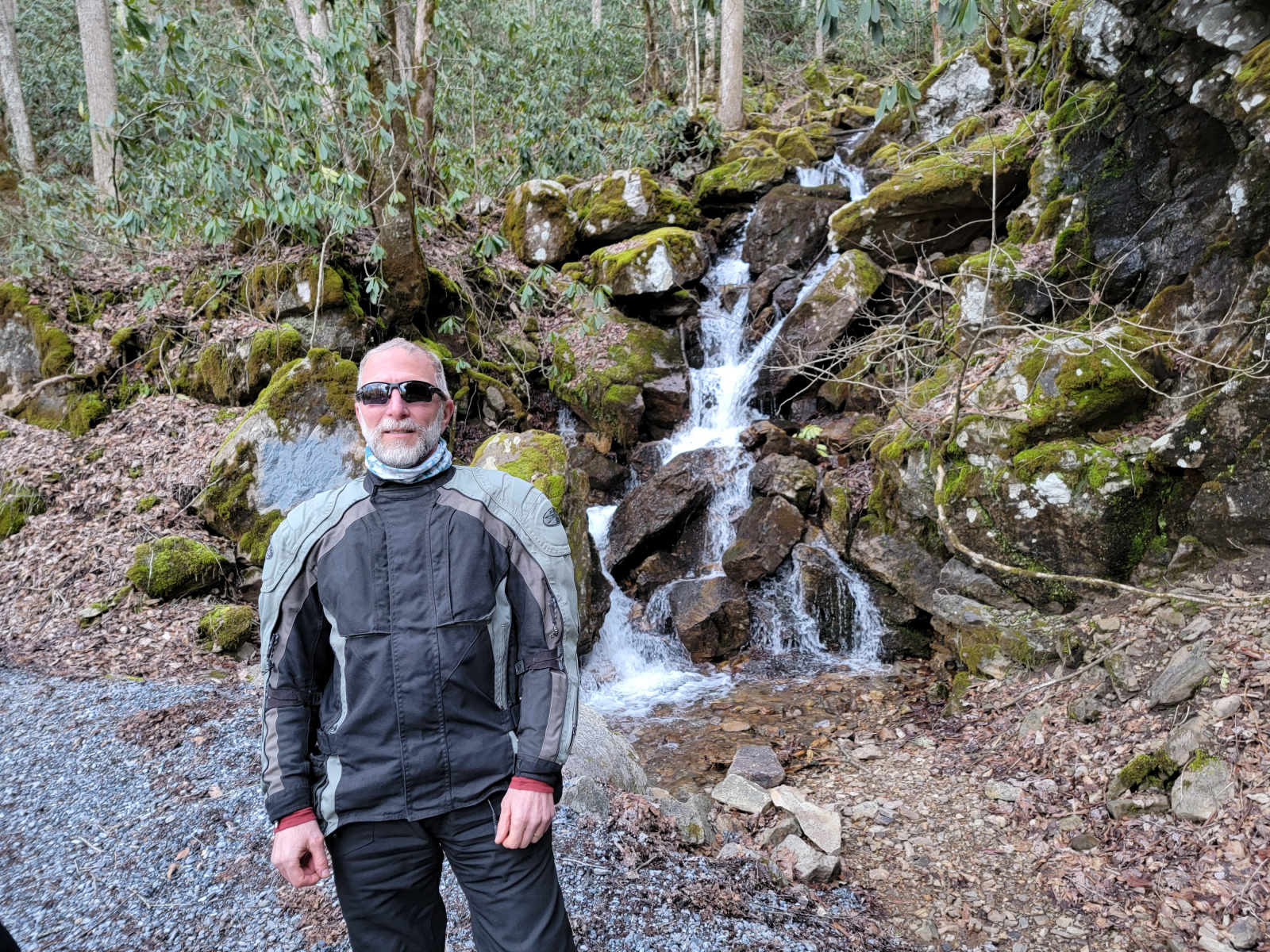
A little further south, the route led us down Chestnut Mountain Road, which crosses back and forth over the Virginia and Tennessee state line a couple of times. At one of these spots, there is a small but pretty waterfall right beside the road. You can park on the edge of the gravel road right in front of it and take a cool picture. I did.
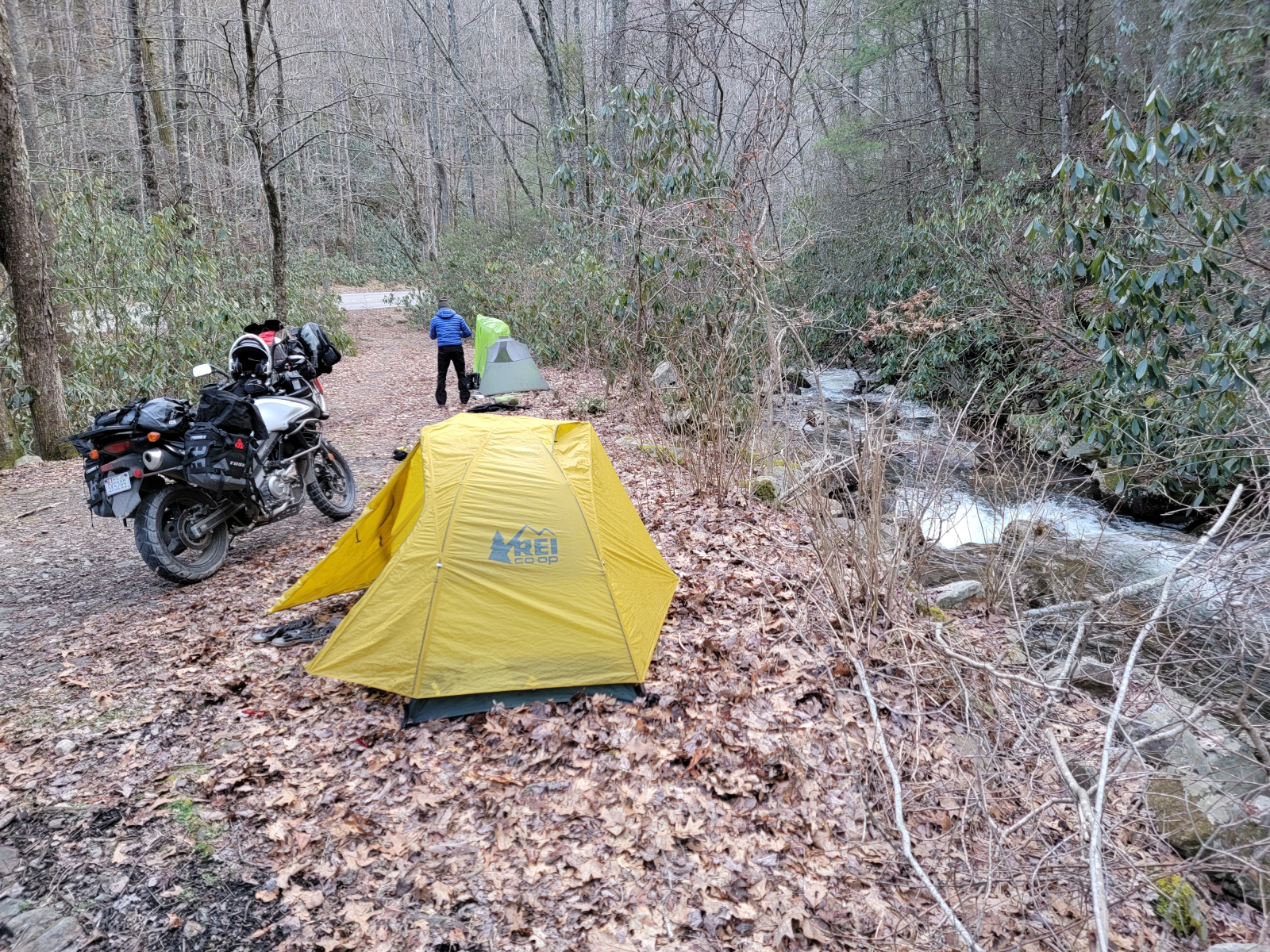
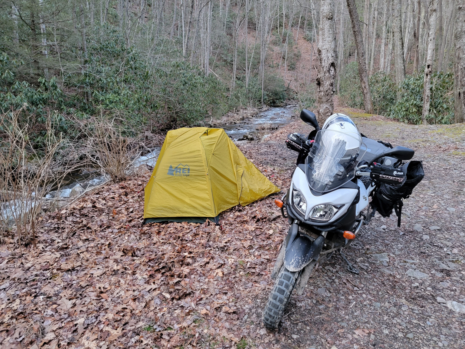
We eventually made it to Damascus and stopped at Crazy Larry’s hostel. We still did not have a plan for where to stay for the night, which is rather unlike us. We’re trying to be more flexible in our old age! We asked Larry about tenting. The town won’t let him have tenters in the city limits, but he suggested some pull-off spots we could camp at long highway 58.
A few miles later we had found a decent-enough spot. We pitched out tents beside a small but roaring stream and relaxed for the evening. It was just getting dark as we finished dinner.
The next morning we rode up to the community of Whitetop and picked up the TransWNC route at the end of the Virginia Creeper Trail. The TransWNC is another bikepacking route. This route follows backcountry and gravel roads from Whitetop south to Boone. We have biked and moto’d this stretch a couple of times before. One of those times it was raining and sleeting on us, but this morning the weather was beautiful!
Shortly before getting into Boone, we parted ways and I headed for home. The end-of-the-trip ride from the mountains back to the Triangle always seems soooo long!!