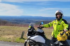
Saturday, April 4th
My watch alarm went off at the usual 6 am, and I promptly rolled over and dozed a little longer as the sky lightened up. I got up around 7 and found something to eat. Most of our stuff was already packed and loaded on the bikes, so it didn’t take long to get ready. It was 37 degrees outside, but the sun was coming up and the sky was clear. The forecast was for a high in the 60’s so it would be warming up soon. Right?
We rolled out of Brian’s driveway at 7:49 am.
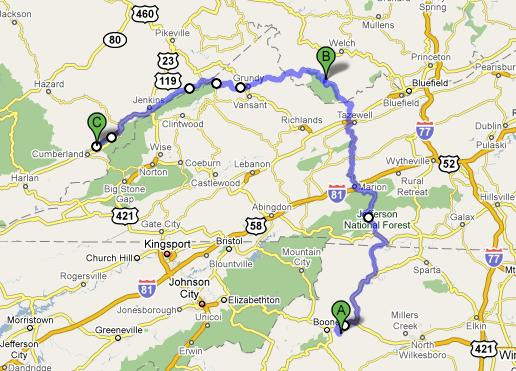
Even though it was still 37 degrees, it didn’t seem quite as cold as I remembered when commuting to work at 37 degrees. Maybe the adrenalin of being on a trip makes a difference. We scooted back up the parkway and got off near Parkway Elementary, where my cousin Donna teaches. We cut over to 421 and then turned onto 221 north.
The winds that kicked me around yesterday were still whipping this morning. The forecast called for a wind advisory until 9 am. I figured we’d have winds until 10 or so. I followed Brian up 221 towards Jefferson. It wasn’t long before I found the familiar death-grip, seat-clench position as gusts hit us from the side. I was pleased that Brian was getting to experience the stuff that made me skip out on more riding Friday night. Otherwise, he might have thought I was just a sissy rider. Could be true, but it was still nice to share this joy!
In Jefferson, we turned onto 16 north. The section up to Volney, VA was very familiar as we use this route frequently to get to Mt. Rogers, one of our favorite backpacking destinations. We stopped at the gas station in Volney to top off my tank, but they were out of gas.
We had both read descriptions of Hwy 16 being as curvy as the legendary Tail of the Dragon, albeit not quite as well maintained. It certainly had length on its side. We picked it up in NC and planned to follow it all the way into WV.
One of my ‘lessons learned’ on the trip was that I should stop and take pictures more often. This part of the country is geographically described as a series of parallel ridges and valleys. Hwy 16 cuts perpendicularly across these ridges and valleys. The result is a road that climbs up a ridge and then drops into the next valley, with plenty of curves in between. We got quite familiar with the signs that said: “Curvy road, Next 3 miles” [insert picture here]. I even commented to Brian at one stop that I wanted to get a picture of one of these signs, but I never did. So I’ll just add [insert picture here] wherever I had an opportunity to take a picture but didn’t.
Several of the ridges were pretty fun to ride up, but the north side of them seemed to have too many curves that were just too sharp going around the outer bend to be fun. I had to drop too far down in speed to safely negotiate these curves. That didn’t allow me to maintain a decent rhythm. We would find other sets of curves later on that were wider and more fun.
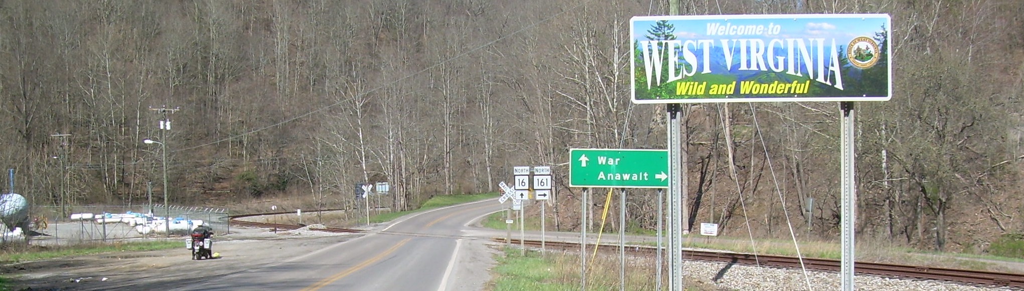
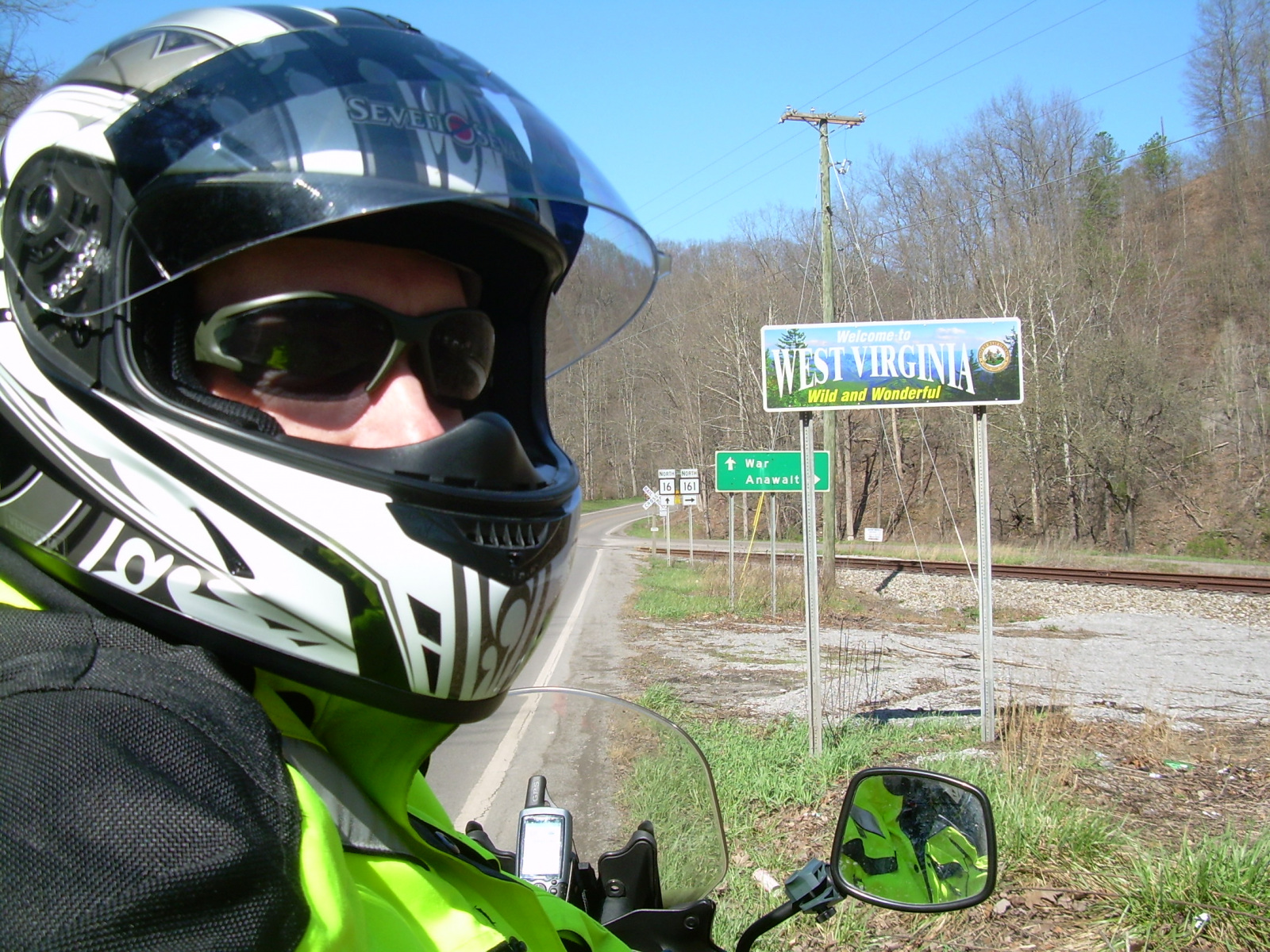
We eventually rolled through Bishop, VA and down the hill to the West Virginia state line. I finally stopped to snap a picture for my collection. West Virginia was the fourth state I’ve ridden in on the V-Strom.
From here we headed off to War.
When we were at War with each other, we passed a group of women selling hotdogs on the sidewalk in front of a small grocery store. Since it was lunchtime, we decided to stop and support the local economy, or at least their fundraising event. They were raising money for the local prom. We saw a few teen-aged girls slinking around, but it seems the mothers were doing most of the work.
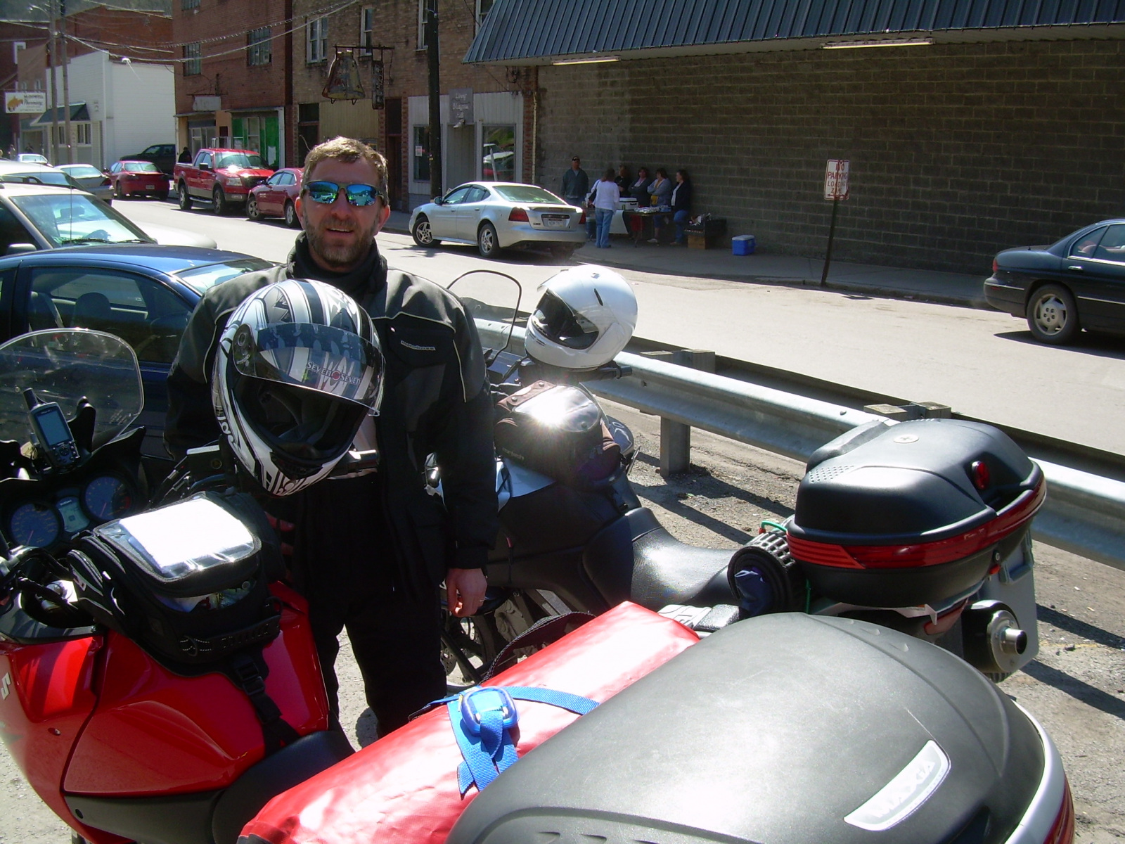
I saw a sign as we headed into town that said War was the southernmost town in West Virginia. [insert picture here] It appeared to be a stereotypical coal mining town. It was nestled in a valley along a river, with steep mountains hemming it in. The buildings all looked pretty run down although they were all still mostly in use. We did see an old school building that was obviously abandoned. We had passed a newer school coming in, which I suppose had made this one obsolete. I had hoped to find a school named something like “War High School”, which would have been sort of picture-worthy, but it was named “Southside High” instead.
After we had been to War, we rode a little further north and then turned west onto Highway 83, which would lead us back into Virginia. Our plan was to cut across some back roads towards Breaks Interstate Park and stop there for a break, of course. The route would require us to leave the major roads and take some smaller roads. My GPS said I needed to turn on Hoot Owl Road. When we got there, I saw the sign, but it was such a small, inconspicuous road that I pulled over and checked the GPS a bit closer. It looked like a driveway heading up into a holler. It was heading in the right direction, and we only needed to go about 10 miles to get to the park, so we decided to give it a try.
As we headed up Hoot Owl Road, the pavement narrowed to one lane, the houses got closer to the road (I’m talking a matter of just feet away), and the road got steeper [insert picture here]. I would bet that at one point the grade was approaching 40 degrees. It eventually reached a saddle at the top of the ridge and crossed into another valley. The other side was just a narrow going down. Even though it wasn’t a high-speed section, it had a very peaceful feeling to it. The sun was shining in a clear sky. There was fresh spring vegetation sprouting. There was no banjo music playing in the background. This might have been one of those areas where outsiders could disappear without a trace, but it certainly didn’t feel like it when we passed through. We eventually popped out on a larger road and followed it up toward the park.
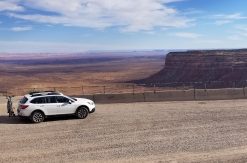
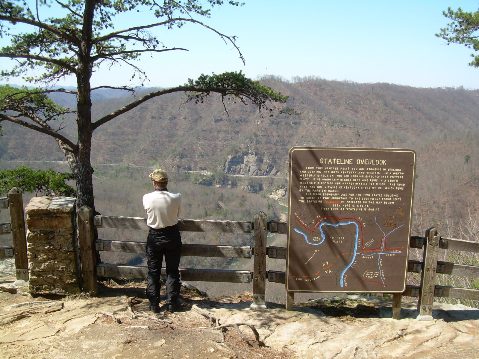
We paid our $2 to enter the park and drove down to the Stateline Overlook. The view into the valley and over to Kentucky was pretty nice. I had not heard of this park until late last year when a friend of mine told me about staying there in a lodge or cabin. When I saw it on the map while researching our route, I figured it was worth stopping to have a look myself.
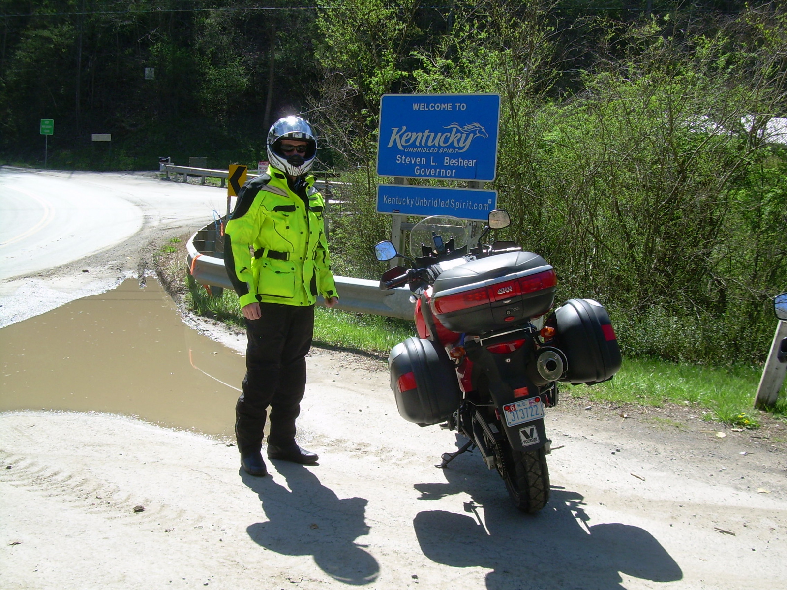
After we left the park we continued northwest and soon crossed another state line. Kentucky was the fifth state I have visited on a motorcycle.
We continued into Kentucky to Elkville, then took a left on 197 and planned to parallel the state line on smaller roads until we could pick up 119. Somewhere in that area, they had changed the roads and we ended up on a larger four-lane highway, which might have been 119 anyway. It was certainly sooner than I expected to be doing highway speeds again.
The highway soon narrowed back down to a two-lane road and climbed up over a ridge. At the crest, we noticed a small brown sign that said “Little Shepherd Trail” and had an arrow pointing right toward “Kingdom Come State Park”. That was our planned destination for the night.
We pulled over and quickly decided to check out this “trail” instead of just following 119 down to Cumberland and going into the park from the “civilized” side. What’s an adventure trip without throwing in a little “what the heck, let’s try it”?
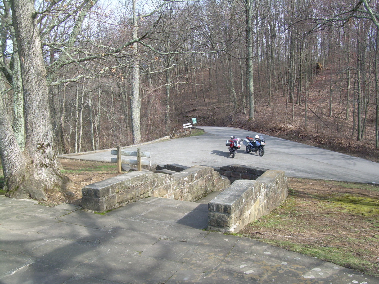
From what we could see at the entrance, the Little Shepherd Trail appeared to be a paved road, although a narrow one. We started up it, with Brian leading. It was really just what the sign said. It was a paved trail, no wider than a greenway path like the ones back home. Except that this one was on top of a remote ridgeline in Kentucky and apparently ran for 15 miles to the park.
When I was planning the route at home, the Mapsource software had routed me along this “trail” into the park, even though the map didn’t show it connecting all the way to the park. I thought the software was acting glitchy, but the further we went down this trail, the stronger my faith in the software became. We spent most of the time in second gear, sometimes first, just winding our way slowly along the ridge crest. There were downed trees still on the road edges in many places, and high weeds that leaned into the road so that the “brush guards” on the grips of my mostly-street bike actually got some use. Fifteen miles doesn’t seem like a lot, but in second gear it seemed like forever, in a good way. We only met two vehicles coming the other way in that entire distance.
As I was crawling up the sharp curves on the “trail’ in first and second gear, I started noticing a light “thunk”, “thunk”, “thunk” noise coming from the chain. I hadn’t heard it before, but then I hadn’t ridden much at such a slow speed. I think I had noticed one “thunk” when taking off from stops in the past but had never figured out what it was. I made a mental note to not forget to lube the chain well tonight.
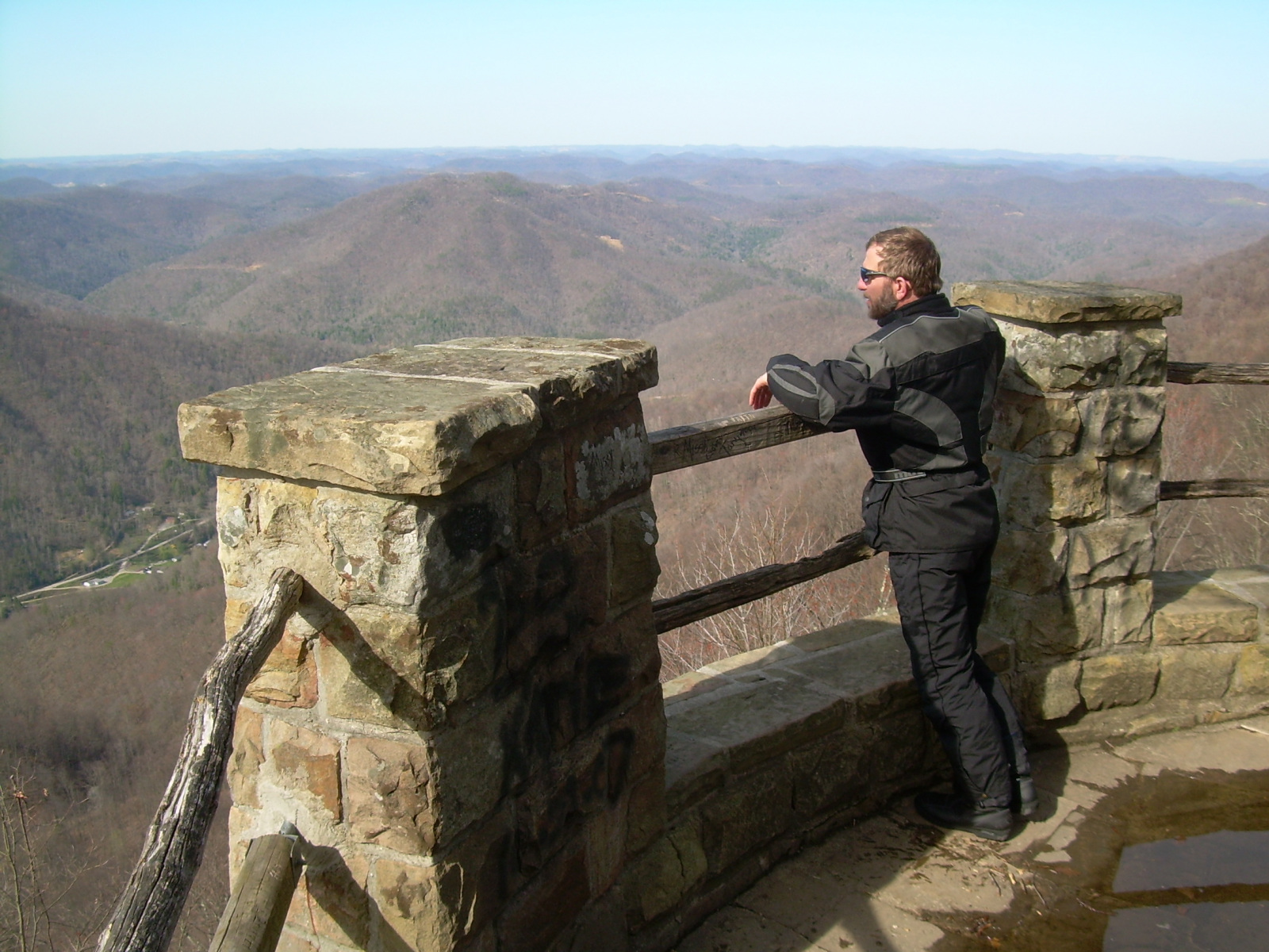
Near the park, we came upon a nice overlook and stopped for some pictures.
I even filmed some of our ride along this trail on a small video camera. Unfortunately, the clips look a bit like old bigfoot sighting films.
Shortly after the overlook we entered the state park. We had a bit of confusion finding the campground and the office, mostly because we had entered from the back side and the signs were all oriented for people coming in from the main entrance. We found the park’s maintenance shop and their headquarters building up on top of the ridge. We also noticed a sign up there that pointed to a continuation of the Little Shepherd Trail. It said Harman was 24 miles away. 24 miles?! Another 24 miles of this bizarre paved trail on a mountain ridgetop?
We rode back down through the park. We noticed a picnic area and a few sites that looked like they might be campsites. They had a big square tent pad and a picnic table, but there were just a few of them. We eventually found the office near the main entrance and paid $6 for a campsite. It seems there were only four camp spots in the park, the ones we had seen. The ranger we spoke to outside the office said the water wasn’t working at the upper picnic shelter, so we’d have to go down to the lower shelter to get water.
There were signs all over the park about the black bears. We asked if we might see any that night. The office lady and the ranger said they weren’t sure, and we weren’t sure how to take that. But we were committed to staying there, so we’d just deal with whatever bear adventure presented itself.
We pulled into the campsite just before 6 pm. We pitched our tents, walked down to get water, and settled in for the evening. I brought along a 10’ x 10’ screen house from REI. We set this up over the picnic table just to see what it was like. I thought it might come in handy on later trips. We didn’t really need it for this one, but I knew from using similar shelters in Alaska that they can make life much nicer if you’re stuck in a place with lots of bugs.
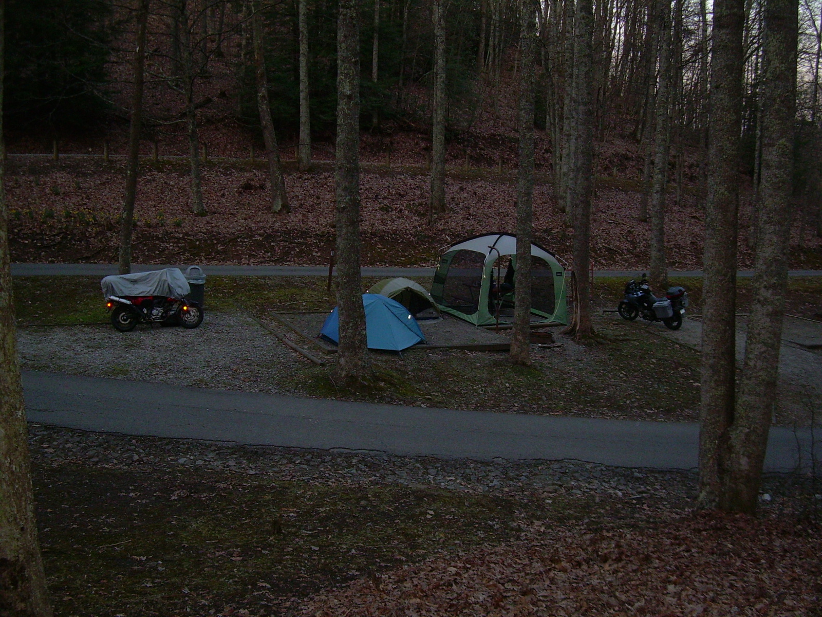
After a long day of riding adventure, it was nice to sit down, have a toast, fix dinner and enjoy discussing the day. There’s something about the simple steps of camp living that is just plain relaxing. Ok, that might not be true for some people, but it is for Brian and me. We also enjoyed being able to say that we had ridden all the way to Kingdom Come to camp.
We walked up to the ridge just above camp to see if we could get a cell signal and call our wives to check in. Even though we had 2 or 3 bars of signal strength, neither of us could get a connection to go through. Apparently, you can’t call home when you’ve gone all the way to Kingdom Come.
The “campground” in the park was squeezed in above the picnic areas, right where the road from the ridgetop drops down into the main part of the park. The road splits there, with one way going through the center of the picnic area and the other bypassing it. These roads were really only about 100 feet apart, so it surprised us to notice over the course of the evening how 90% of the traffic coming down the mountain chose to drive through the picnic area. We were also surprised how much traffic there was. I’ll bet there was a vehicle coming through every 10 minutes.
We only knew of the one way to get into the park from the ridgetop, and that was down the 15 miles of Little Shepherd Trail. It seemed odd that all of these vehicles would have come through the trail to get here. After a while, we realized that a number of these vehicles were repeats. Apparently, there were several people just driving loops around the park. Maybe there wasn’t anything else going on in the area on that Saturday night. The campsites’ position at the split in the road made it seem like we were camping in a highway median. At least the traffic was low speed.
Finally, at about 10 pm we decided it was time to turn in. I suggested we go close the gate across the road into the picnic area and make the traffic take the bypass around us. We’d still get the noise, but at least the headlights wouldn’t be lighting up our tents every time a vehicle went by. There weren’t any groups at the picnic shelter, so I reasoned that as paying campers, we were the only ones that had any business on the picnic/campground road anyway. Brian agreed and we shut the gate and crawled into our tents. Magically, the traffic stopped. I think I heard two more vehicles come down the mountain before I slipped off to sleep, but that was it.
Mileage for the day: 267 miles
Trip mileage: 456 miles