Sunday, July 12th
We got up on Sunday morning, broke camp, and headed out before 7 am.
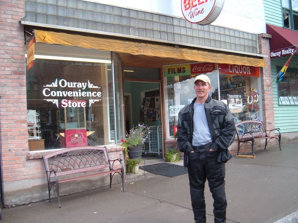
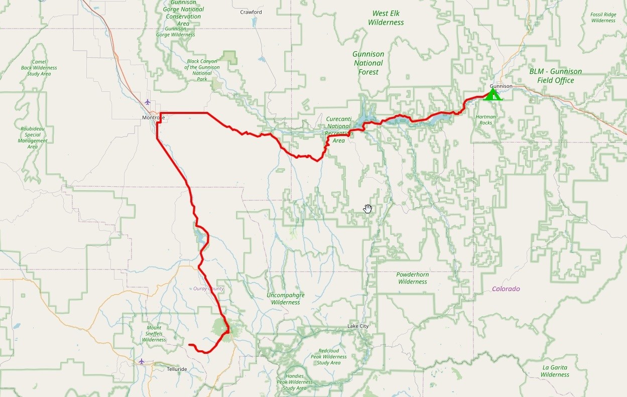
We rode through the town of Ouray, which is tucked in a tight mountain valley, and stopped on the side of the road at the south end of town before we started climbing further into the mountains.
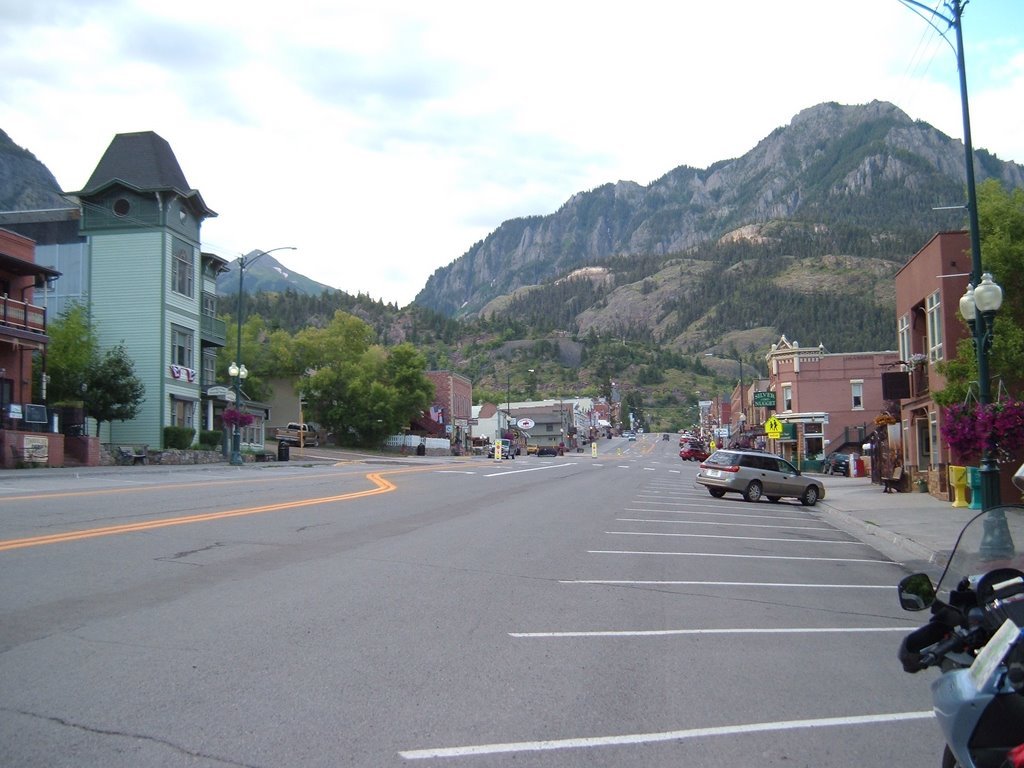
Where we stopped was beside what appeared to be the upper end of a town “ice park”. They had water pipes set up to spray or dribble water down the canyon walls to create artificial frozen waterfalls in the winter to give ice climbers a place to play. I’ll bet it looks cool then. Right now it was just a neat canyon with a wild creek at the bottom.
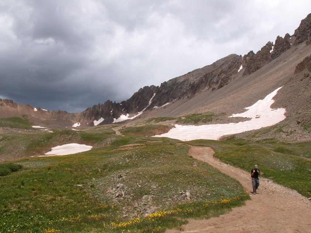
We aired down our tires in anticipation of lots of gravel road riding today. Just as we started back on the road, three guys on mountain bikes pedaled past us. We soon passed them as we climbed up the road. The further we went, the steeper and rougher the road got. At one point, the road went around a sharp corner on a shelf that was barely as wide as the road. The cliff dropped off straight down from the edge for a few hundred feet. Lots of exposure!
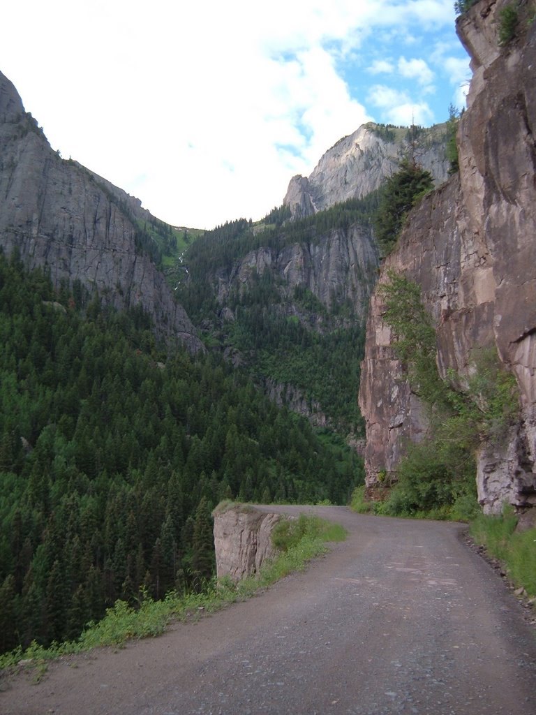
The road kept getting narrower and rougher as we went along. At another spot the road was actually cut into the rock of the cliff, leaving an overhanging roof of rock above us, and a big drop off to the gorge on the left side. Nice!
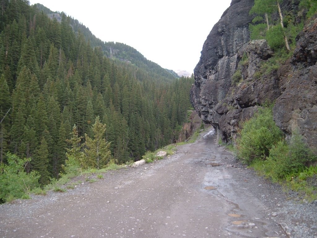
Our plan was to ride up this road into Yankee Boy Basin as far as we could, then park the bikes and hike the rest of the way up to the summit of Mt. Sneffels. At some point, we passed a place commonly known as the “two-wheel-drive” parking lot. It wasn’t marked clearly, so we’re not sure when we passed it.
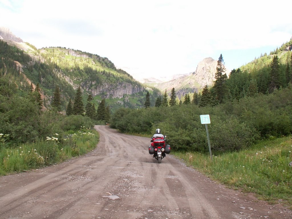
As we kept climbing, we started encountering water dips. From below these were high mounds across the road that we had to ride up, then pause exactly on top while we quickly assessed what the other side looked like, choose a line through it, and then continue on. With our bikes fully loaded and our position so low on the learning curve, this riding proved a bit exciting. We kept pushing carefully up the mountain, one water dip at a time.
We were getting very close to what appeared to be the high hanging valley where the “four-wheel-drive” parking was located and the start of the hiking trail. We got to a section of the road that was even steeper and clinging to the side of the valley. I was basically riding from the top of one water dip mound to the next. Stopping in between wasn’t really an option.
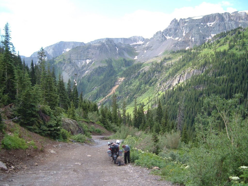
Somehow Brian got slowed or stopped in between dips and found himself on a steeply sloped section. Fortunately, his bike ended up leaning to the right, toward the hillside. It had propped itself up on the side case without going much past a 45-degree lean. We’re not sure if we’ll count this as a lay-down or not. I parked my bike on top of the next mound.
We walked up the road to see what it looked like further up. We looked at where we were. We needed to decide if we should push on, go back, or park here. We tried to move Brian’s bike back down the hill to the last mound, but were having trouble maneuvering it.
The three mountain bikers we had passed at the start of the road came by one by one. The last one stopped and with his help, we were able to get Brian’s bike turned around and back down to the last mound. We parked it there and decided that we could get by leaving the bikes where they were while we hiked up to the summit. There had been plenty of vehicles coming by already and they seemed to get around our bikes just fine.
We switched to hiking gear and headed up the road. It was slow going, one step at a time, like most hiking at altitude. The final turn-around for 4wd vehicles was a lot further up than I would have guessed. It was over 12,000 feet in elevation. We trudged on up the hiking trail and onto the scree and talus field below the summit ridgelines. The trail turned and headed up a scree and dirt slope to a notch on the ridgeline. The summit was just up to the left from the notch.
The notch was about 400 feet above us. We worked our way up the steep, loose slope. The trail route was more like following a general direction with lots of places where climbers had been up and down before. About halfway up to the notch, several of the climbers ahead of us turned and started heading down. We had been watching the clouds off to the southwest. They were quickly developing into thunderstorms. We watched to see if they were headed our way or not. We did not want to get caught on top in a thunderstorm. That was pretty much what the climbers who turned around had decided – they couldn’t get up and back quick enough. Better to live another day and be able to try again.
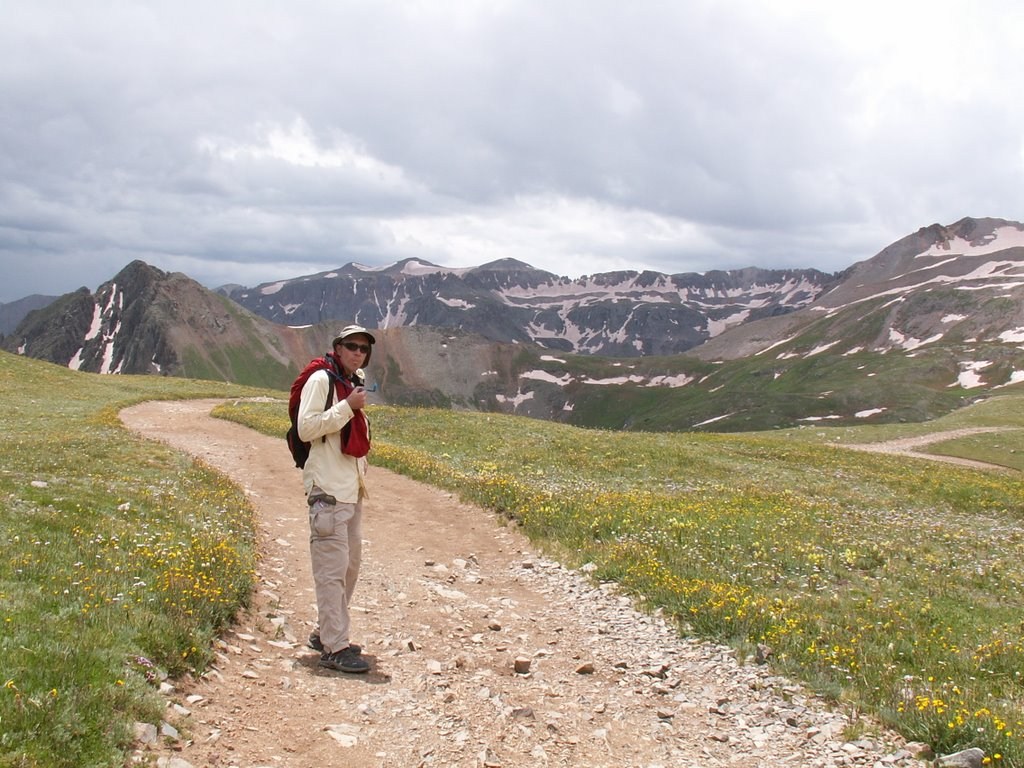
One lady coming down said we still had about 2 hours of climbing to the summit from where we were. I didn’t quite believe her, but the clouds were building quickly. We pushed on a little further up but then decided to call off our climb. It hurt to give up, but it was the smart decision to make. As we descended, the heavy clouds began to move our way even more. We got a few raindrops on us as we continued back down.
We met a guy from Idaho in the group we ended up hiking down with. He and Brian talked a bit about internship opportunities for Brian’s students at App. He had parked at the highest 4wd spot. As we parted ways, we saw the three mountain bikers hiking down from the summit. A short time later, they rolled past us on the way back to town. I was impressed with their ride up and summit climb. They were faster on mountain bikes than we were on motorcycles. From here it was all downhill for them.
We were glad to find our bikes as we left them. We changed back to riding gear as the clouds darkened even more. The most intimidating part of the descent was getting going again. Releasing the brake and letting gravity take over required a bit of faith. But once you were rolling the natural stability of the bike became evident and it was easier to relax and enjoy the ride down.
The only trouble I had was at one particularly abrupt water dip. There was a stream actually flowing across the dip and the edges were slightly eroded. Coming up, we found that the left side was a little better for crossing smoothly. Going down, I found myself more in the center of the roadbed and stopped to make sure Brian was still with me. He was, so I started down again. I turned the front wheel to the right to get more in line with the sweet spot. Apparently, my tire hit some loose gravel and slid a bit. That made my heart skip a beat or two, but the tire grabbed traction again and I managed to steer it to where I wanted to cross the dip.
Shortly after that scare, the raindrops started. A few moments later, they turned into a hard rain like from a thunderstorm. I noticed some of the stuff falling on the road in front of me was bouncing, then I realized there was hail and slush mixed in with the rain. Nice! Fortunately, that mix didn’t last too long and the precipitation soon slacked off to a light drizzle.
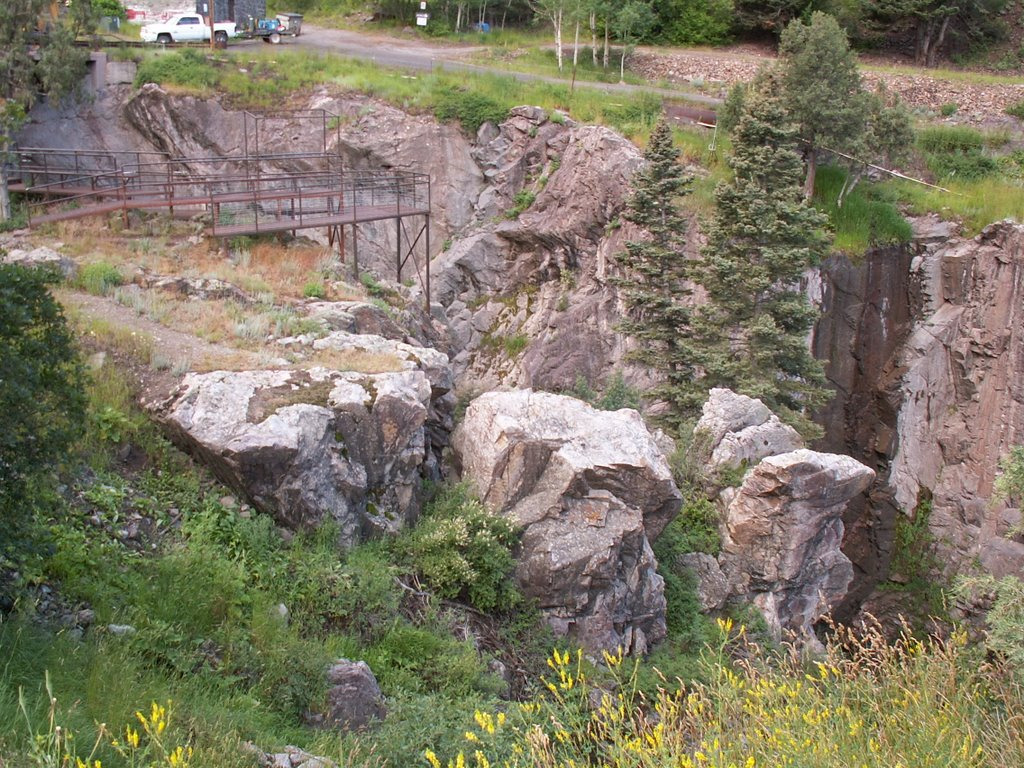
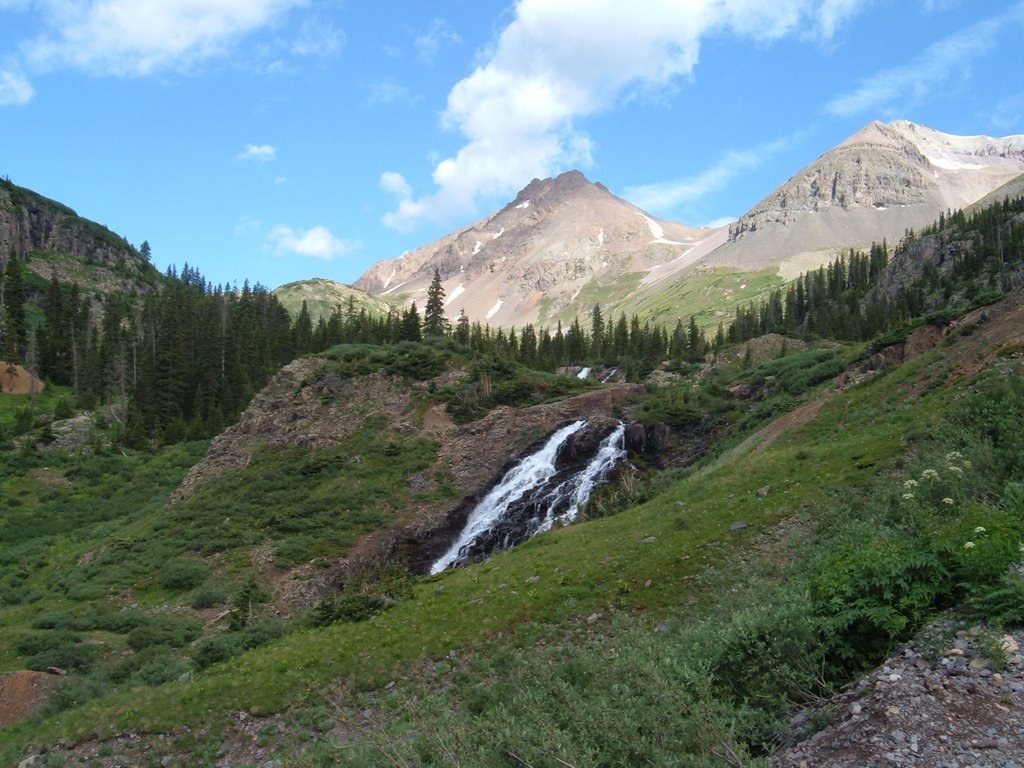
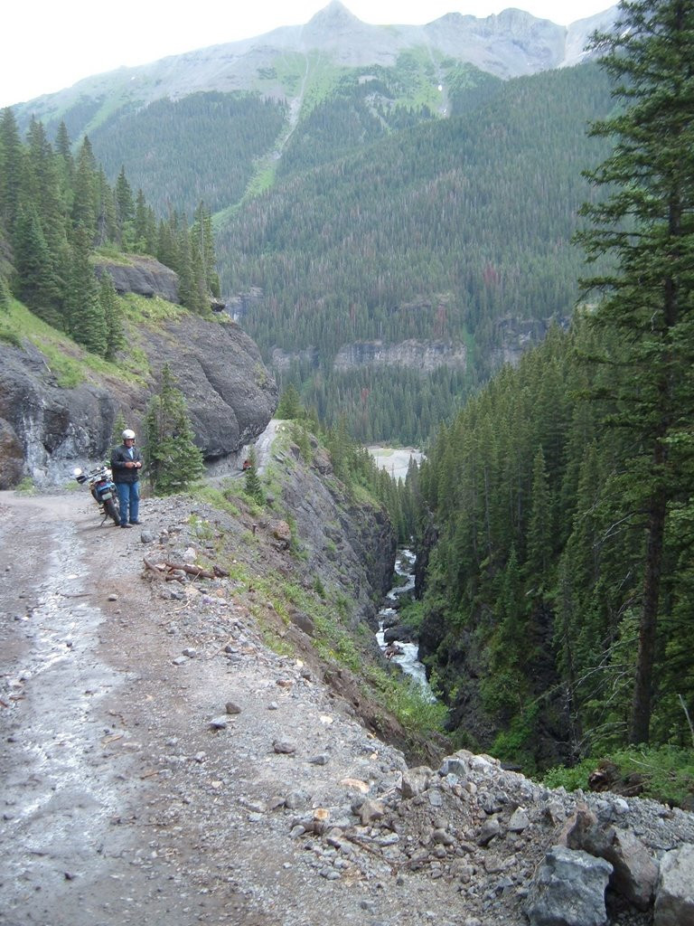
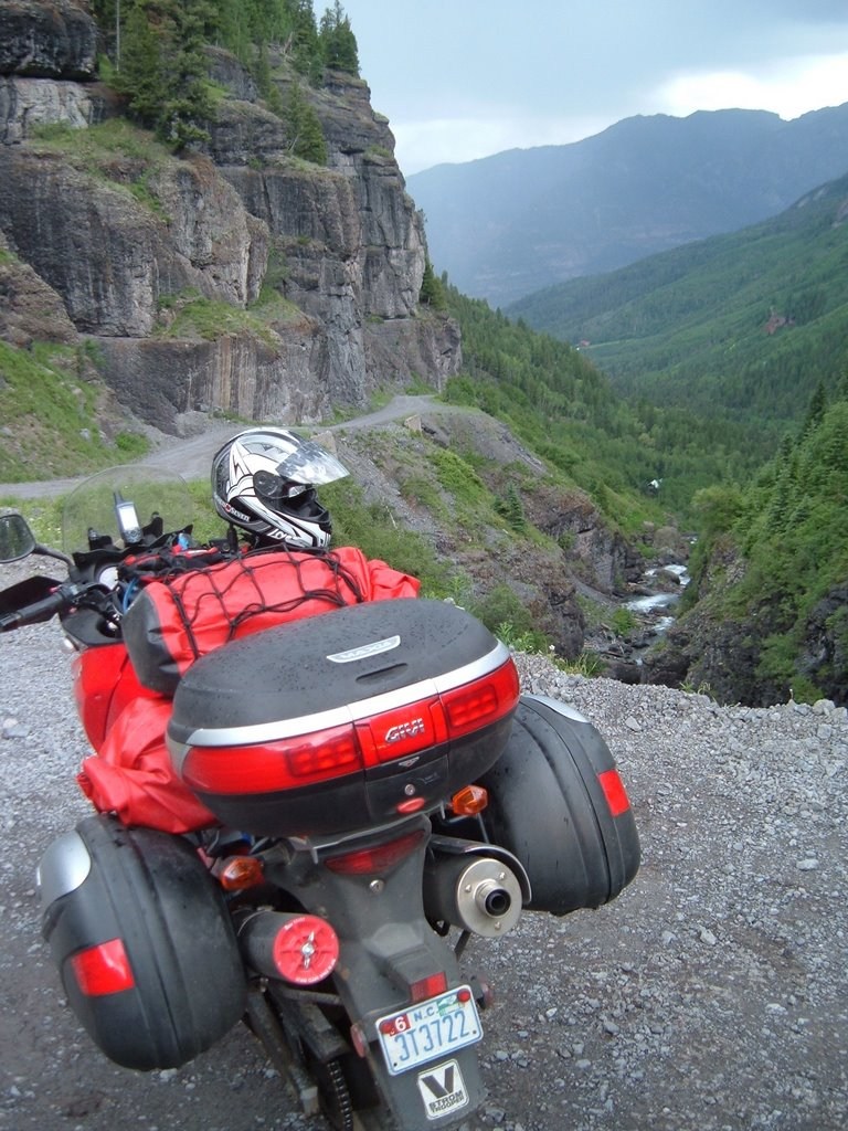
We carefully worked our way back down the mountain, stopping to get a picture of the adjacent gorge that we didn’t notice going up.
It was a relief to make it back to town, even though we didn’t make the summit. We rolled slowly through town and parked at the lower end of Main Street. We walked back up through town to find a place to eat lunch. We picked Maggie’s Burgers. Turns out it was a good choice as they had a nice wide covered porch. As we ate at a table on the porch, we watched the lightning storm on the mountain we had just come from. The storm passed over the town and a downpour soaked all the other tourists trying to run from shop to shop. The pain of regret from our decision to turn back from the summit eased a little more. I had a buffalo jalapeno burger. It was delicious.
We hung out on the porch until the rain stopped then walked back to the bikes and hit the road. We stopped at a gas station just below town to fill up and air the tires back to normal running pressure.
Then we headed north to Montrose and turned right on CO 50. We were following the back edge of the storm that had rolled through earlier, so every now and then we’d catch a little rain. Hwy 50 was nicely graded, wide and curvy as it climbed up over a pass and dropped down again. It generally followed the Gunnison River. I’d love to go back and ride 50 again someday when it was dry.
We eventually reached Gunnison, CO and I switched from following the GPS directions to following the road signs in order to find the KOA campground. That was a mistake.
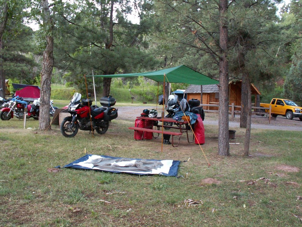
We eventually figured it out and found the KOA behind the airport. It was a nice little kampground. They had a couple of features for tenters that I really appreciated. First, the tent sites were grouped together in an area that was covered in lush grass – perfect for sleeping on! In the middle of this area was a covered pavilion with several picnic tables for the tenters to share. There was also a kitchen island under the pavilion that had a sink and an electric stove top mounted on it. No need for firing up our gas camping stove. That was a nice touch. Since there were no other tenters in this section, we had the pavilion to ourselves most of the evening. A couple from CA did come over and use the sink once, but that was it.
There was a group nearby with two Harley-Davidson bikes, but they were nowhere to be seen. They eventually showed up and we learned they were from Denver and had ridden over to Gunnison for the weekend, followed by their wives in an SUV. They went out for dinner (and breakfast the next day) in the SUV.
We took our time relaxing before setting up the tent. The last little shower of rain fell as we set it up. Since we were at the back edge of the eastward moving clouds, we had sunshine and rain at the same time. Shortly after that, we were treated to another nice double rainbow.
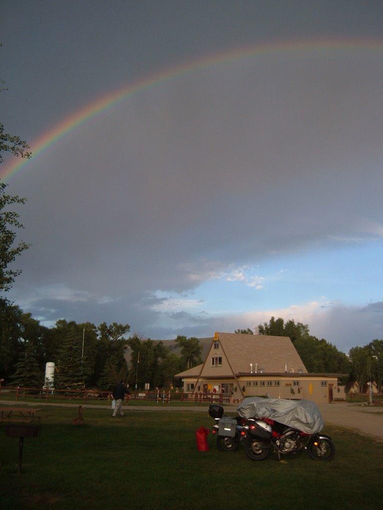
One drawback to the lush grass was that it doesn’t make for a good solid surface for the bike kickstands. The kampground had a solution though, with a stack of plywood circles available for us to put down under the kickstand feet. Perfect.
We cooked our dinner in the pavilion and settled in for a nice night’s sleep.
| Mileage | |
| Today | 127.0 |
| Trip Total | 3,022.4 |