Monday, July 13th
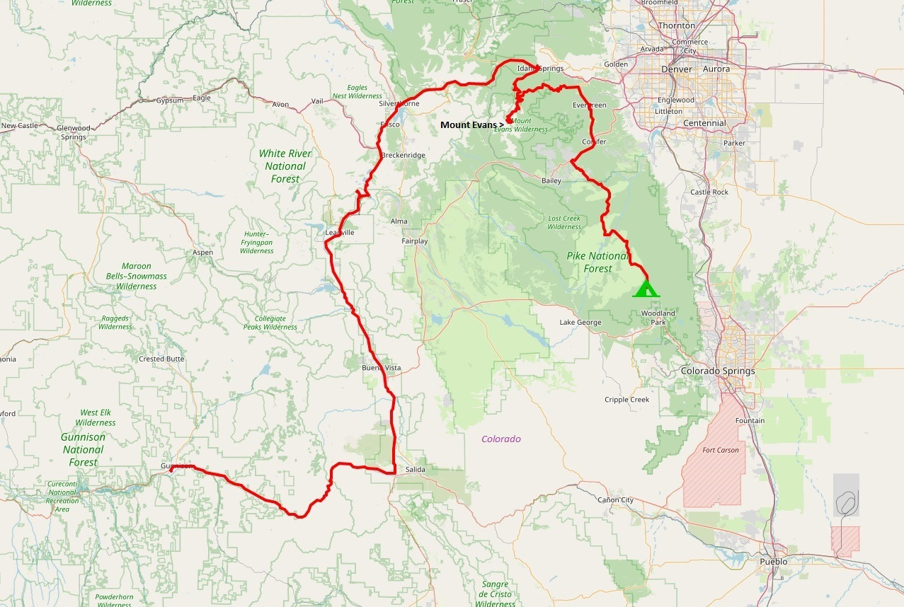
From Gunnison, we rode further east on Hwy 50. Once again this road showed its scenic qualities.
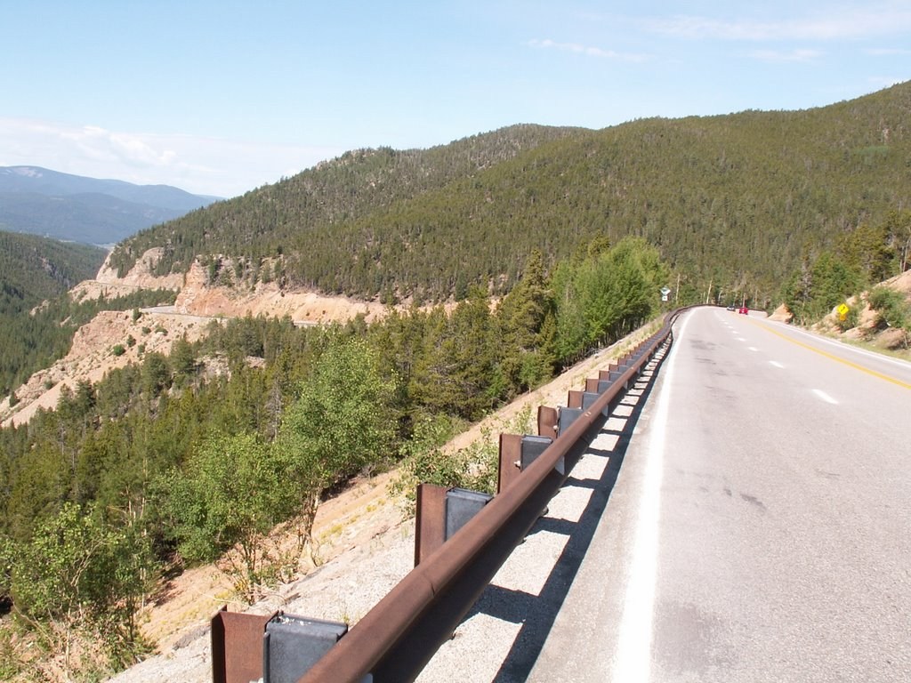
While we were stopped to take this picture, a fellow on a Harley pulled over to do the same. He noticed our NC tags and said he was from High Point! He and some buddies had trailered their bikes out to Denver behind an RV and were touring around. He had to go home early so was headed back to Denver.
We stopped in Leadville, CO for lunch. When we stopped, we noticed the clouds building over the mountains just to the west of town. The bank thermometer in town said it was 70 degrees.
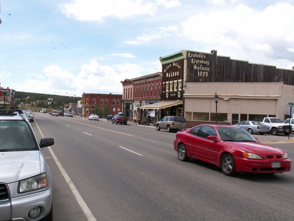
We walked down the main street and checked out a gear shop and the headquarters building for the Leadville marathon. Leadville claims to be the highest city in the US at over 10,000 feet in elevation. We had a burger at a little shop at the west end of town. When we came back out, the temps had dropped to 54 degrees and there was a light rain trying to fall.
Back on the road, we crossed over another pass and rode through heavier rain coming down the mountain. Near the Copper Mountain Ski Resort, the highway passed through a pretty long tunnel under the mountains. Riding through the tunnel was pretty neat.
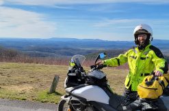
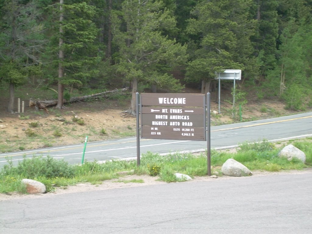
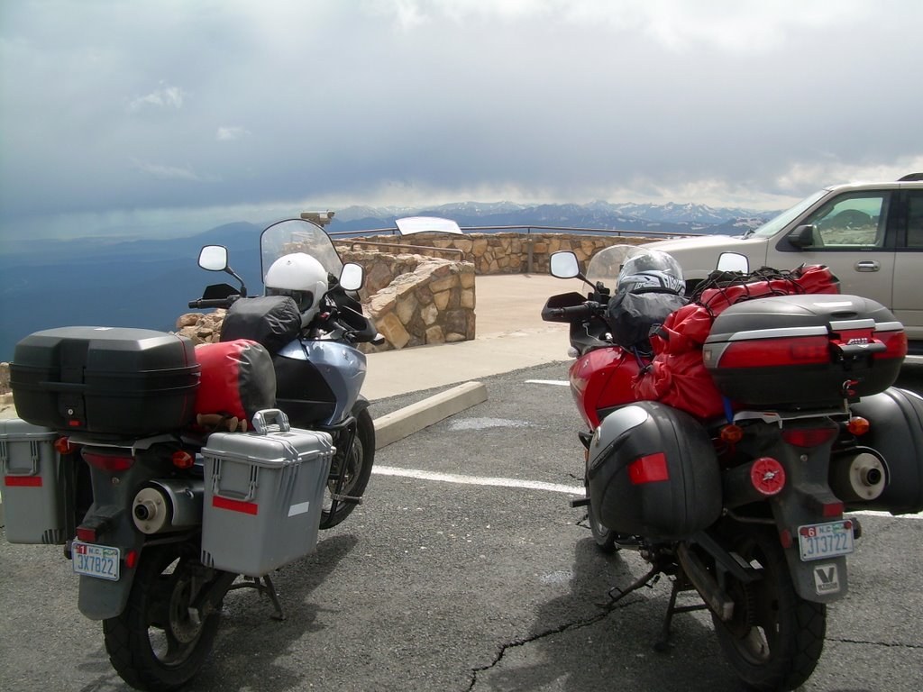
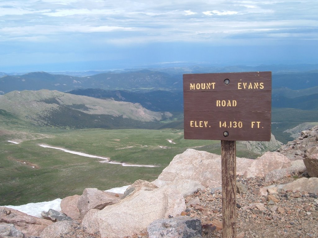
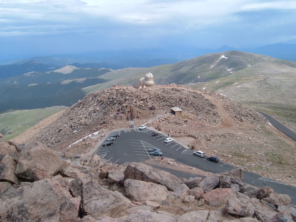
At the bottom of the mountain, we stopped for gas and removed some of our rain gear, as the sky was clearing. We headed over to Mt Evans and Brian paid the fee for both of us to ride to the top – $3 each. This paved road is the highest paved auto road in North America, taking us to over 14,000 feet.
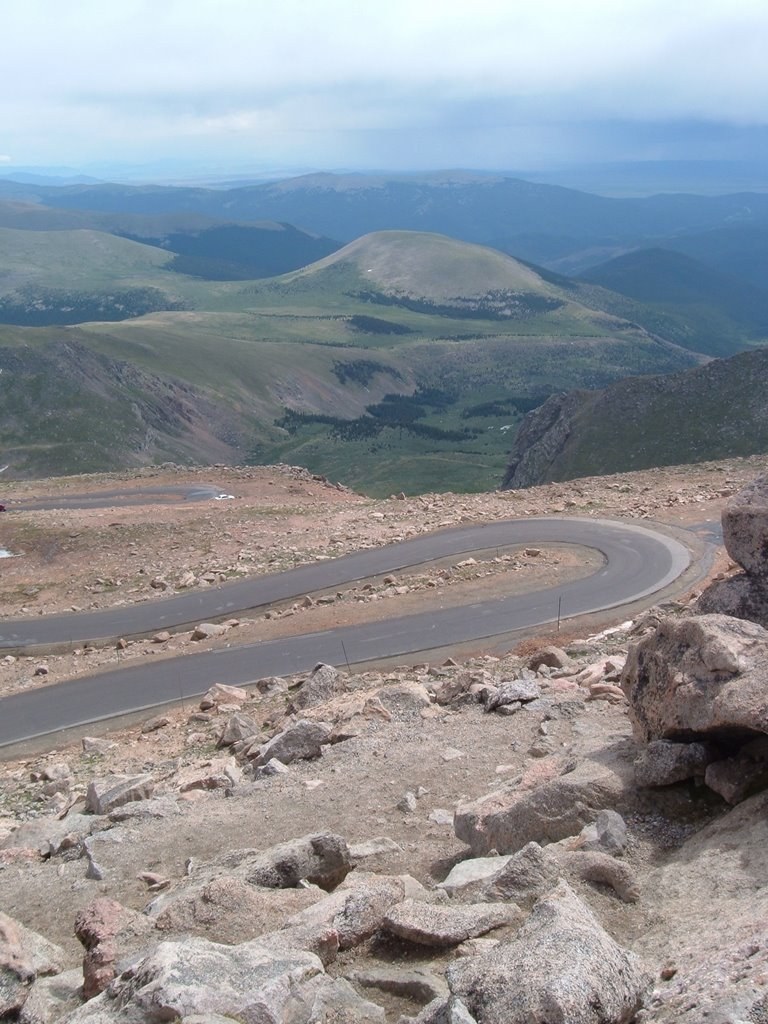
The ride up the mountain was challenging due to the switchbacks. Especially those near the top that were really tight and included all the exposure of cliff drop-offs to the side.
At the top, we parked the bikes beside another vehicle in hopes that we could avoid having the stiff wind gusts blow the bikes over. We even turned the bikes to face the wind, to help with this issue. Having had his bike blown over in Boone before, Brian was extra sensitive to this potential.
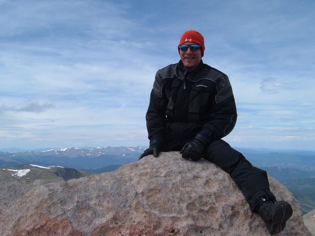
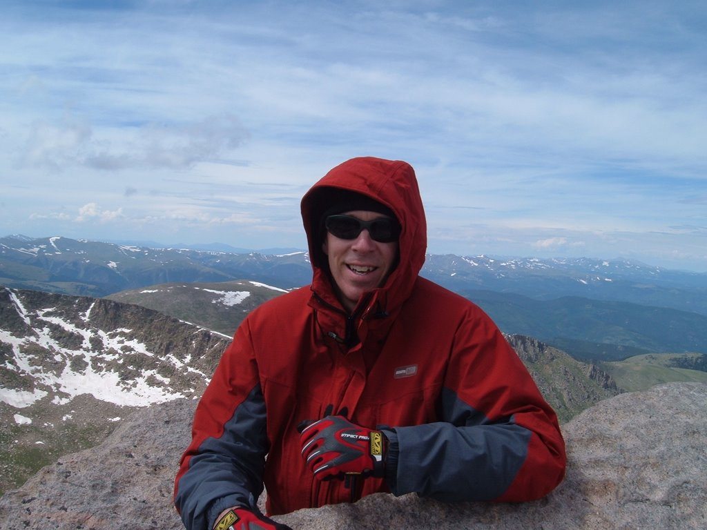
We hiked the last 50 feet or so of elevation up to the highest rocks on the summit and took some pictures.
The remains of a house beside the parking lot had been turned into a scenic historical display. We took a few moments to walk through and admire the view they must have had before a propane explosion destroyed the house. They had a nice view of Denver from up here. We were lucky to have missed the thunderstorms that were clearing out now, giving us a nice view too.
Near the parking lot are the ruins of a house that blew up in the 1950s, a new park service restroom, and an observatory. I think it’s the highest observatory in the US.
We survived the ride back down and stopped at the gift shop. We chatted for a while in the parking lot with a local who was really enthusiastic about this area and thought it was cool that we were riding across the country on these bikes.
In the gift shop, we asked for some info about the road up Pike’s Peak and were directed to an employee who gave us some suggestions for fun roads to ride to get there from here. We took notes and then rode out the rest of the parkway from there.
The road dropped off the ridge and down into a town called Elk Park. As we were grinding along in afternoon traffic, I noticed that the three lanes of traffic were all slowing to a stop, even though I couldn’t see a stop light up ahead. Then I noticed a horse in the middle lane – no, wait! It wasn’t a horse, it was an elk! Just wandering across the road, and the cars were stopping for it. It was as big as a horse, just thinner from side to side. Then I noticed that it was headed for a group of 30-40 more elk walking through the lawn of a business on the side of the road. It was very strange to see this herd of elk casually walking and grazing in a suburban setting like this. If traffic had actually stopped, I would have gotten a picture, but they just slowed enough to not hit the elk.
We finally got through town and back into more rural areas where we picked up the first of the roads that the guy at the gift shop had told us about. It started out like a normal neighborhood road, but then the houses disappeared and the road got curvier. It was a nice ride. Traffic was very light, as he had predicted. It led to another road that ran through an area that had experienced a huge wildfire several years ago. The guy had mentioned it by name, but I didn’t recognize the name.
Eventually, we reached another road that looked like a wide parkway road, with wide paved shoulders. It appeared to be out in the middle of nowhere. There was no development along it and it went on for miles. Very nice.
We finally reached a National Forest campground and pulled in to camp for the night. It was the Painted Rocks Campground. Not much to it, but it had a flat place for the tents and a water spigot. There was apparently a camp just up the road as we could head a large group of kids singing camp songs that evening.
We were only 15 miles from Pike’s Peak here. Our plan was to get out early and climb the mountain before the midday thunderstorms fired up again.
We heard some coyotes before we went to bed. During the night I heard them going crazy with howling and suspected that they had caught and killed something to eat.
| Mileage | |
| Today | 318.3 |
| Trip Total | 3,340.7 |