The elevation profiles in the Second Edition of the Uwharrie Lakes Region Trail Guide aren’t the only new features. Each trail and trip in the guide has its own brand new detailed map to help you visualize the route and identify important locations along the way.
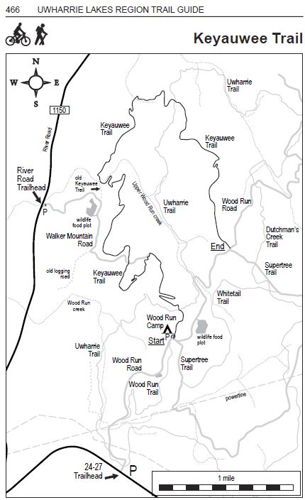 All of the maps were redrawn for the second edition. Each trail was GPS’d in order to provide a more accurate presentation. The maps in the first edition were good, but the trails were painstakingly hand-traced on contour maps before being digitized. The method used for the new maps eliminated the manual tracing step.
The trails and roads on the new maps are proportionally accurate. No stretching or squishing was used to make things fit. Verification against aerial photographs was performed where possible. A scale is included on each map to give you an idea of the zoom level of each map. Each map is custom-zoomed to provide the best balance of detail and surrounding landmarks for that map.
Other trails and roads that intersect the featured route are shown on the maps. You will find matching text entries for these intersections on the corresponding elevation profiles. All of this information is provided to help you visualize the route from both a bird’s eye view and a sideways elevation perspective.
A compass rose is included on each map, to show you which direction is North. Trail heads and parking locations are marked, as well as the Start and End locations, which match the direction on the elevation profile. Above each map are symbols indicating appropriate use for the highlighted route, such as biking and hiking for the example above.
Using the information in this guidebook can save you from spending too much time trying to figure out where you are or where to go, so that you can focus more on enjoying your trip and having fun!
If you don’t have a copy of the new edition of the Uwharrie Lakes Region Trail Guide, order one today!