One of my goals for 2023 is to ride more long trails. My friend Rémi had not ridden the American Tobacco Trail yet. Inviting her on this ride seemed like a great opportunity to start off the year. Not only would we ride the full length of the trail, but since we were doing an out-and-back route, we would ride it twice!! We expected a total ride length of about 44.5 miles.
2023 also marks the 20th anniversary of the opening of Wake County’s American Tobacco Trail County Park. This 6.5-mile-long section extends from the southern end of the trail to the Chatham/Wake county line, just north of the tunnel under Yates Store Road.
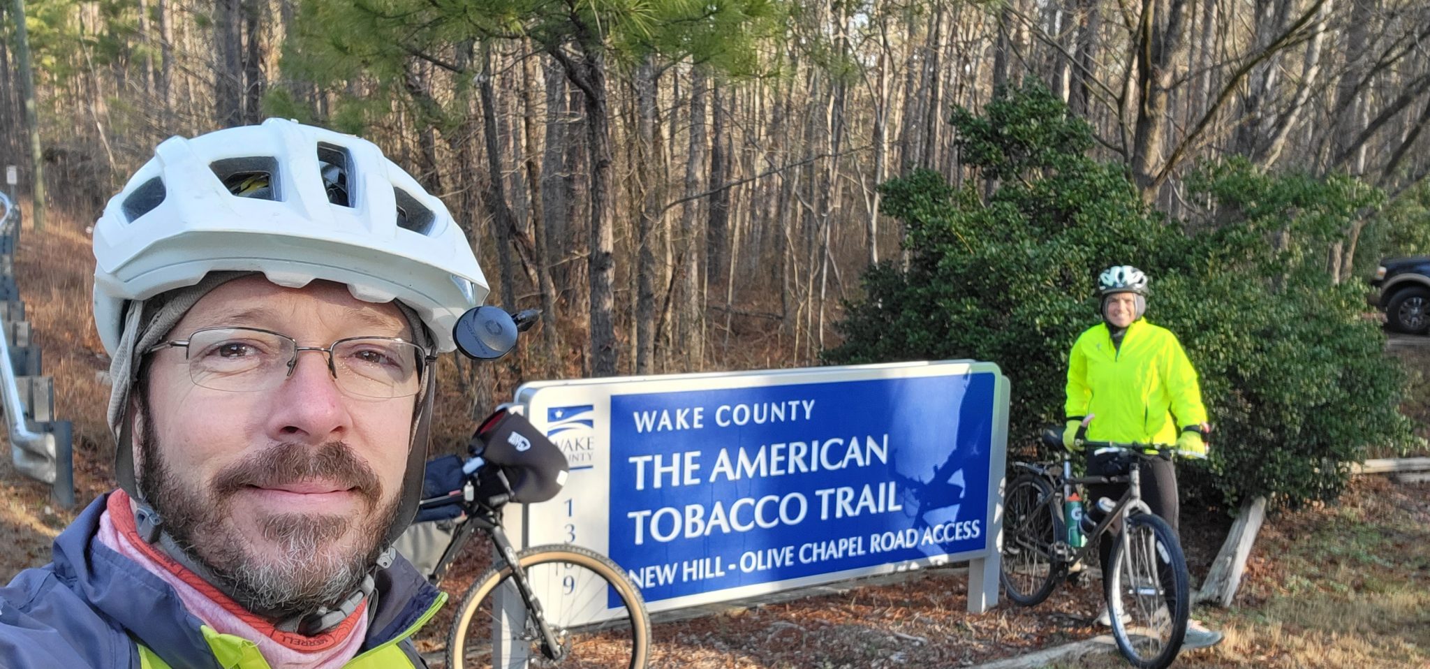
Temperatures were in the upper 30s as we parked at the New Hill – Olive Chapel Road Access at the southern end of the trail. But the forecast called for mid-50s later in the day. We put on layers and tried not to ride too fast!
The American Tobacco Trail is North Carolina’s first rail trail. At 22.25 miles long, the ATT is also the longest rail trail in the state.
The first section of the ATT was formally opened on June 3, 2000. This is the northernmost section, running from the north end at Morehead Avenue 3.2 miles south to Cornwallis Road. Because of its overall length, the effort to complete the full ATT route took many years and involved numerous agencies and organizations. The trail is currently maintained in sections by three organizations: the City of Durham, the Town of Cary (which handles the Chatham County section), and Wake County. The completion of the bicycle/pedestrian bridge over I-40, in February 2014, connected the full 22.25 miles of the ATT as it exists today.
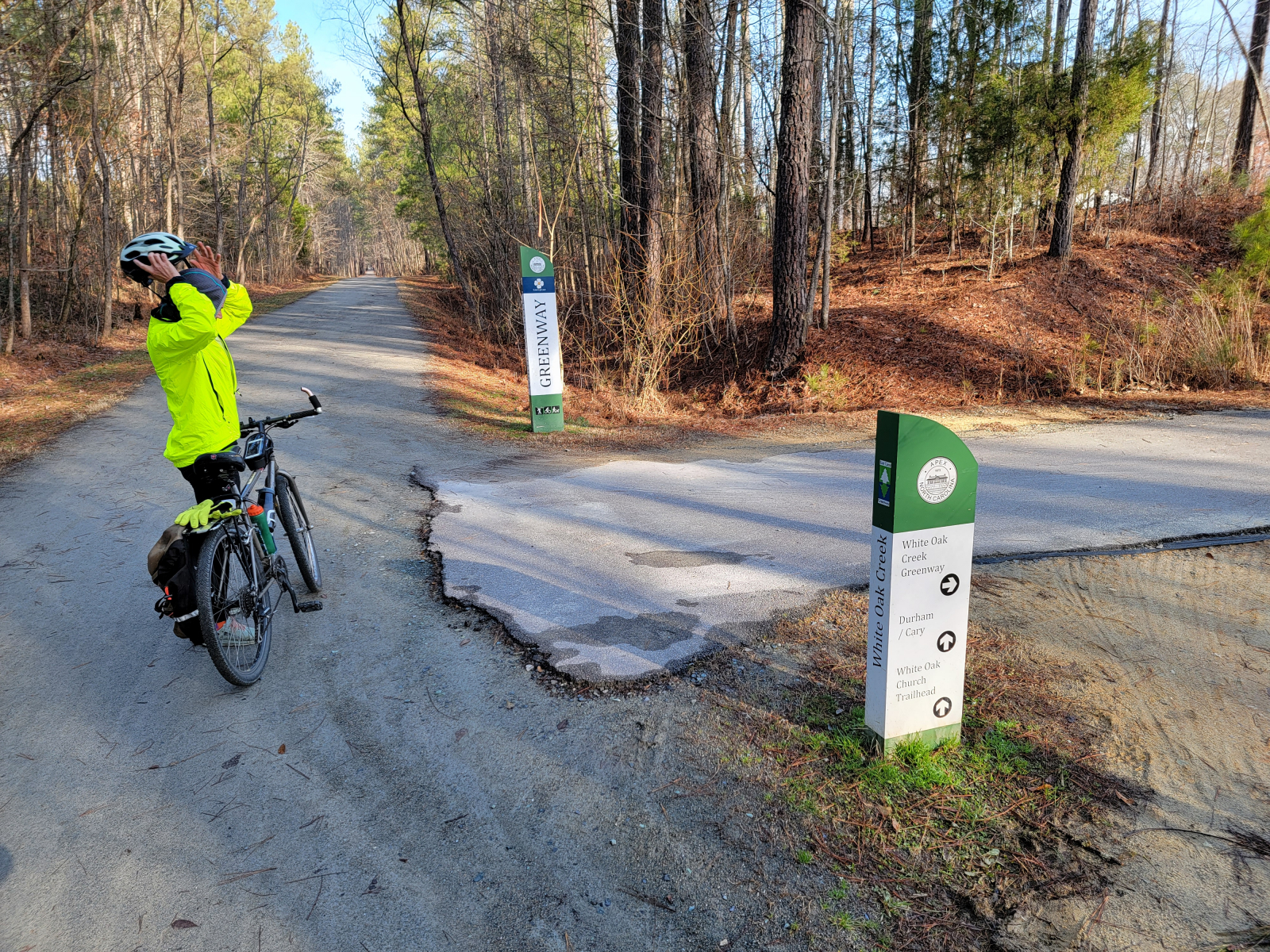
Side trails continue to be added, connecting the ATT to new neighborhoods and other area greenway systems. The most notable of these is Cary’s White Oak Creek Greenway. This connection links the ATT thru Cary to Umstead State Park, Raleigh’s Crabtree Creek Greenway Trail, and then to the Neuse River Greenway Trail (NC’s longest greenway). The East Coast Greenway route follows the ATT as it crosses the Triangle on its way from Maine to Florida.
Rail trails begin life as a working railroad. In this case, the route was originally planned out for the New Hope Valley Railroad in 1905. Before construction began, additional investors came on board and the Durham and South Carolina Railroad Company was formed and took over the project. They built the original line from Durham to Duncan, generally following the New Hope River valley. The spur line to the American Tobacco Company in Durham was built in 1925.
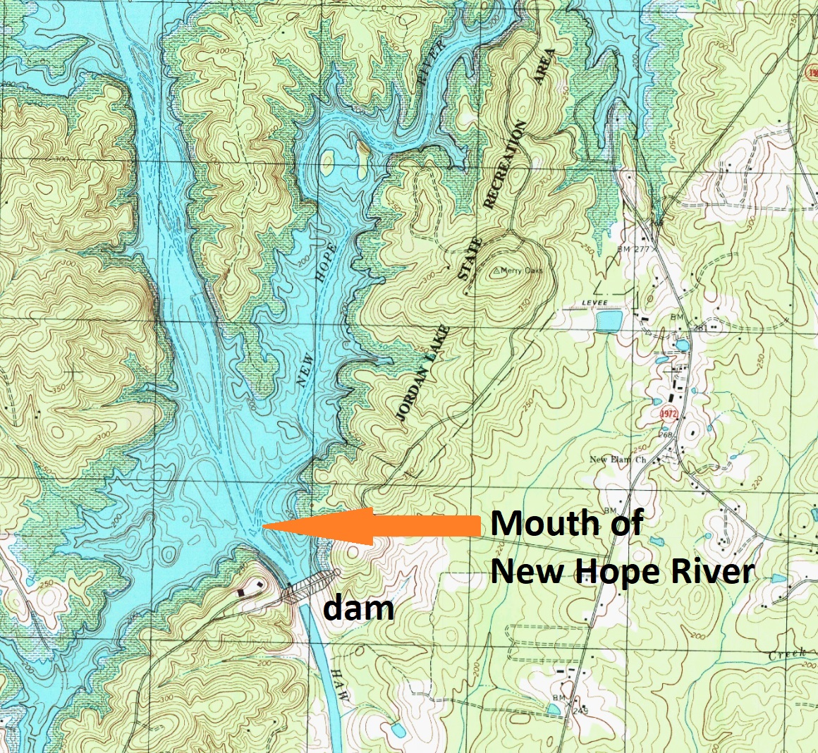
In the late 1960s, the US Army Corps of Engineers started a project for a flood control dam across the Haw River, just below the mouth of the New Hope River. The waters of the new lake would flood most of the New Hope River valley. As a result of the lake, a large portion of the rail line had to be moved. The new “bypass” line was constructed on the east side of what is now Jordan Lake.
Shortly before the bypass line was completed in March of 1974, railroad company mergers made the bypass line redundant. Formal abandonment procedures began in 1979 and by 1983, the rail and ties had been removed. It’s not clear how often the bypass line was actually used by trains. Some local tales say the third train to run the tracks was taking up the rails as it went!
As Rémi and I rode and talked, I shared this history. She had not heard of the New Hope River, which wasn’t surprising. The spot where it flowed into the Haw River is now under Jordan Lake, about 1,500 feet north of the dam. The upper end of the New Hope River, where it formed at the confluence of New Hope Creek and Little Creek, is just south of the Durham County line and is also now also under the lake. The entire length of the New Hope River is covered by Jordan Lake, so it doesn’t really exist anymore.
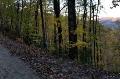
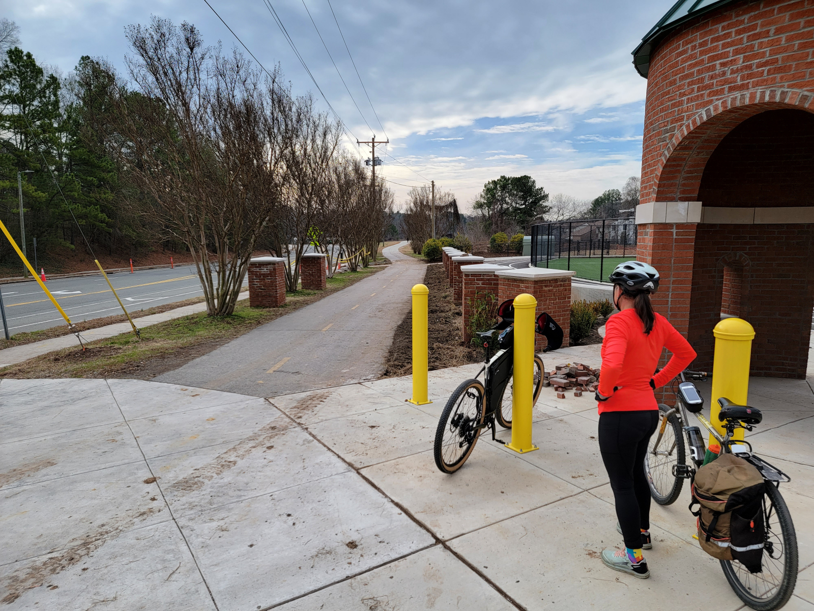
As a rail trail, the ATT offers users the safety of separation from vehicular traffic, except at road crossings. There are quite a few crossings on the northern end of the trail, in Durham. The middle and southern parts of the trail are more rural, though increasing development is making them feel more suburban than rural.
The ATT has three different surface types. The 10.3 miles from Durham southward to Scott King Road are fully paved with asphalt or concrete. The 4.2 miles from Scott King Road southward to New Hope Church Road have a hybrid surface, with two-thirds of the width paved with asphalt and the other third being a fine gravel surface. This allows equestrians to use the trail without having their horses walk on pavement. The southernmost 7.5-mile section is fully unpaved, with a fine gravel surface. All of the unpaved sections are surfaced with the same type of fine gravel screenings. I hear that unless the ground is really wet from recent rains, even skinny road bike tires should be ok on this surface.
If you are looking for a long “gravel” ride, it is possible to ride from the southern end all the way to Massey Chapel Road (just south of the Streets of Southpoint Mall) without riding on pavement. Runners and cyclists have worn a narrow, but clear, path beside the asphalt along the fully paved section. You can get a 27-mile gravel ride by riding an out-and-back along this part of the ATT. An out-and-back ride on just the southern unpaved and hybrid sections would be just over 23 miles.
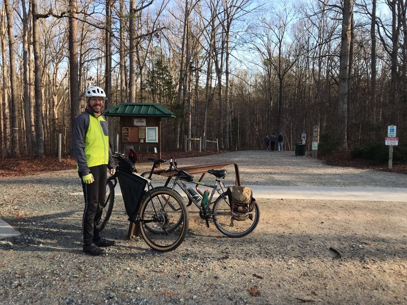
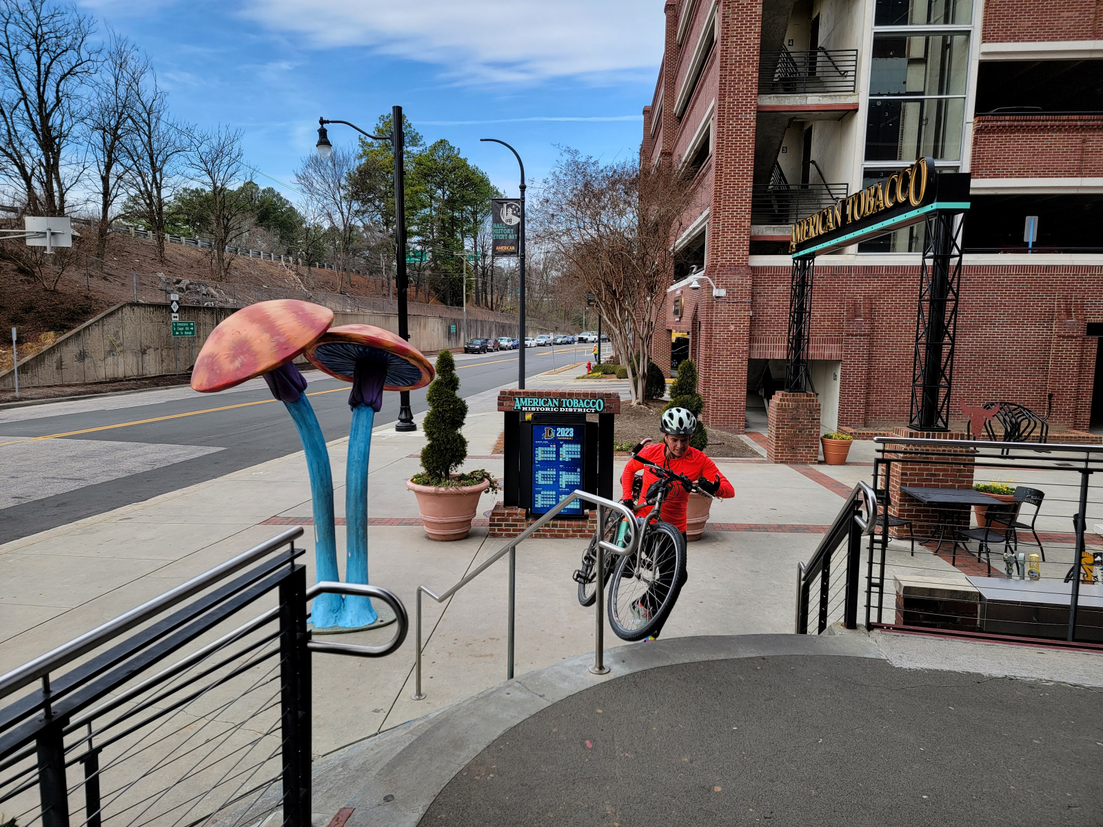
As of January 2023, the construction of a new park at the intersection of Morehead Avenue and Blackwell Street in Durham has temporarily (hopefully) caused the removal of the “ATT 0.00” milepost marker on the sidewalk. Our main goal for the day’s ride was to bike the entire trail. It was a little disappointing to reach the end only to find this finish-line reward missing.
Our consolation prize was a delicious lunch just across the street at Mellow Mushroom in the American Tobacco Campus. A delicious pizza and two cold drinks, all matching the shape of those missing zeros, made us feel better! In warmer weather, you can enjoy their outdoor seating, but on this chilly January day, sitting at a warm table inside felt pretty good.
Before we left, we looked around the American Tobacco Campus and noted a few other restaurants that would do for a tasty lunch next time.
On the ride back down the ATT, the sun warmed us enough to be able to drop a few layers.
I ended up recording just over 45 miles for the day’s ride. Not a bad start to the year!