
It was one of those rare windows of opportunity when schedules and weather align just right. My cousin Brian asked if I wanted to bikepack the Appalachian Gravel Growler route over a 4-day window he had open. I knew it would probably hurt, but what the heck. I had been wanting to do a serious bikepacking trip, so I agreed.
Appalachian Gravel Growler
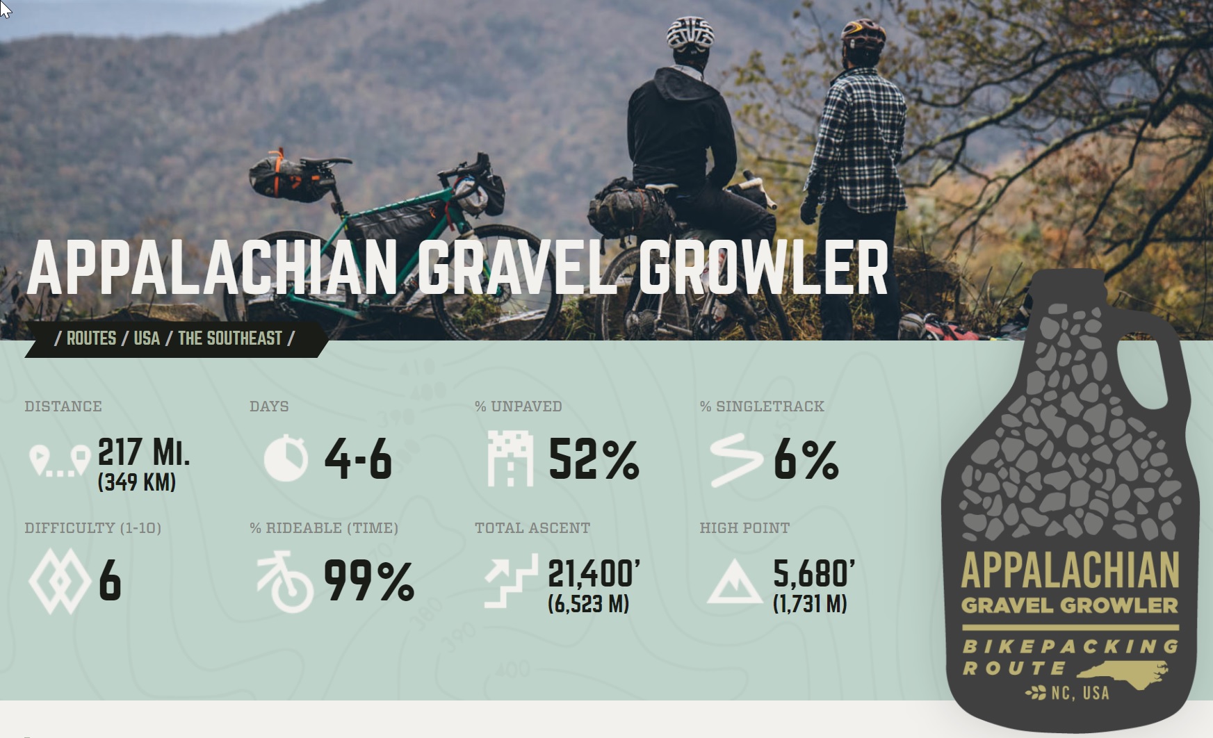
The Appalachian Gravel Growler is a 217-mile-long route for bikepackers that avoids pavement as much as it can while leading adventurous bicyclists from Morganton, NC, by Mt. Mitchell, and on to Brevard, NC. Think rural paved roads, public gravel roads, gated-closed Forest Service roads, singletrack trails, and some bits of erosion where a trail may or may not have ever existed at one time.
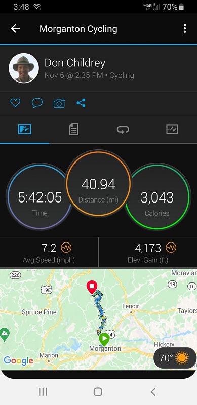
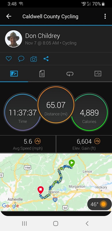
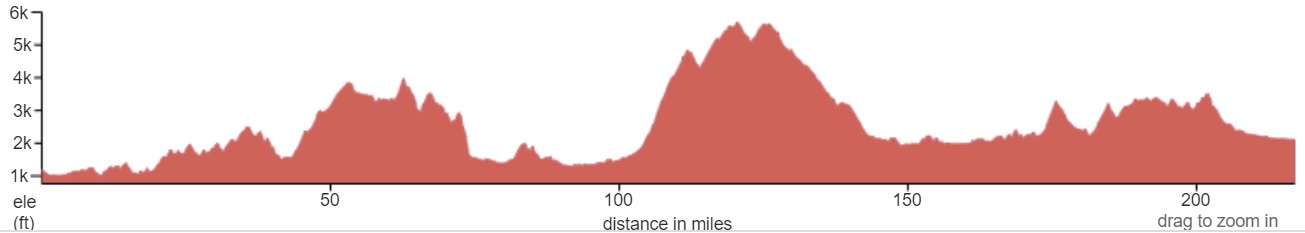
The significant numbers about the route are in the image below, but knowing how to interpret those numbers makes all the difference. Over the four days of riding, we had time to ponder the meaning of the numbers and the impact of our interpretations.
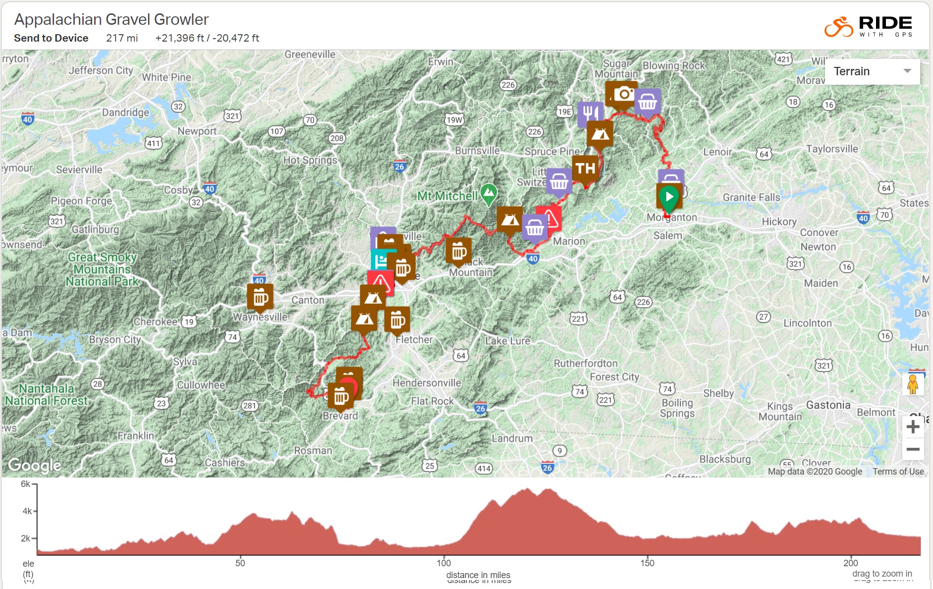
The map below shows what the route looks like, in general. The route designer indicated helpful spots along the way, campsites, stores, etc. (I have to give a shout out to Logan and his bikepacking.com website. The site has lots of great info and inspiration!)
The elevation profile below the map shows the climbs and descents along the way. An interactive version of this map can be found on the route page.
Preparation
After agreeing to do this trip, I had about three weeks to get my legs and my gear ready. I dusted off the 8-week training plan from CycleNC that I used for their Mountains to Coast ride several years ago. I tried to pick a couple of the weeks that would help the most without killing me. In the end, I mostly managed to ride almost every day, with rides increasing in length before a weekly rest day.
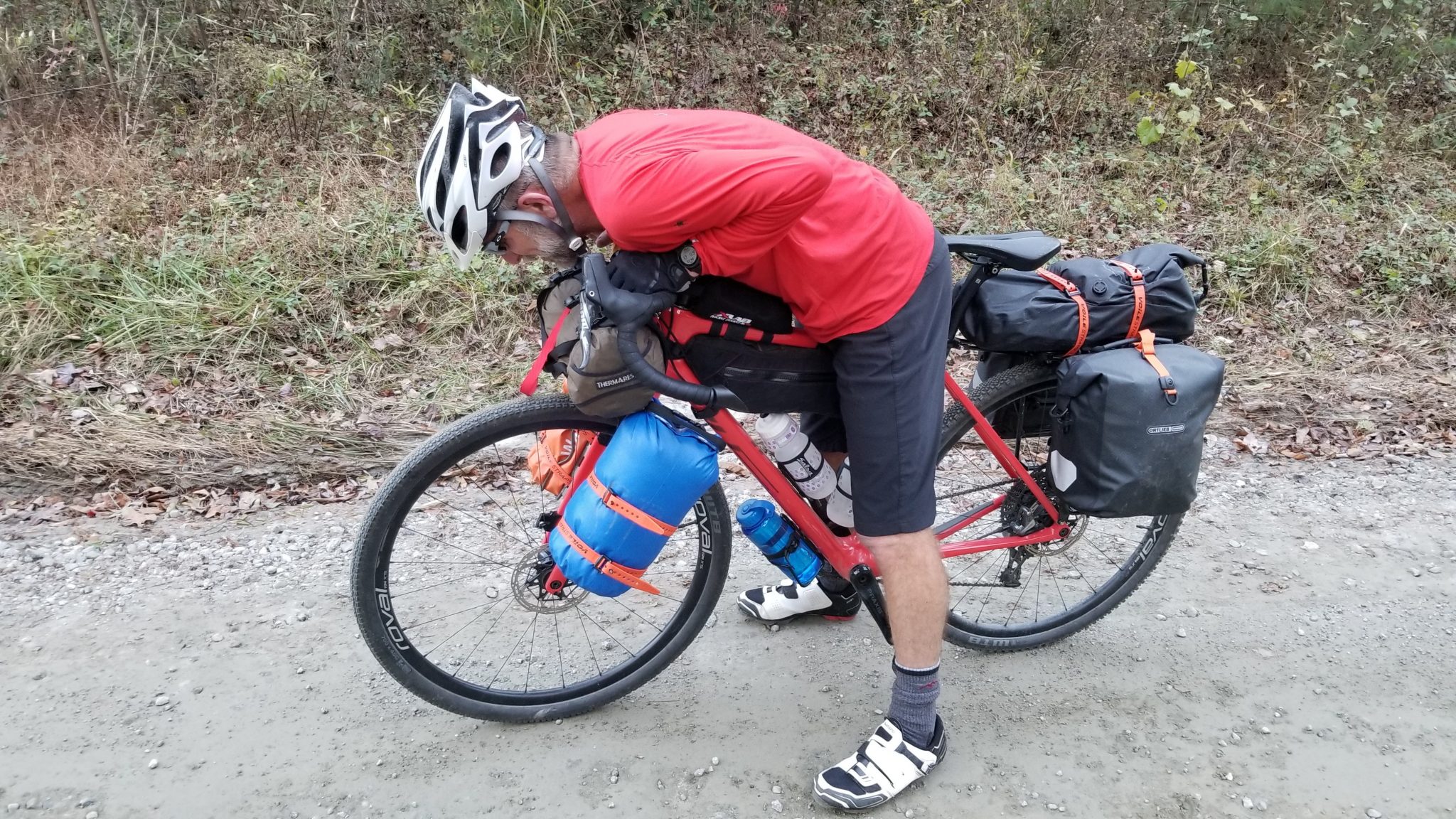
As for gear, I already had a few bikepacking bags/attachments, such as a tail bag and a bar harness. I added a frame bag that fit the big triangle on the bike, and some fork cages for smaller bags of gear. I threw a water bladder and more food in a small backpack, although I would have preferred to not wear a pack.
Thursday
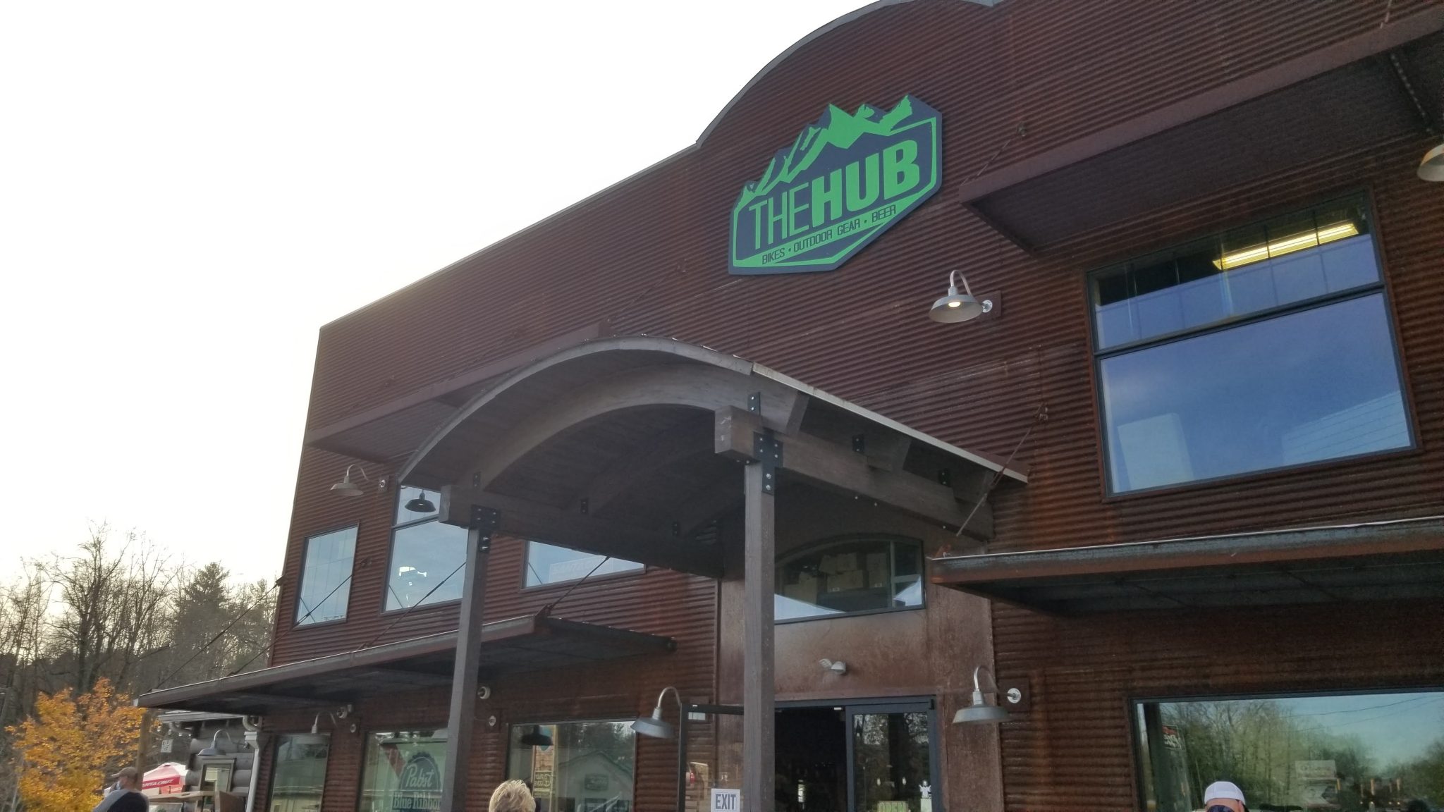
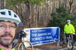
Brian and I met up at The Hub in Brevard on Thursday afternoon to leave a car for the end of our trip. We drove back to his house near Boone and tried to organize our gear.

Friday
After Brian taught his Friday morning class at ASU, we drove to Morganton and parked in the lot at Food Matters grocery store. One of the cashiers at the grocery store said it would be fine with her (no manager was to be found).
Just before we set out I weighed our rigs. Each one (bike plus gear) was almost exactly 63 pounds.
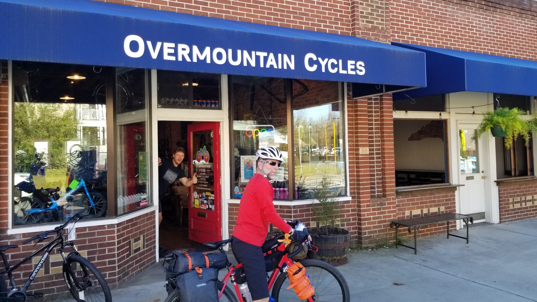
A few blocks away we stopped at Overmountain Cycles to say hi.
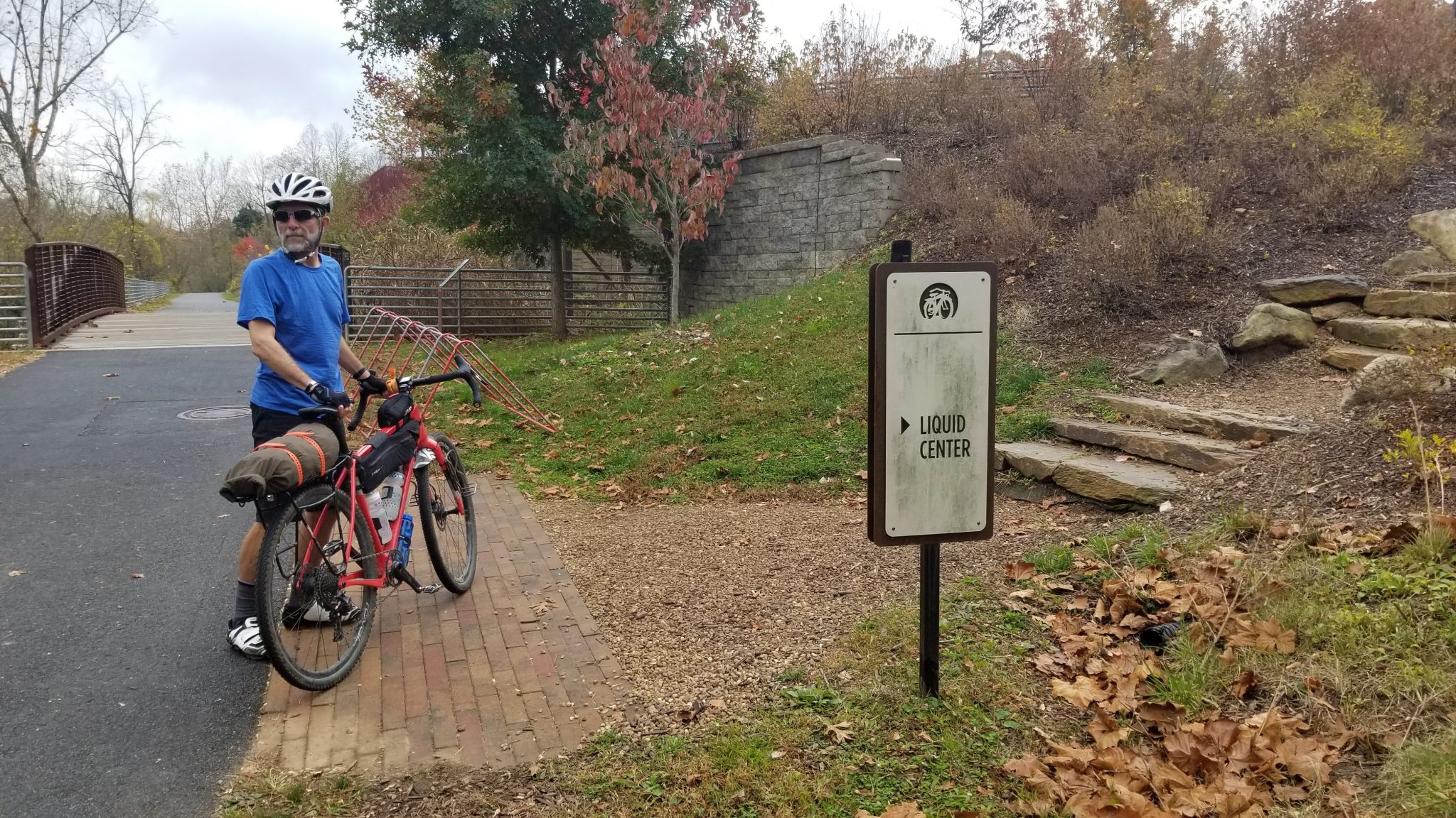
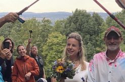
Right next door is Fonta Flora Brewery (not open at the time). Fonta Flora is the official start point of the route. We took our obligatory starting point photos at about 2:30 pm.
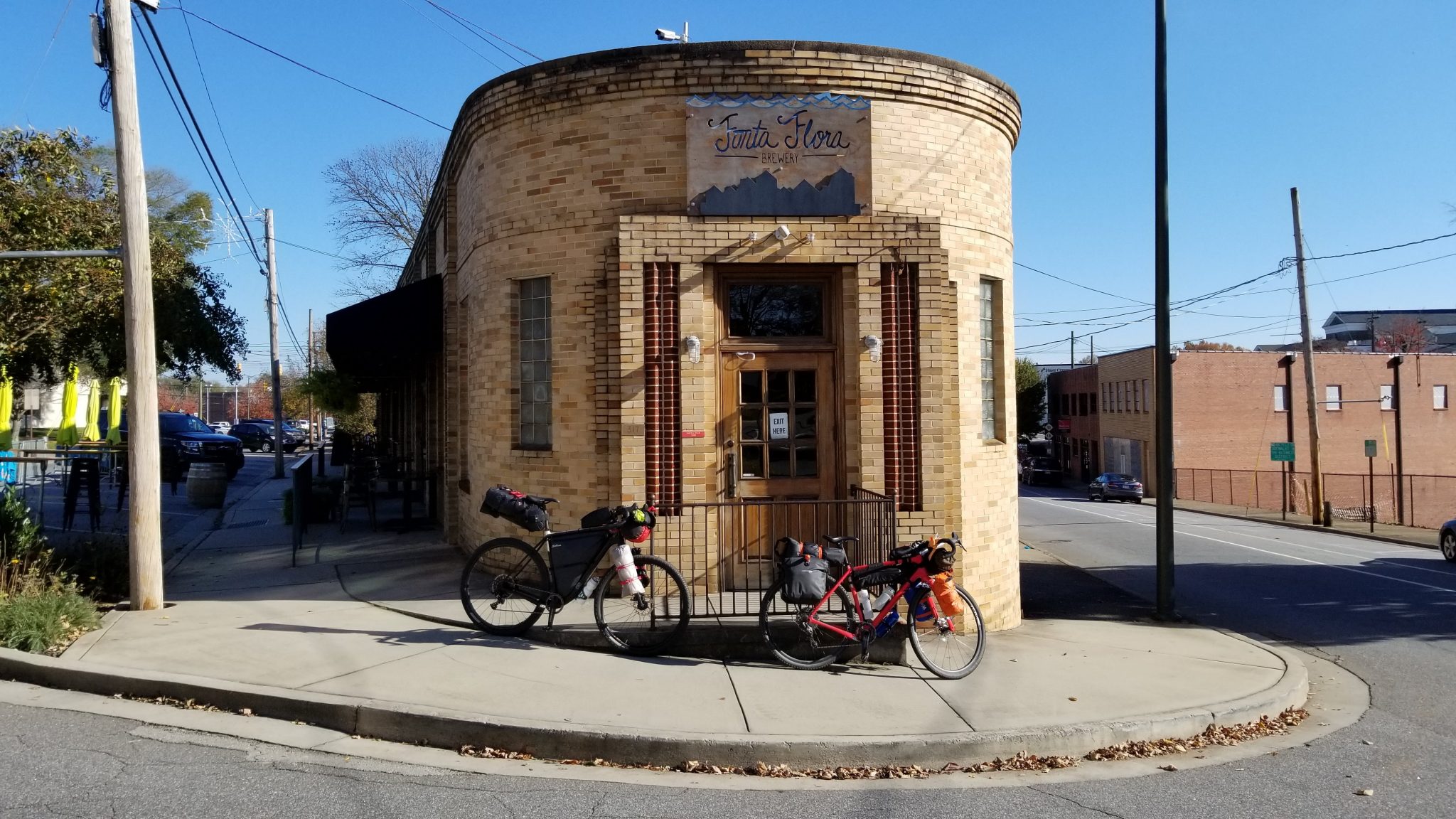
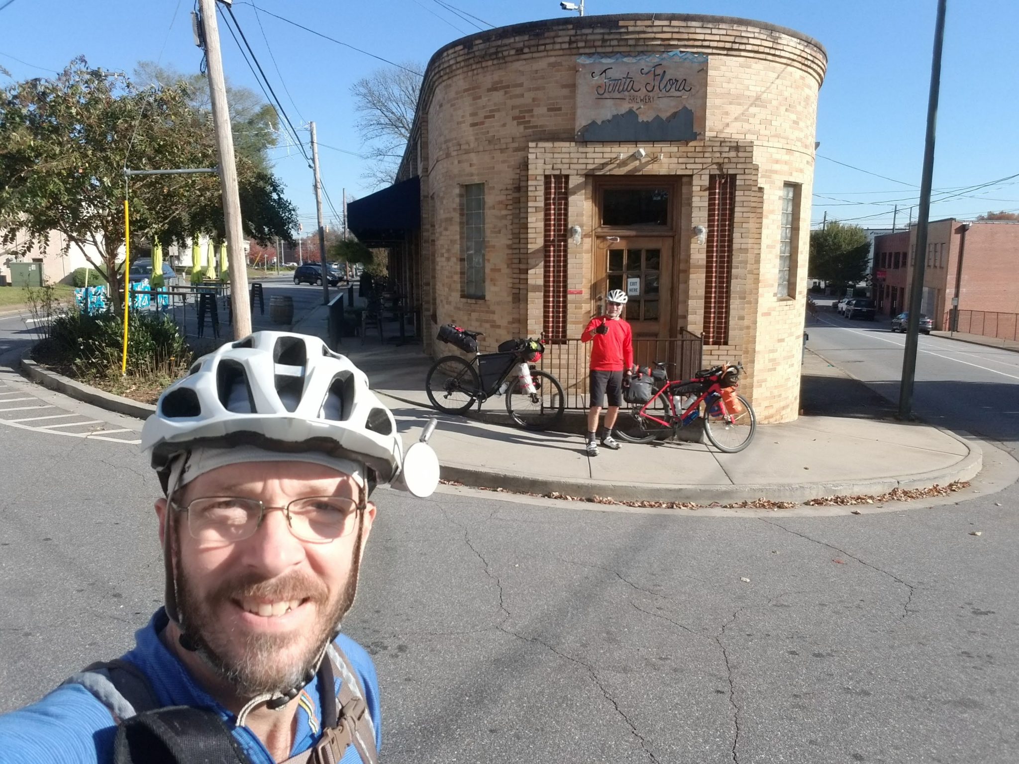
The in-progress Fonta Flora State Trail is marked with feather images. This trail runs right by Fonta Flora and we spotted a few feathers within feet of starting out.
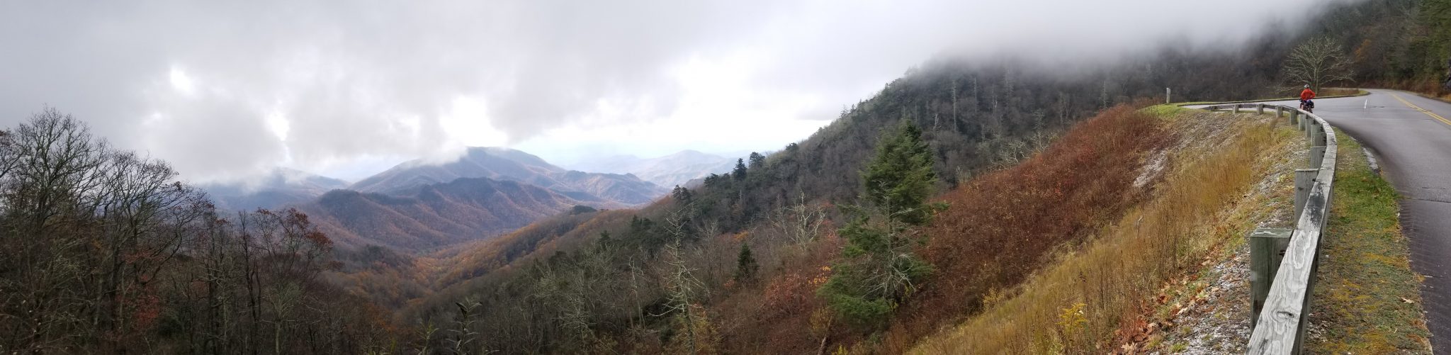
We rode thru the nearby Catawba Meadows Park on a greenway along the Catawba River before heading out of town and into the countryside. We soon climbed high enough to get a glimpse of Table Rock over at Linville Gorge. We would ride on the other side of it the next day!
The rural pavement soon gave way to gravel roads. The rolling hills gave way to steady climbing.

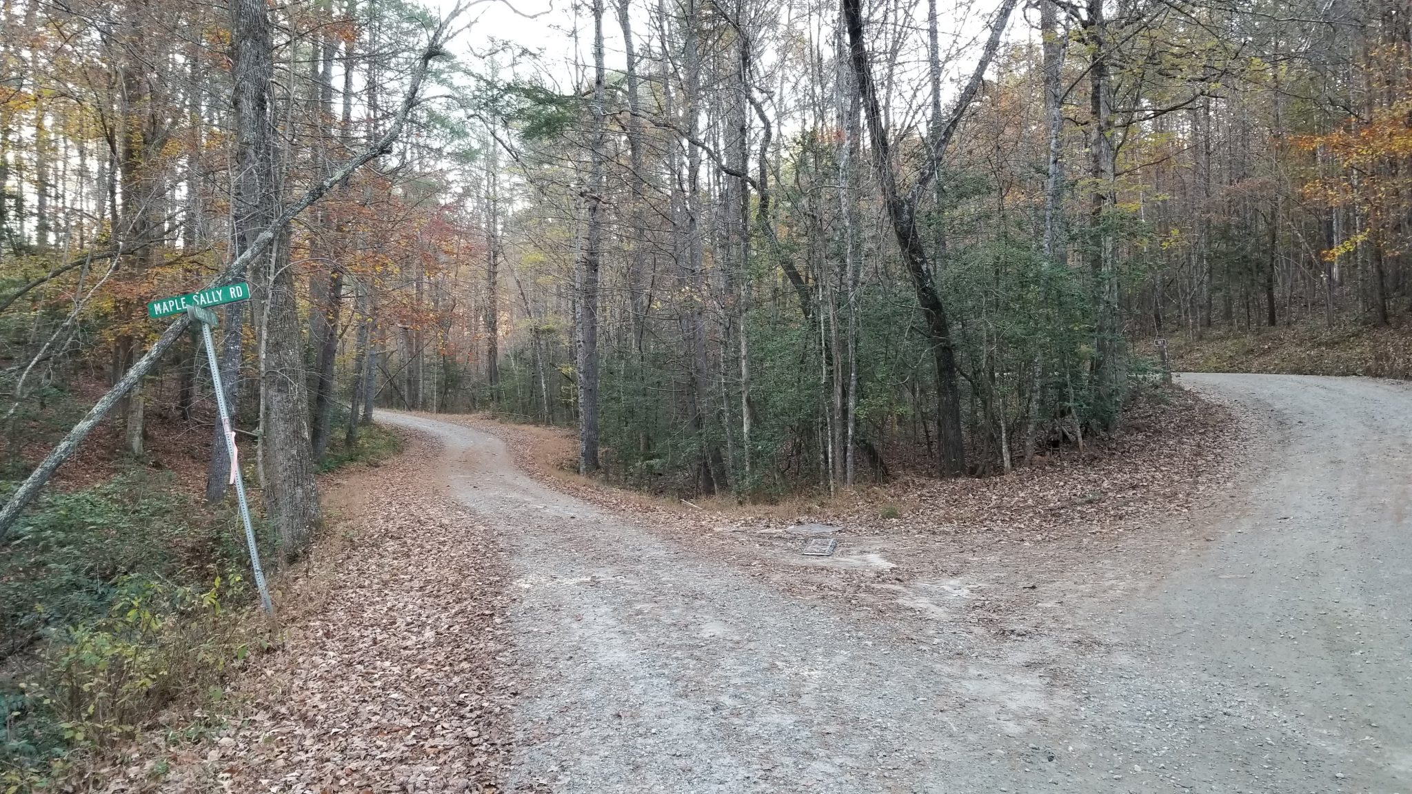
The route included Maple Sally Road. How could one pass up the chance to ride up a 20-mile-long gravel road with lots of rolling hills?!
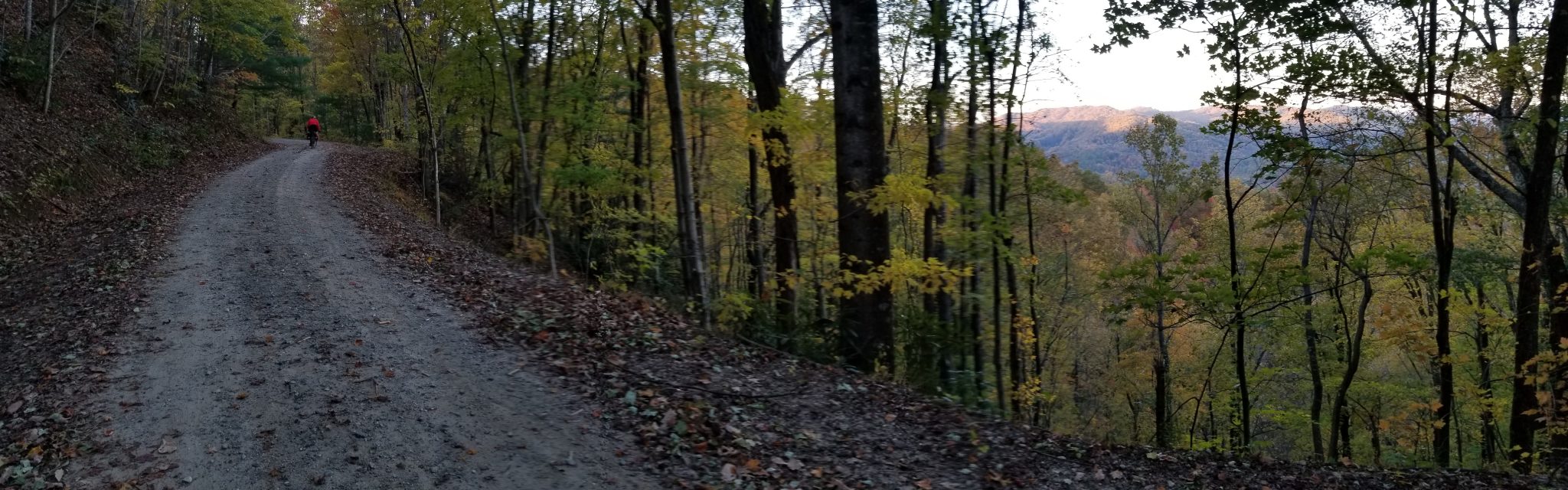
Eventually day turned into night. That happens shockingly early in the day if it's November. We turned on our lights and kept riding.
And riding.
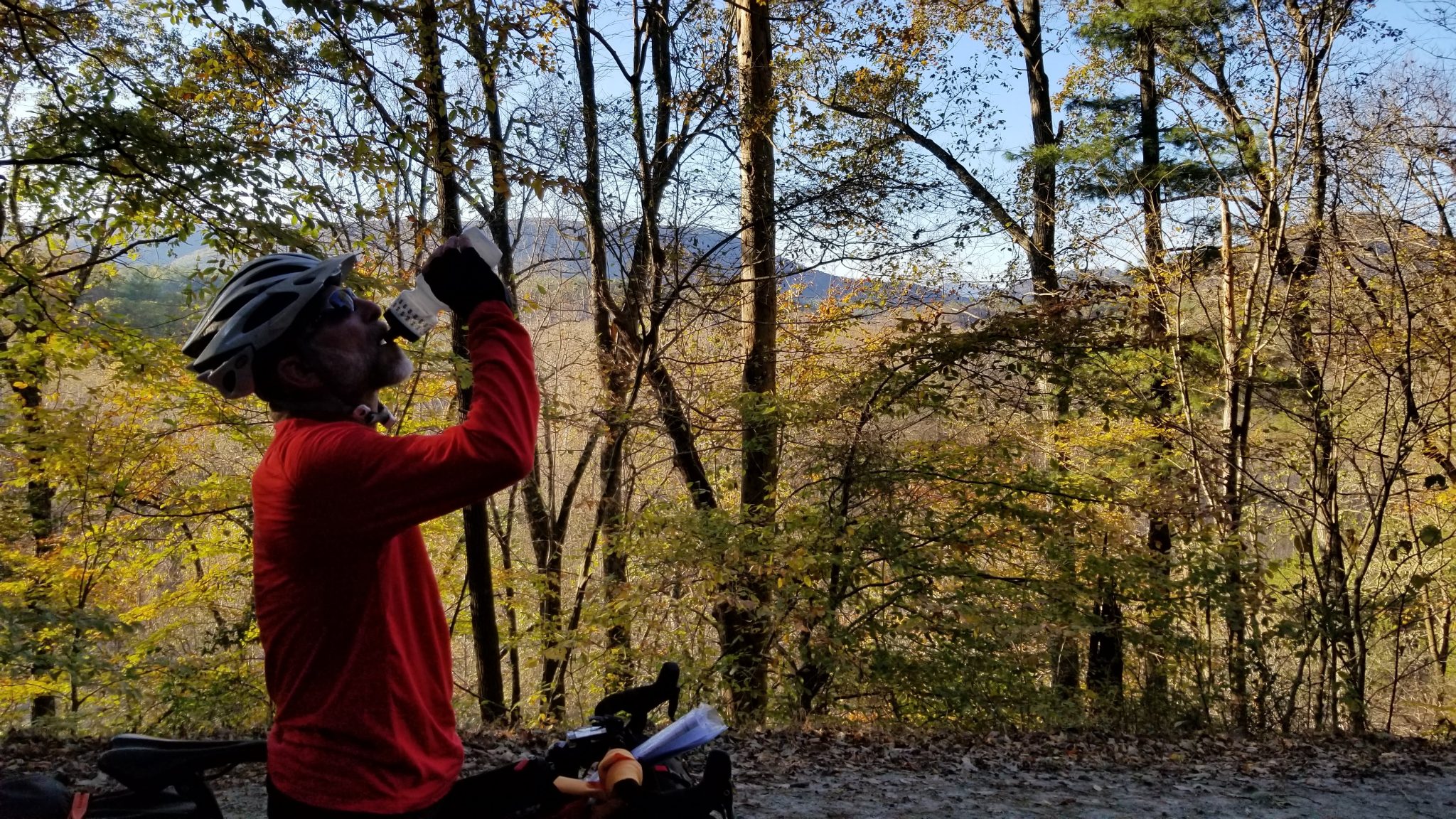
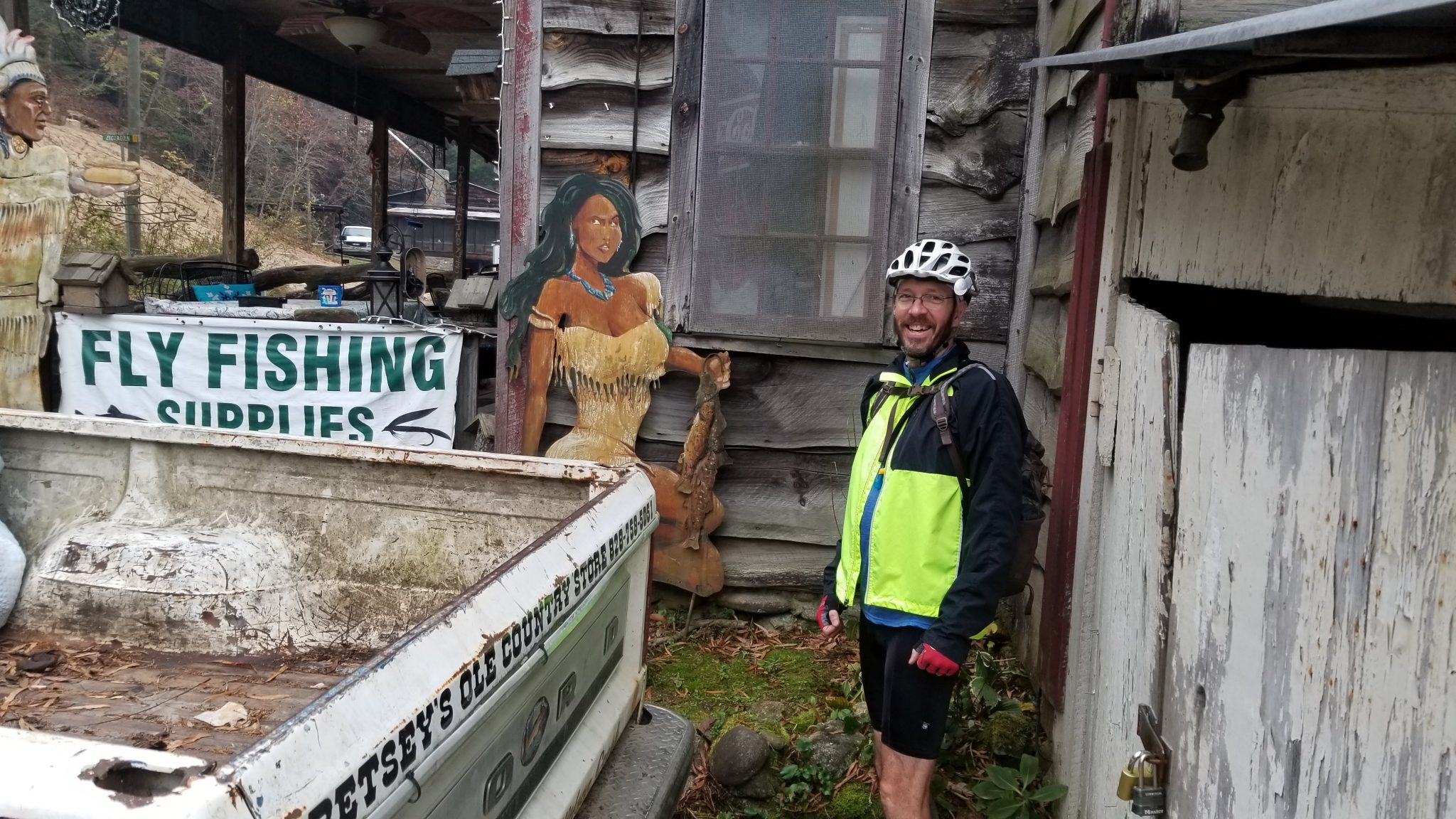
After a long, fast, chilly ride down a mountain into the dirt-road-crossroads community of Mortimer, we reached the welcome lights of Betsey's Ole Country Store. It was a little after 8:30 pm and the temperature was in the mid-40's. I stood at one end of the store and took a pic of Brian and the greeter-dog at the other end.

I was tired, hungry, dehydrated, and slightly hypothermic, which is why I bought a gatorade from the drink cooler and downed it without realizing what that would do to my core temperature. Some involuntary shivering occurred as I pitched my tent and changed out of my sweaty clothes.
The numbers for the day showed I set a personal record for elevation gain in a single ride: 4,173 feet! My previous record of just over 3,200 feet was earned on the Colorado Trail a few years ago.
Saturday
We were up and rolling before 8 am, which was before the rest of the 'town' started moving, except for the Indian princess fishing guide. She was out, but she wasn't moving very fast. I took a few pics of the store before we hit the gravel.

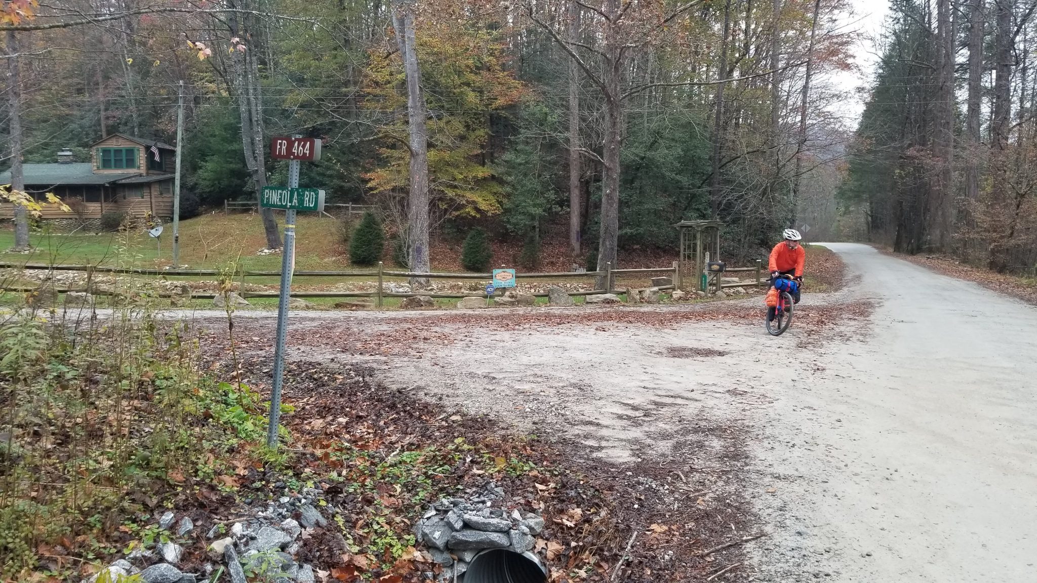
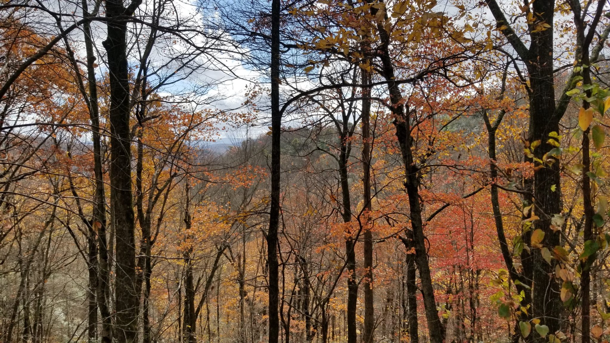
The headline challenge of our second day was a climb up Pineola Road. It was seemingly endless and relentlessly uphill. At least the fall colors on this overcast day were pretty.
We stopped to refuel and have a much-needed break at the church at the top of the climb.

A few miles of pavement and a ride on part of the Blue Ridge Parkway led us to the community of Linville Falls. We saw another group of riders coming out of the Rock House Restaurant as we passed by. We eventually spoke to them and learned they had driven up from Birmingham, Alabama to do the same route we were on! They started earlier than us on Thursday and had ridden beyond Mortimer the first night.
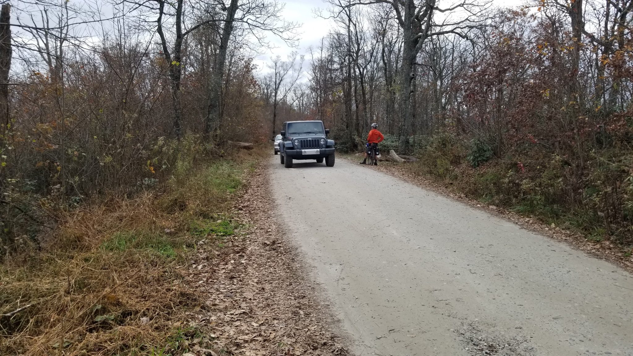
From Linville Falls we turned onto the Kistler Memorial Highway. I had driven this gravel road along the west rim of Linville Gorge many years ago, but I did not remember how steep the climbs were. There was much bike pushing. Fortunately, a steady stream of cars ranging from an extended family of Asia-Indians in their fleet of Alpha Romeos to a herd of Tacoma overlanding rigs to good ol' boys out bear hunting kept our minds off the pain of the challenge at hand. A nice lady runner detailed the number of switchbacks ahead of us as she passed us.
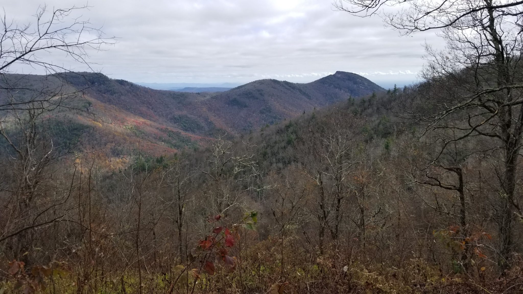
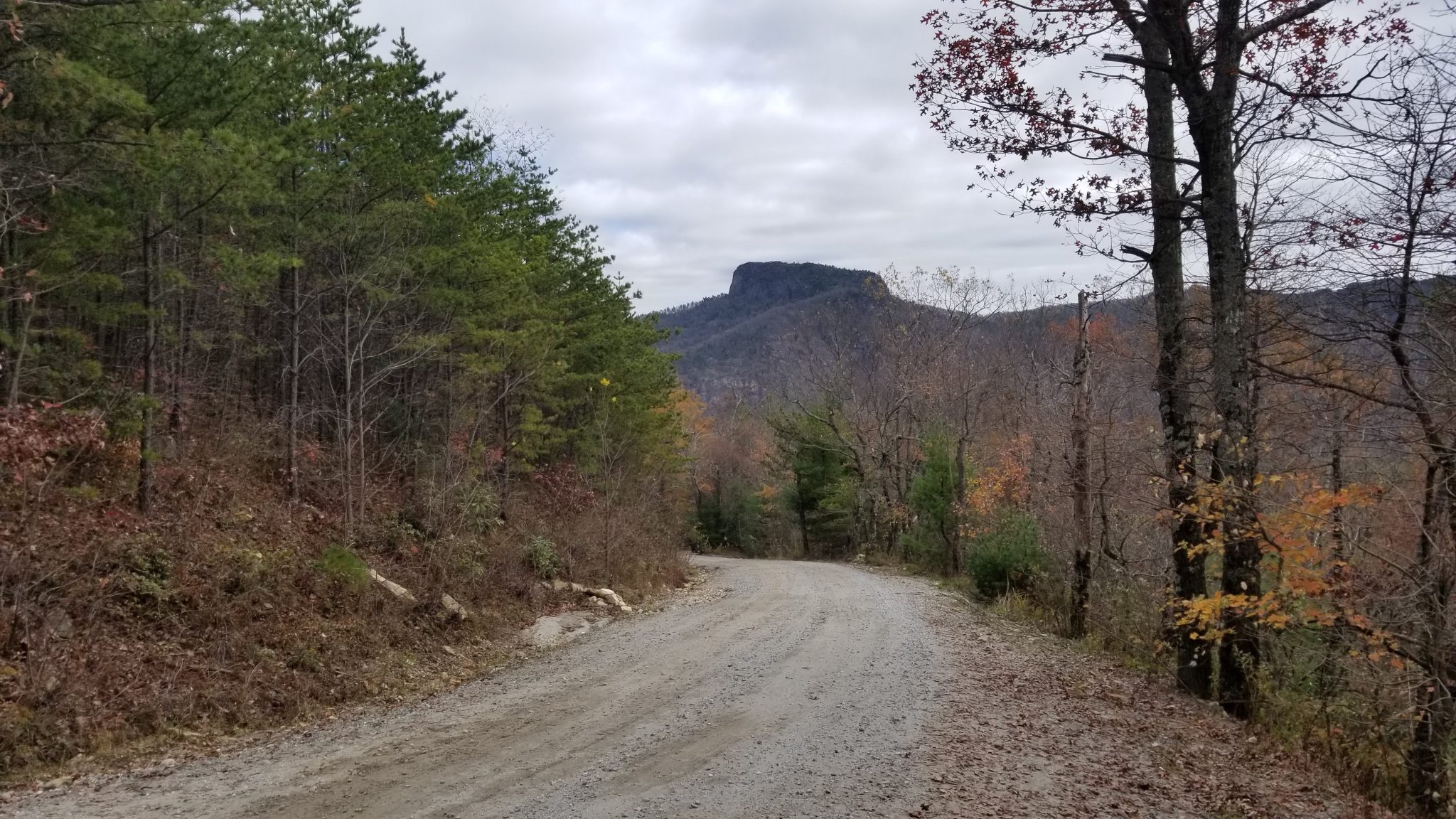
After we passed by the turn for Wiseman's View (there was too much traffic so we skipped going to the overlook), the traffic eased up a bit and we got a good look at Table Rock's west side.
As much as the bike pushing uphill annoyed me, there was a positive downside to reaching the other side of the hills. The thrill of letting go of the brakes and feeling gravity actually pull you forward is hard to describe. It was more than just the sensation of starting to roll. It felt like there was an invisible rubber band urgently pulling you ahead.
We met more cyclists. This was a group of three guys who came up from Florida to ride another route from bikepacking.com, the Two Gorges Gravel S24O.

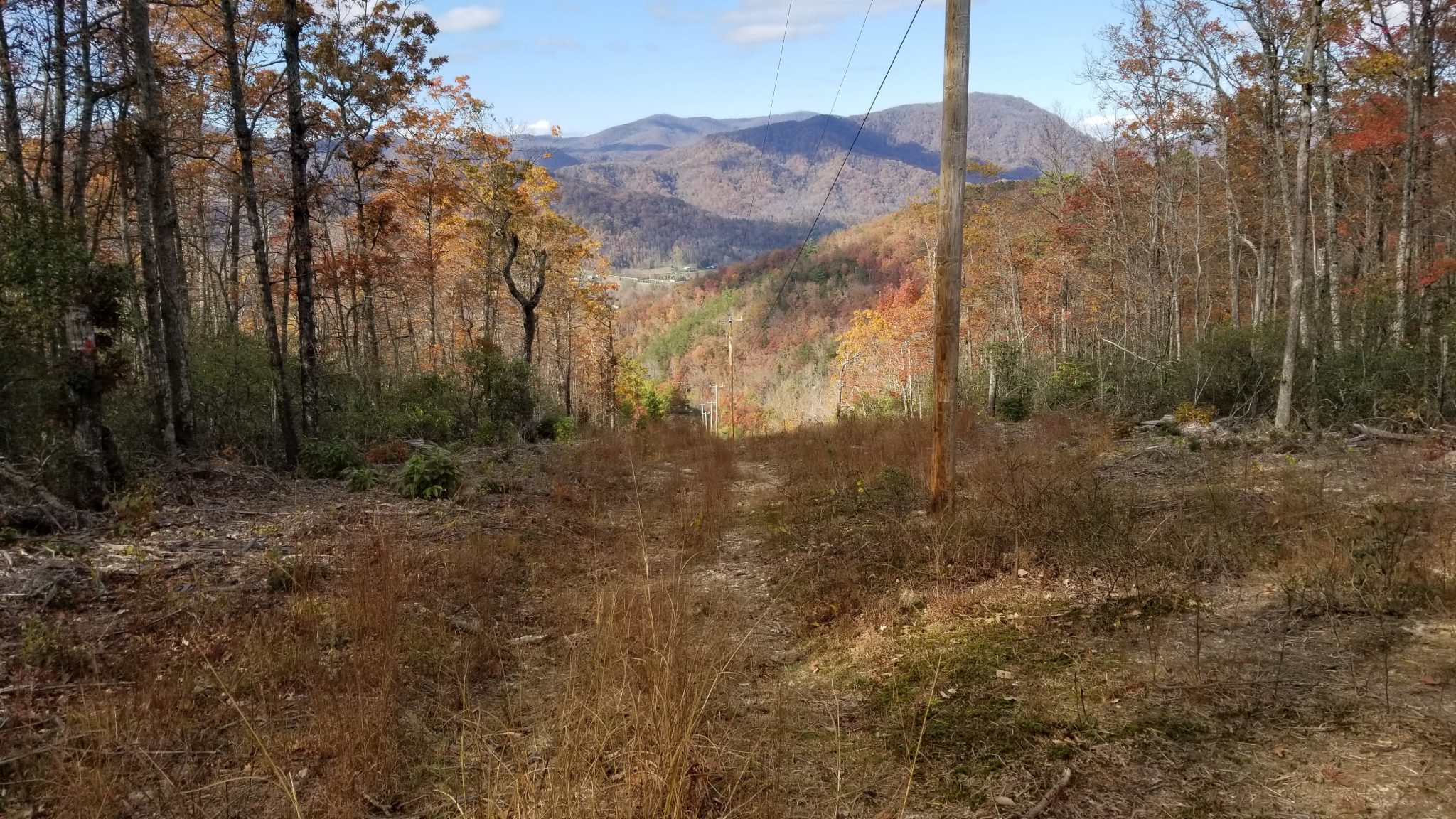
We eventually made our way to the top of another mountain where a cell tower was located. The tower marked the turn onto a powerline clearing that would lead us, in two miles, down to a paved road. I took a few pictures of the upper flat-ish part. I couldn't let go of the bike as we walked down on the wildly eroded, rocky, steep parts to get a picture of that craziness. Brian lost his bar-end mirror somewhere in this section.
More pavement riding led us to a convenience store on US highway 221. It was time for a serious snack. I bought a quart of gatorade, a quart of chocolate milk, a giant honey bun, and a banana. The first three went down before we left the store.

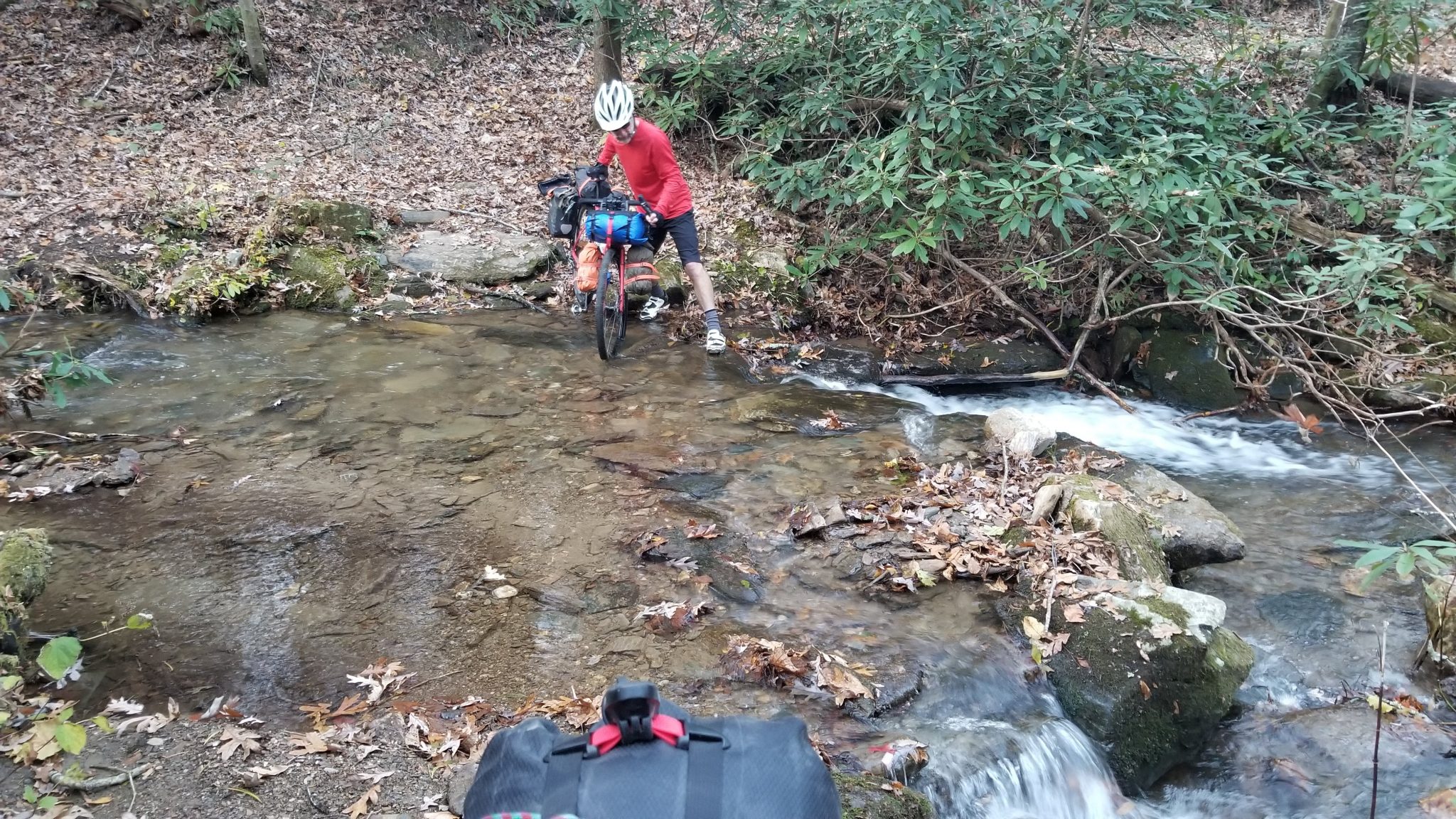
The route then led us (like lambs to slaughter) to a six-mile singletrack trail that I would not have enjoyed even on my full-suspension mountain bike, unloaded. I stopped pushing and cursing enough to take a pic of a waterfall and a stream crossing, but that was it.
We reached highway 70 after dark and rode six miles with lots of vehicular traffic, no shoulder, and fear for our lives. My front light died shortly after turning off 70, so I followed Brian's light for the last five miles to Curtis Creek Campground.
Bad news for us, the campground was full. Good news for us, the Birmingham boys were standing around their campfire and were kind enough to let us pitch our tents beside theirs. Thankfully the folks in the rv beside us turned off their generator around 9 pm.
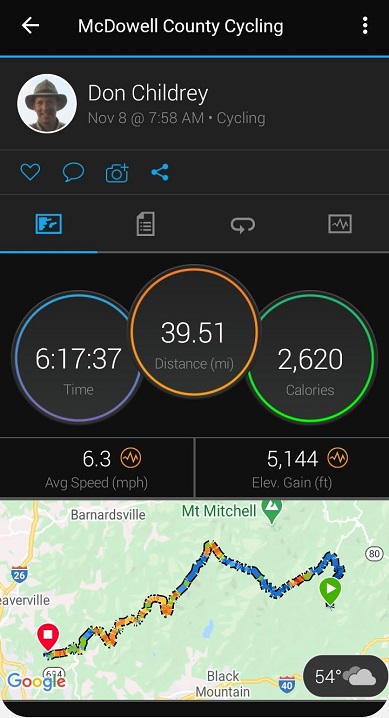
The numbers for the day were impressive. Nearly 12 hours of effort and I smashed my previous elevation gain record with a new total of 6,604 feet!
Sunday
The headline challenge for the third day was a climb up to Mount Mitchell (highest point east of the Mississippi River). It's the big set of humps in the middle of the elevation profile. The Birmingham boys got out of camp a few minutes ahead of us.
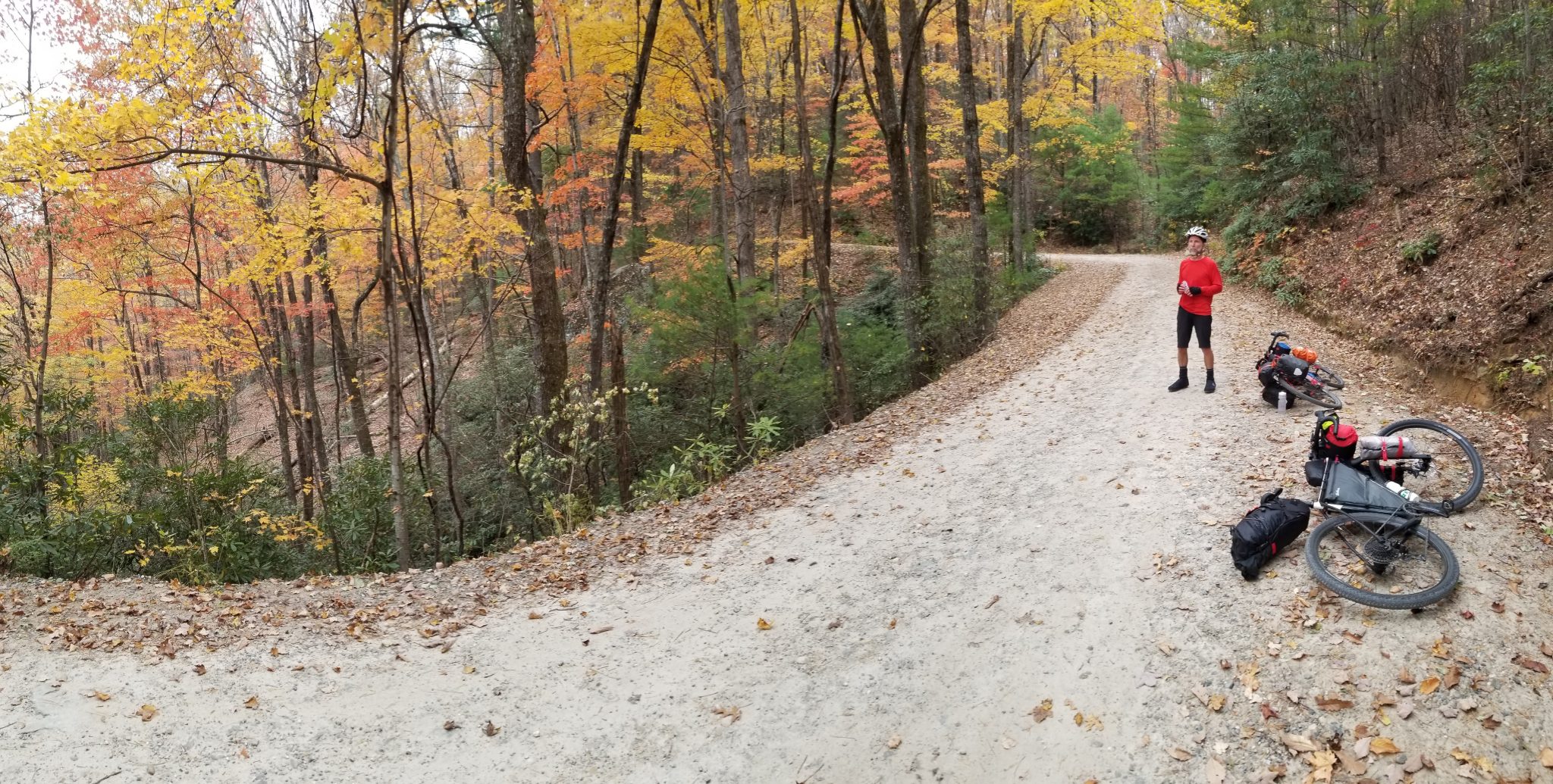
The first half or so of the day's elevation gain was on gravel. We reached pavement after 90 minutes of steady uphill grinding. Then we climbed into the cold, wet clouds and spun our way forever uphill on the Blue Ridge Parkway.
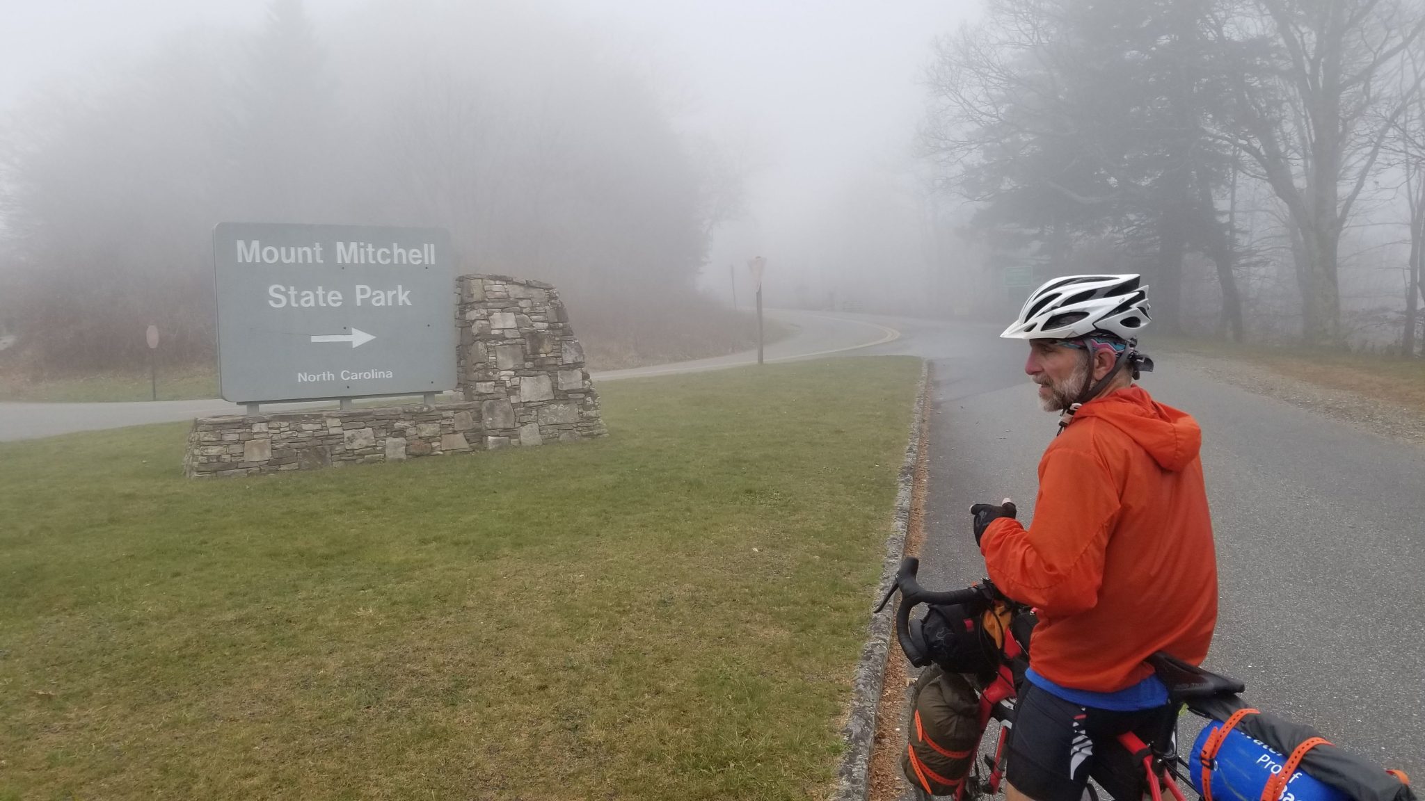
Despite being pretty sure I was going to expire on this section and just keep pushing pedals uphill for eternity, we eventually crossed over the last hill. Then we began a blissfully long descent toward Asheville.
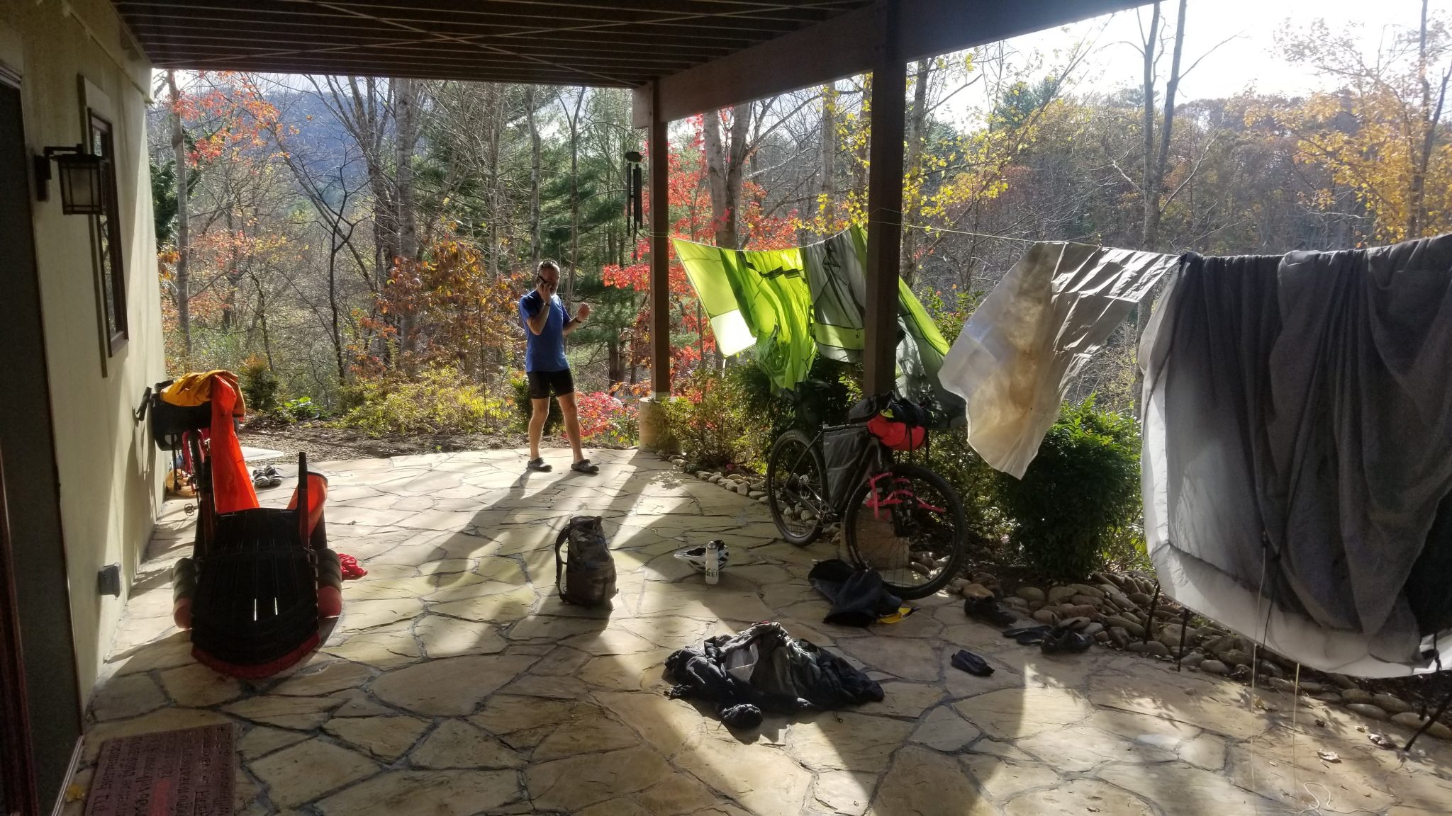
We dropped below the clouds, the sun came out, and we warmed up again. By the time we arrived at our friends Karen and Vic's house, life was good again.
We dried out our heavy, dew-soaked tents and ran all clothing through their laundry. Three days of wearing the same riding clothes in our humid southeast environment was enough. I was starting to leave chamois butter smears on the saddle when I got off the bike.
The numbers for the day did not match the pain and ugh-ness I was feeling on the ride. Some of that dismay may have been due to alimentary canal turbulence - the fuel I was forcing in just didn't want to sit well. Some of it could have been a lack of oxygen. The elevation gain for the day came in at a disappointing second place in my list of records. Only 5,144 feet.
Monday
We were rolling by 7:20 am because we had about 72 miles to go on this final day. We'd also learned a bit more about the route designer's not-so-hidden sadistic streak and really wanted to finish before dark.
Unfortunately, our 4-day window and the choice to stay with friends on the north side of Asheville put us riding through the entertainment district of town early on Monday morning. Nothing was open yet.

The route led us into the Bent Creek area, known for its beautiful trails. But before we reached them, we had to find a hidden trail. After a little backtracking, we found it between two houses in a manicured neighborhood. It was leaf-covered to the point of being nearly invisible. It was the kind of trail local kids would use to cut through to a friend's house, or to sneak into the Bent Creek trails.
The trail it connected us to was covered with wet pine roots. It was probably fine on a dry day with a superlight bikepacking load and gonzo riding skills. After the two ends of my bike slid in opposite directions and nearly put me into a dirt nap, I decided to call upon my map-reading skills and found a less aggravating way out to something we could actually ride.
Leaving any area with 'creek' in the name can only mean more uphills. We found ourselves climbing gravel up to the Blue Ridge Parkway for the third time on this trip. Well, almost. We passed under a bridge that carried the BRP over our heads. But then we had more downhill!

That downhill led to more uphill, of course.
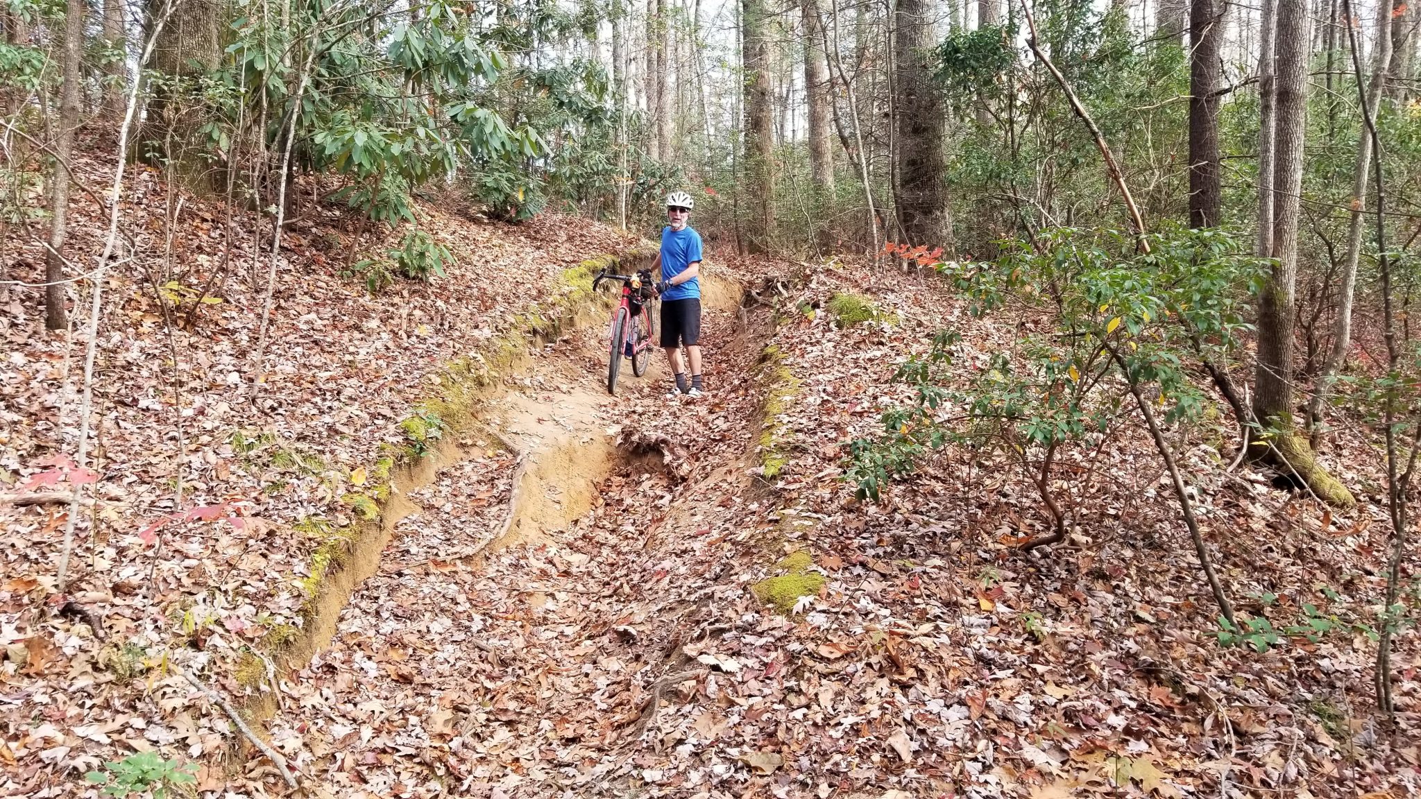
And that led to a piece of something that was once a trail. But the trail had eroded away and we drug our bikes down through the hole that was left behind. I get that this piece of the route might be needed to connect two areas of gravel road that otherwise did not connect, but dang. Even the knobby tracks left by true mountain bikes were accompanied by plenty of marks from shoes, hands, helmets, and other parts that don't usually come in contact with the ground when one is 'riding'.
When I mentioned earlier that interpreting the numbers was key, this is what I meant. When it says 99% rideable for 217 miles, it means well over two miles would not be rideable!!
I won't go into detail about the section of the GPS track that was just wrong. Just know that after a bit of backtracking I used my adventure racing skills to lead us off-trail through the woods in the middle of nowhere until we encountered something we could work with!
By this point, we were getting close to Shining Rock. The weather was beautiful, despite a scare of rain moving in during the afternoon.

We eventually approached the westernmost point on the route and the last bit of climbing. I had already adjusted my brakes due to cable stretch (not unusual on a newish bike but the stretch was accelerated as I tried to decelerate down these mountains). Now my shifter didn't want to let me into my two lowest gears (which I climbed in most of the time). Ugh. I finally stopped and figured out how to make the adjustment it needed.
That's about when we met two women on full-suspension mountain bikes. They tried to give us pointers on which routes down the mountain would be better on 'those bikes'. I was too tired at this point to object to their dissing of our drop-bar mountain bikes. They wished us well and rode their cushy bikes down the mountain out of sight.
We found our correct turn and bounced down until we reached a gravel road. From here we had just over 12 miles of increasingly better roads to go. Most of which were downhills. Before we dropped too low to have cell signal, I called Karen and Vic - they were going to meet us at the end.
All the little waterfalls we had seen along the way had put a Jimmy Hendrix earworm in my head. I had been humming 'Waterfall' to myself for days.
And then we rounded a bend and saw this awesome example streaming down the cliff. I think it's called Daniel Ridge Falls, or Tom Springs Falls, or Jackson Falls, or all of them, depending on who you ask.

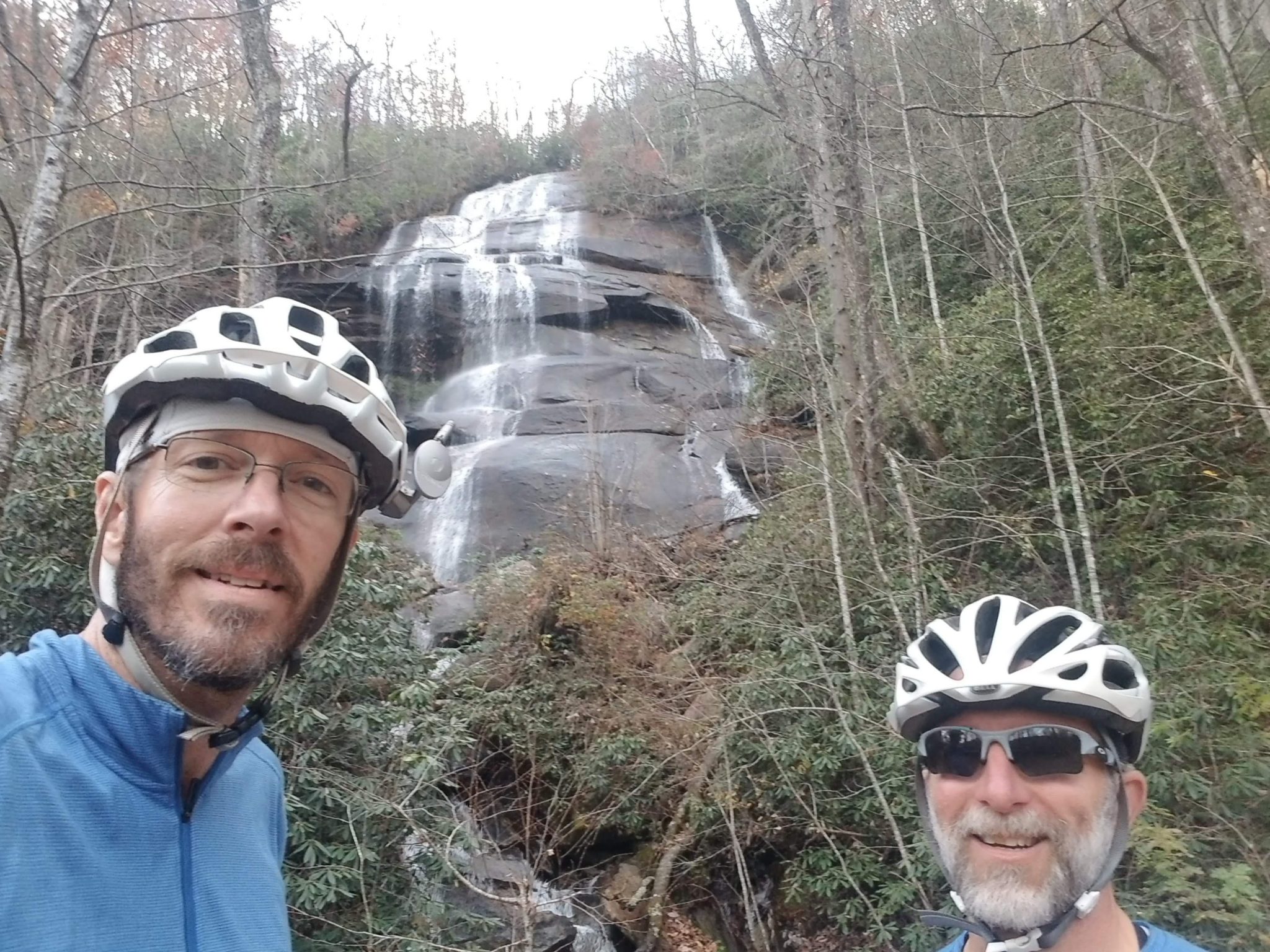
We did stop for pics here (the waterfall is higher than my pics make it look) but otherwise we bombed down the mountain as fast as we thought we could while still staying upright.
We considered bypassing the Davidson River Trail section and staying on pavement, but the two women bikers recommended we ride it. They were right! It was 99% smooth gravel, about 12" wide, running right along the river for about two miles, with enough downhill to pull us along but not so much we needed to brake. We were having too much fun to stop for pics along the way. Awesome flowy riding!
Darkness found us again as we rolled on towards Brevard.
Fatigue and adrenalin and heading-to-the-barn excitement set in. Brian started singing John Prine's 'Paradise':
"Daddy, won't you take me back to Muhlenberg County,
down by the Green River where Paradise lay.
Well I'm sorry my son, but you're too late in asking.
Mr. Peabody's coal train has hauled it away."
I had a new earworm now. As I tried to draft behind Brian I hummed the tune and wished for Mr. Peabody's train to come haul me away as we cranked out the last 8 miles with whatever energy we had left.
When we finally reached town and turned into The Hub, the occupants of the car that had been patiently riding behind us yelled out "You made it!!". It was the two women bikers from up on the trails. Nice to have fans cheer us on!
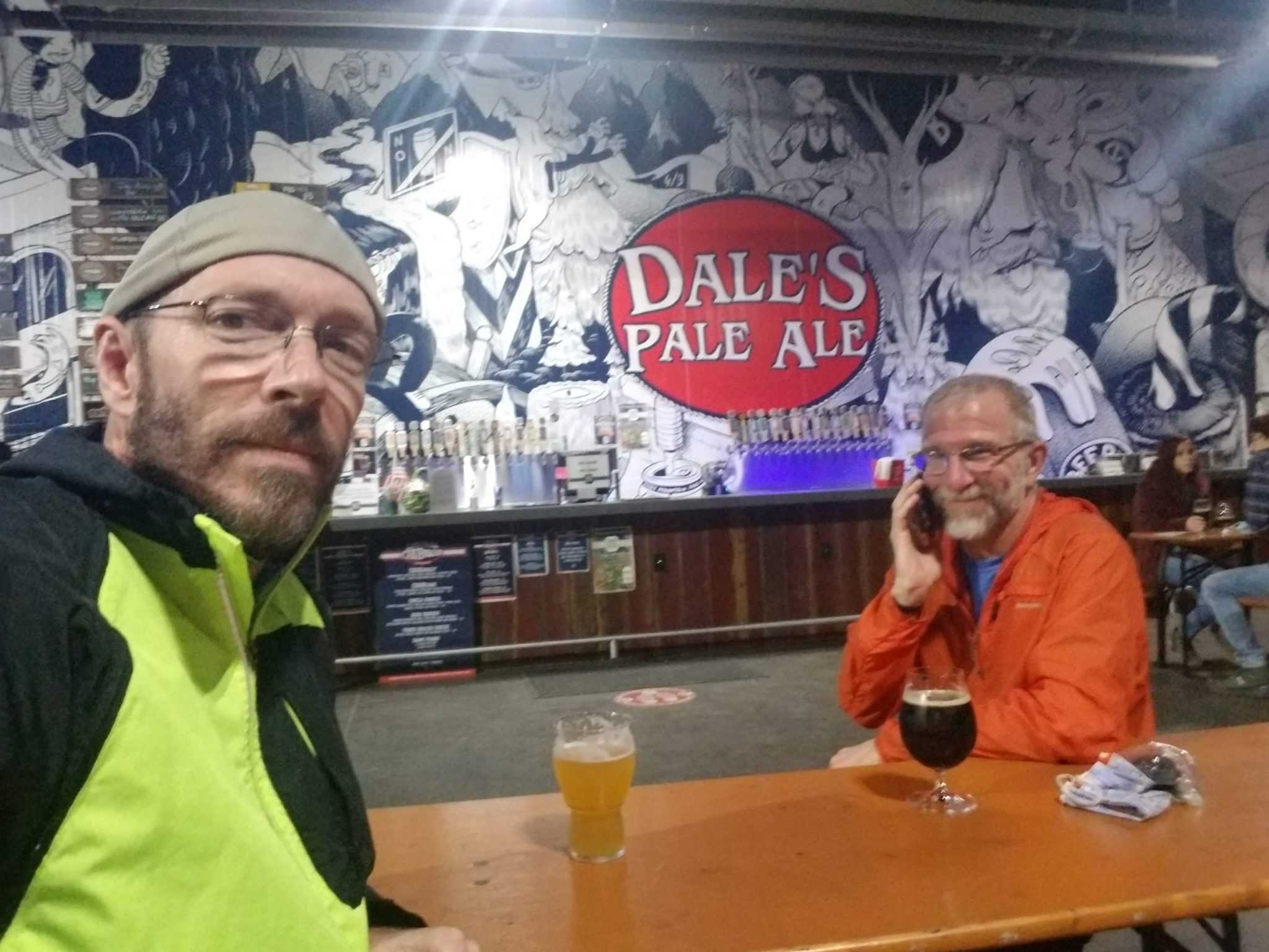
We confirmed Brian's car was still there and then rode the last three miles over to Oskar Blues Brewery, the official end of the route. Karen and Vic met us there for high fives and then ferried Brian back to get his car.
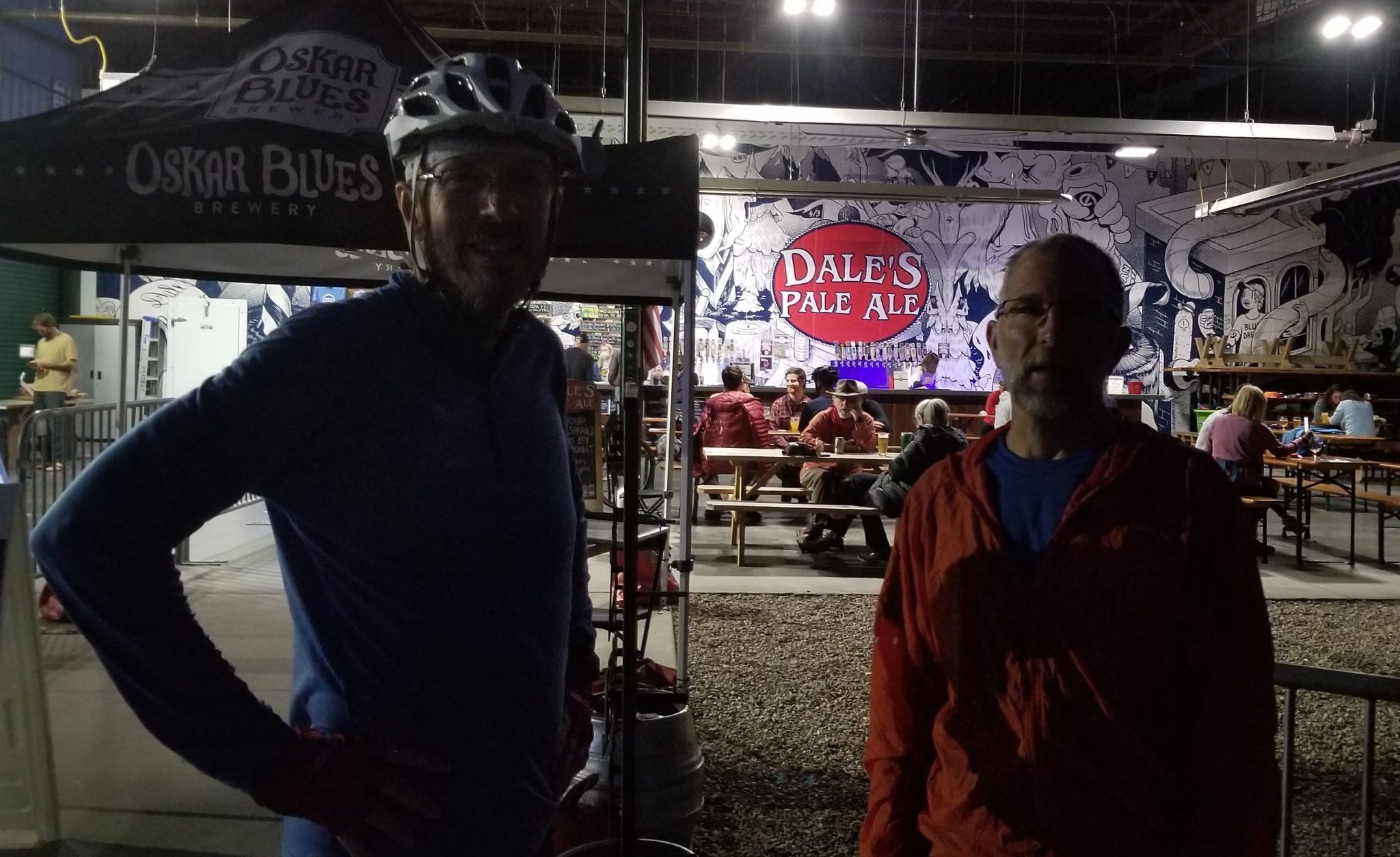
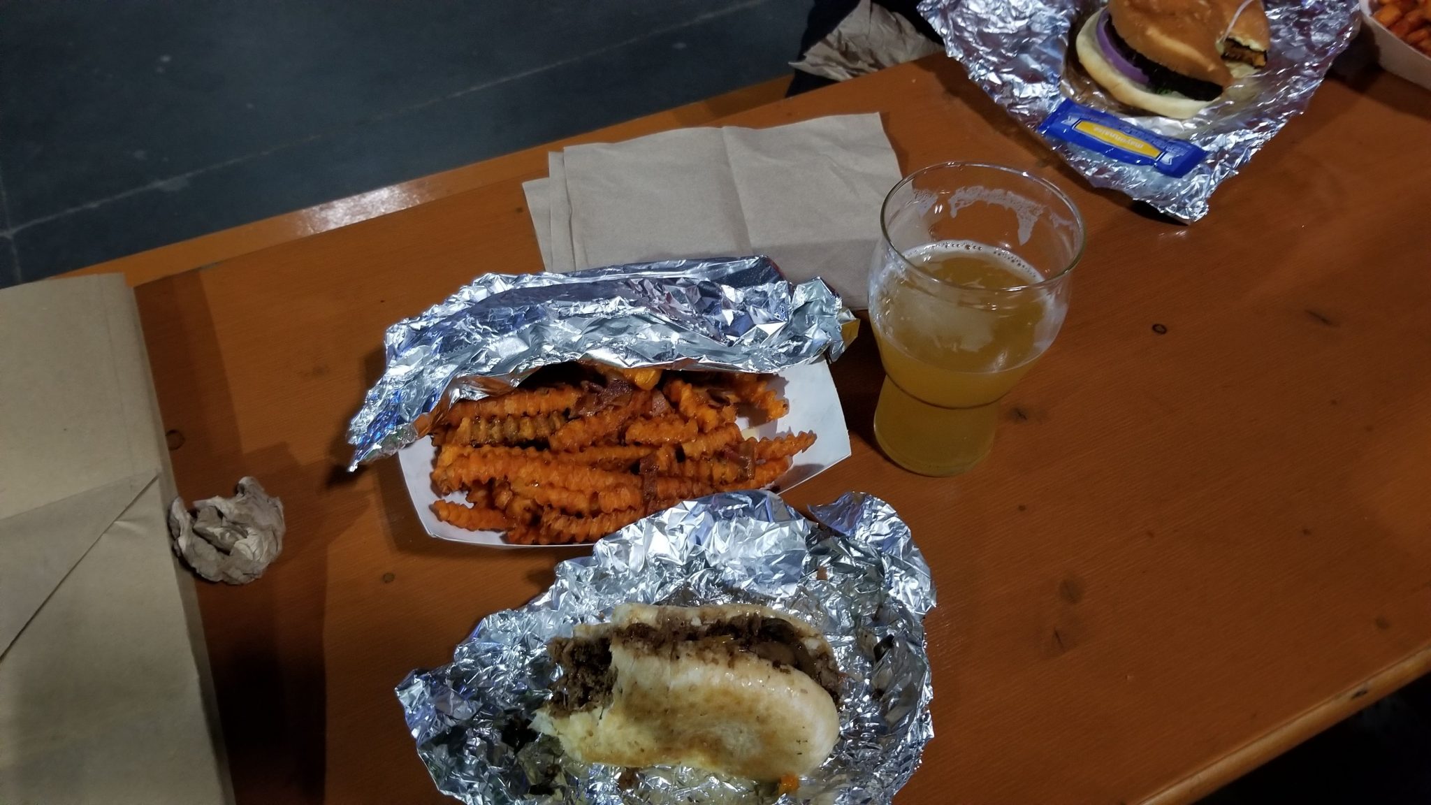
The Birmingham boys had been there just long enough to be on their second round. We grabbed a table beside them and ordered from the food truck. I had a philly steak and sweet potato fries with bacon. It was incredibly delicious!!
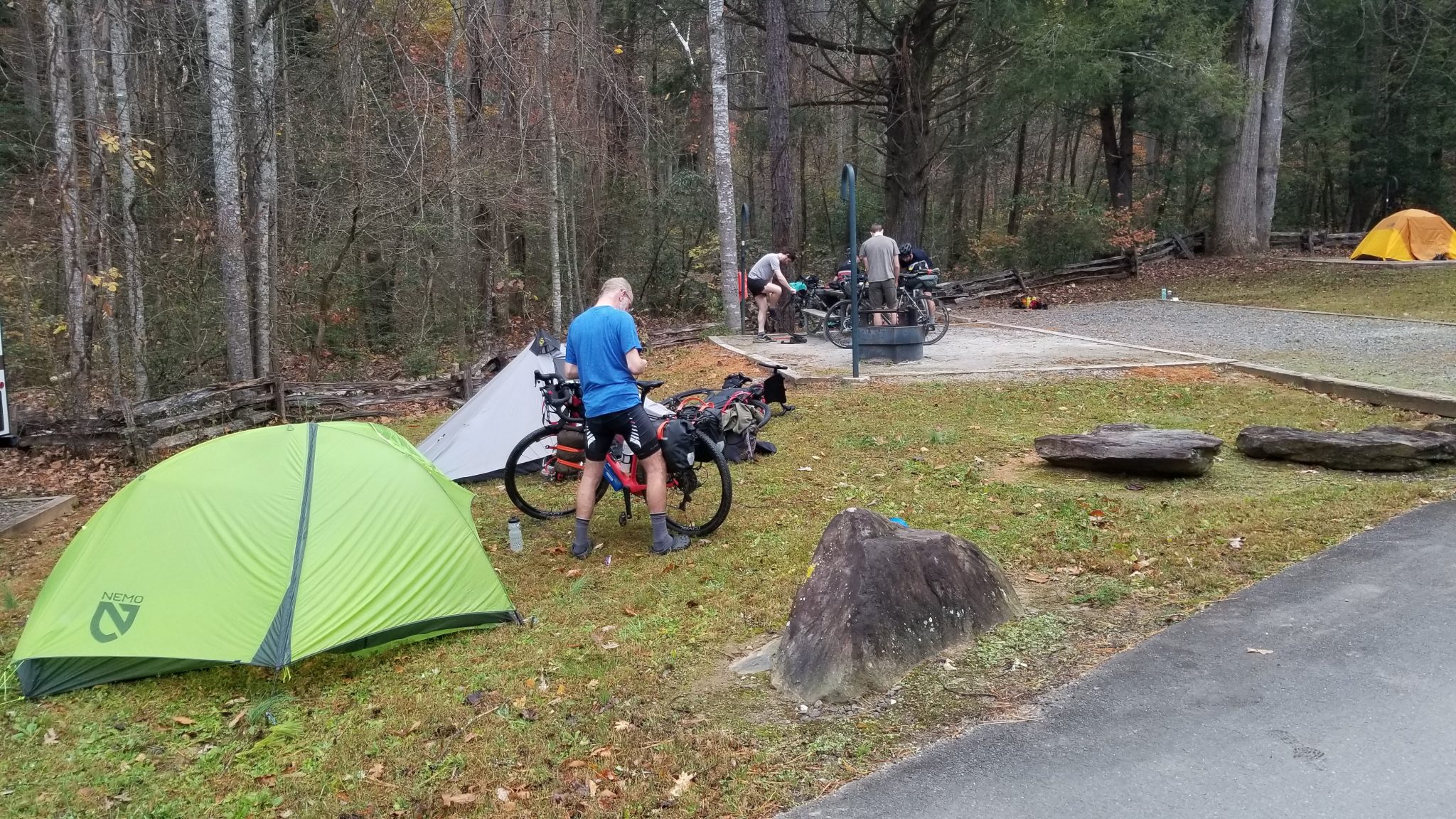
After refueling we drove back to the Davidson River Campground and pitched our tents. The showers were 50% hot, meaning every other time you pushed the button you got scalding hot water. The other times, you got cold water.
The numbers for the day showed a new second-place elevation gain record. Oh well. The mileage for the day ended up less than 72 miles because we cut out the zig-zags through downtown Asheville that would have led us by not-yet-open breweries.

Overall, we rode 214.1 miles and climbed 21,400 feet!
Tuesday
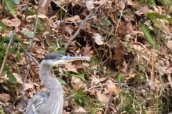
Somewhere around 2:30 am, I heard loud banging at one of the dumpsters in the campground. Maybe someone was tidying up in the middle of the night. I thought I heard a grunt or growl too, but maybe they were just heavy bags of trash.
As we pulled out in the morning fog and rain, we saw 3-4 bags of trash spread out on the ground beside the dumpster. At least the bear didn't stop to lick the chamois butter off my bike saddle!!
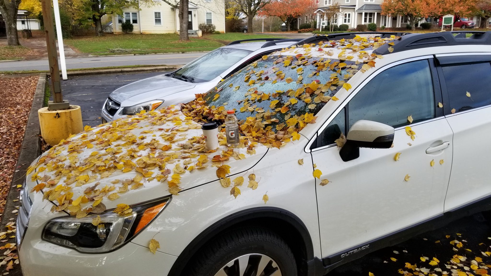
I was happy to see my car still intact where we left it in Morganton, albeit covered in pretty yellow maple leaves.
The next 200 miles went much faster, but boy did my legs hurt when I got out of the car!!!
Lessons Learned
Training works. It's hard to make myself put in the time and effort to get in better shape for a big ride, but it really does pay off.
Too much food. I brought home 2.4 pounds of food. I can lower my total rig weight by taking better advantage of buying food along the way.
Too many miles. While we managed to complete this route in four days, it would have been more enjoyable with less miles and less hours of riding each day. The route designer suggested 4-6 days. I should definitely lean toward the long end of these suggestions if possible!
Bike pushing. I really despised it at the time, though I know it's just part of adventurous riding. I felt much better about it once I knew we were past the unrideable sections. If I ride this route again, I'll take the fairly easy to find bypasses for most of them. Not sure how to apply this to routes I haven't ridden before, but there must be a way!
Difficulty. If a professional rider rates the route as difficulty level 6/10 and says it's 99% rideable, be honest about your ability level. Most riders can probably get through the route, but you may perceive it as much harder and take a lot longer if you're not riding at an elite level. Set your expectations realistically and you won't feel so surprised by the inevitable challenges.
A better bike can help. After a couple years of window shopping, I used this opportunity to get a better touring bike. I wanted a lighter touring bike with fatter tires. My friends at Oak City Cycling in Raleigh helped get a bike designed for riding the Great Divide Mountain Bike Route, a 3,000-mile off-pavement route from Canada to Mexico. The Salsa Cutthroat Apex 1 tipped the scales nearly 15 pounds lighter than my 38-pound steel tourer. I am very pleased with the Cutthroat. It handled the challenges well and I'll feel even better on it once I learn how to handle it properly.
Say yes. When someone asks if you want to go for a bike ride, just say yes. It's very unlikely you'll regret whatever adventure follows!

January 17, 2021
Hi Don
Really great write up of the AGG. A friend of mine and I are going to do it the first week of May. With regard to pushing, justt curious what gearing and what size tires were you running. As far as the difficulty of the powerline and single track, How much of a mountain biking background do you have? I do know what you mean about Logan Watts tending to rate technical sections a bit low.
My friend that I’ll be riding is a sting road rider but not much of a mountain biker.
I’m planning to do on a fully rigid Surly Karate Monkey with 29×2.2 Teravail Sparwood gravel tires. I will run a SRAM Eagle 1X12 32×11-50 drivetrain, full hydraulic disc brakes and a dropper post. We will carry minimal weight as we will probably have a support vehicle and plan 6-7 days.
Any recommendations you could make would be appreciated.
January 17, 2021
Hi John!
I don’t usually brag much so self-rating my mtb skills may be misleading. I have ridden mtb’s since ’89 and currently ride a full-suspension Salsa Pony Rustler. The Cutthroat I rode on the AGG is my first foray into drop-bar gravel bikes. I can mtb most of the trails in the Triangle fairly successfully but I do try to avoid stunts that can send me to the hospital (again). In just the last few years, I’ve ridden parts of the Kokopelli and Colorado Trails in CO, the Whole Enchilada in UT, and the Tahoe Rim Trail in CA. So maybe I’m an Intermediate+ rider?
The Cutthroat I rode on the AGG had the stock 29×2.2 Teravail Sparwood tires set up tubeless, and the 1×11 36×11-42 drivetrain. It does not have a dropper post and just had the TRP Spyre mechanical brakes. I did ride the Cutthroat through most of what I think I could/would have ridden with my mtb, it was just less comfortable. There were parts I would have walked with the mtb too – mostly because there wasn’t really a trail, just erosion gullies, loose rocks and sticks, steep wet leaves, etc.
There were times on the long AGG climbs I would have liked to downshift further, but at some point your speed gets so low you just fall over. Stronger quads would be more helpful than lower gears. Mine were getting much stronger by day 4! It’s hard to prep for those climbs here in the Triangle where our biggest hill climb only gains 100 feet.
If you break up the route to 6 or 7 days and put most of your gear on the support vehicle, you should be fine. Also, you’re going into it with better expectations about the less-rideable parts than I had. I wasn’t really expecting much hike-a-bike so it was an unpleasant surprise for me. The proper attitude is to expect it and then be happy when you can ride more than you thought you would!
There doesn’t appear to be a decent route alternative to the powerline section, but some of the short bits of rough singletrack on the western part of the route have easy gravel or paved road bypasses. Some of the other posted bikepacking routes use these roads instead of the trail.
Hope this helps some!