Please buy the latest edition!
The idea to write the Uwharrie Lakes Region Trail Guide occurred to me sometime around 1993. There was no guidebook for the Uwharries available at that time. I had spent many weekends hiking and backpacking there as a Boy Scout, and my young family was now living there. These trails were literally in my backyard, so I decided I could write a guidebook for the Uwharries!
A lot of my free time over the next five years was spent pushing a measuring wheel down trails, drawing maps, writing up descriptions, finding a willing publisher, and working through numerous edits.
One of the unique features of the book is the inclusion of both Trails and Trips. For each Trail, I documented its details and history. But I also created likely Trips that trail users might take using parts of multiple trails. I had often found myself piecing together details for a custom trip route from separate sources. I thought my readers would like to have that already done for them!
I worked out a deal with my publisher where I would do the page layout work instead of him having to hire someone else to do that part. This created more work for me but also earned me a slightly larger royalty on each book. I even took the pictures that appeared on the cover.
I used Corel Draw to create the maps and profile charts, and Adobe Pagemaker to layout each page. The final version was delivered to my publisher as a big stack of laser-printed, camera-ready pages.
After five years that seemed like forever, I finally held a copy of my first published book in my hands. That was pretty cool!
Uwharrie Lakes Region Trail Guide (First Edition)
The first edition was published in 1998.

All of the copies in that first print run were sold by 2010. Somehow, the slides and photographs used for the cover were misplaced, so a new cover had to be designed for the second printing. The publisher just used stock photos for the new cover. These copies were printed in 2010 with a new cover but the same interior pages.
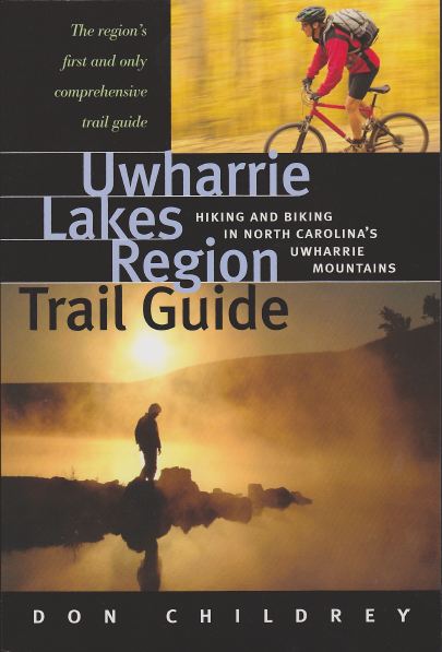
The basic details of the first edition were:
- ISBN-10: 0964369834
- ISBN-13: 978-0964369832
- Paperback, 6″x9″ format.
- 302 pages.
- 185 maps and graphs.
- Published in 1998 by Earthbound Sport, Inc.
- Second printing in 2010.
Uwharrie Lakes Region Trail Guide (Second Edition)
By 2008 it was already apparent that major revisions were needed. New trails were being opened and existing ones had been rerouted. I started gathering data for a new edition but quickly realized I also needed new tools and methods. I switched to using GPS instead of a measuring wheel. To be consistent, I needed to rewalk all of the trails again. I also decided to include additional trail systems in the region to provide a more comprehensive reference book for trail users.
Some of the software I used to create the first edition wouldn’t run on my newer computer. Some of the files couldn’t even be opened with newer software. I ended up having to recreate all of the maps and profile charts from scratch. To avoid retyping all of the text, I sawed the binding off of a copy of the first edition and scanned each page using OCR (optical character recognition) software. With my slow typing skills, editing those results was quicker than retyping everything!
For the second edition, I used the Adobe Creative Suite of software tools (version CS4) to build the maps and profile chart and layout the pages. I also took the pictures for the front cover of the second edition. When I finished all the edits, I created a single PDF file of the final version and emailed that to the printer.
In July 2014, after six years of effort, the second edition was published, with 223 more pages than the first edition!
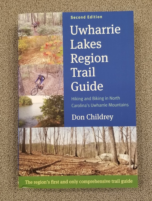
In 2020, the publisher switched to a new printing service. Copies from the new printer have a matte finish cover, whereas the previous copies had a glossy cover. The newer print runs are also on thicker paper stock, making the book a few ounces heavier and a little bit thicker.
The basic details of the second edition are:
- ISBN-13: 978-0-9915802-0-0
- Paperback, 6″x9″ format
- 525 pages
- 215+ miles of trail
- 113 named trails
- 95 multi-trail trips
- Published in 2014 by Earthbound Sports, Inc
Corrections and Updates to the Second Edition
January 2021 Update – The Walkers Creek Trailhead was opened in January 2021. The Uwharrie Trail route was shifted onto new trail leading to this new trailhead, reducing the road walk in Section 2. This PDF file contains new maps and profiles for Uwharrie Trail Sections 2 and 3.
Uwharrie Lakes Region Trail Guide (Third Edition)
Yes, I’m already thinking about a third edition. As of 2021, it looks like I can still work with the digital files from the second edition (whew!). But I’m pretty sure another edition is still many years away. I want to wait until the Uwharrie Trail route corridor is fully rerouted onto public land (and the road walk eliminated). I will need to revisit all of the other trails and make adjustments where needed. And I’m already working on a couple of other books, so the third edition will have to wait in line!