Thursday, July 9th
On Thursday morning we woke to the sound of chirping birds and a nip in the fresh mountain air.
The long road in from the night before was our way back out this morning. The rocks and gravel on the unpaved road made the bikes bounce around a lot, so we decided to air down the tires to 28-30 psi to make the ride out more enjoyable.

We stopped at the ranger station to pump them back up with my portable compressor. The little compressor works, but it takes a while. Brian had a problem with the valve on his front tire sticking open and letting the air out. We thought maybe one of the Dynabeads was getting caught in the valve since he didn’t have the special valve cores with a filter. I used my valve core tool to remove it and put it back in. That appeared to have cleared the problem and it inflated and sealed fine after that. We also topped off our freshwater supplies from the now-open ranger station. This whole process took us about an hour.
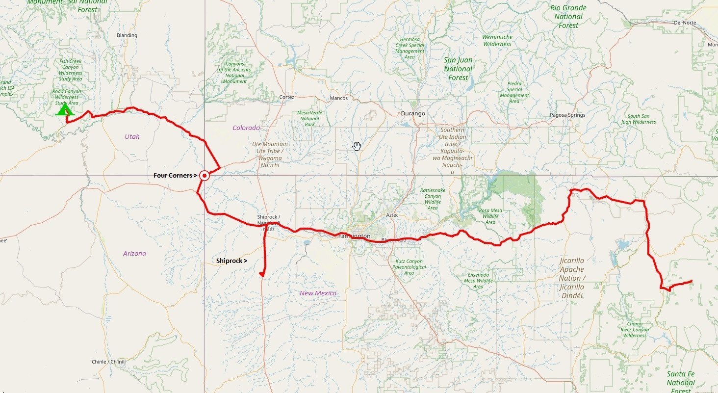
Once back on the road we followed US 84 north to Chama, NM, and then turned west on US 64. The section of 64 over to Dulce, NM was pretty nice, with high cliffs and forested slopes on either side of the road. It also had some nice curves to carve.
We stopped in Dulce for gas and decided to buy lunch from a Native American roadside vendor. Even though we were in Jicarillo Apache territory, we had a “Navajo burger”. It was frybread with two burger patties, cheese, lettuce, and green chilies. It was delicious.
While we were eating, an RV pulled up to buy pinon nuts from the vendor and we chatted with them for a while. They were a retired couple from Idaho. He used to be a game warden in NM and knew the area well. She still had her hair in curlers and loved pinon nuts. She bought about $40 of nuts while there. Lots of other locals came up for “Navajo burgers” while we hung out, so they must be pretty popular.

Continuing west on 64, the next section was even nicer. Lots of curves. The road passed through shallow, open valleys with lots of creeks and forested hillsides. I think we were pretty high in elevation, as you couldn’t see anything beyond the hills that lined the valleys.
We eventually dropped from the higher valleys down into more desert-like terrain, with rockier ridges and sparser vegetation. This section wasn’t quite as nice, and it eventually led us to the oil fields east of Farmington. Most of the pickups and hauling trucks had a flagpole with a red and a white flag on it. We never figured out why but guessed it had something to do with the oil business. There were wellheads everywhere. The further we got into Farmington and west of there, the hotter and more desert-like the area became.
We finally reached the town of Shiprock, NM. We could see the namesake butte to the southwest. I turned southward on 491 hoping to get a better picture of it (and because I missed a turn for 64) but we eventually turned around and continued west on 64. We got a few pics of Ship Rock from 64.

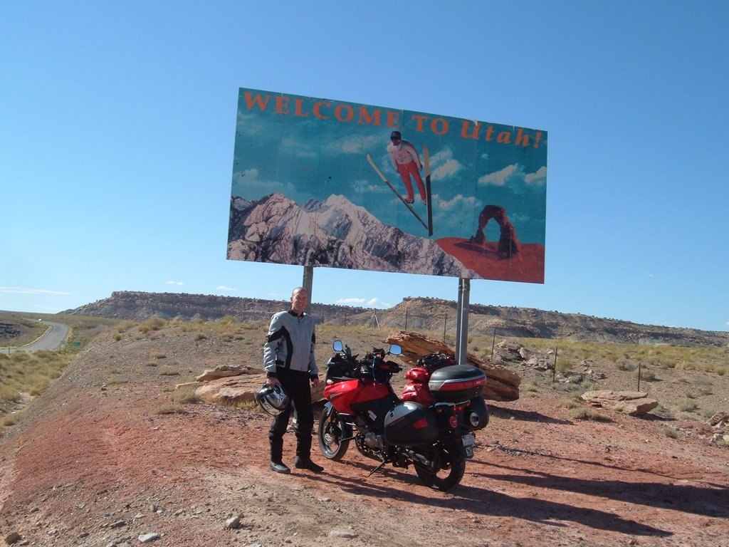
We crossed into Arizona after going past Ship Rock.

A few miles into Arizona we turned right off of US 64. This intersection, in Teec Nos Pos, AZ, is actually the western end of US 64. This bit of map geekiness is mostly interesting to me since my house is only a half mile from US 64 back in NC.

A few miles up US-160 took us back into New Mexico and then brought us to one of our primary destination goals for this trip – the Four Corners Monument!
This spot is out in the middle of nowhere on a flat, desert ridge. It’s surrounded by a circle of plywood booths where vendors set up to sell you trinkets and stuff. We bought a few more gifts here and stood in line to take our pictures at the monument.


The Four Corners Monument is the only point in the US where four states touch. The point also lies on the boundary of two Native American governments; the Navajo Nation and the Ute Mountain Ute Tribe.
We also bought snow-cones while we were there. It was nearly 100 degrees and we had another hour of riding to get to our planned stop for the night in the Valley of the Gods. As we left the monument, we actually rode through the corner of Colorado, but I had a truck bearing down on us from behind so we didn’t bother trying to get a picture of the sign. We knew we’d be going into Colorado again later, after spending some time in Utah.
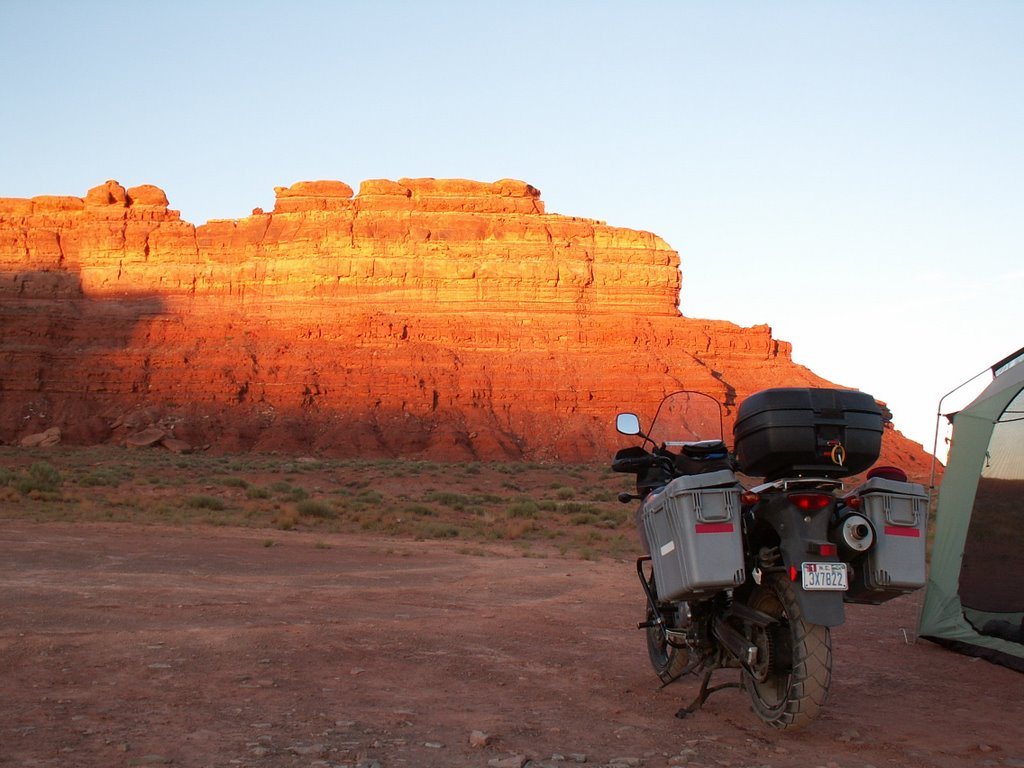
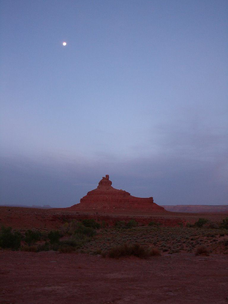
Valley of the Gods lies on BLM land and contains a 17-mile-long unpaved road winding through a valley full of interesting sandstone buttes and rock formations. The north side of the valley is formed by the side of a high mesa. To the southwest, we could just barely see the buttes of Monument Valley. (Valley of the Gods became part of Bears Ears National Monument in 2016.)
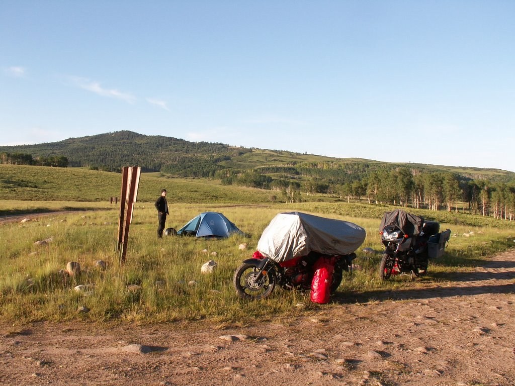
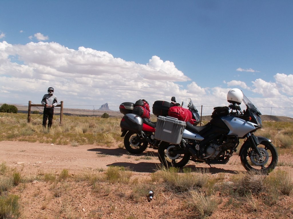
We only saw one other person in the valley, a photographer taking pictures. About 3 miles in, we stopped at a well-used pull-off campsite and checked it out. We had our own water, so all we really needed was a flat spot to pitch our tents on. There was no shade at the moment, but we knew the sun would be setting behind the mesa in less than an hour. We were tired of riding and tired of being swaddled in our protective riding gear. Once we stopped, it was easy to convince ourselves that this site would work. We quickly changed to shorts and sandals and started setting up the bug tent. There was a decent wind here, so we had to use the bikes as a windbreak to help keep the big mesh tent from blowing over.
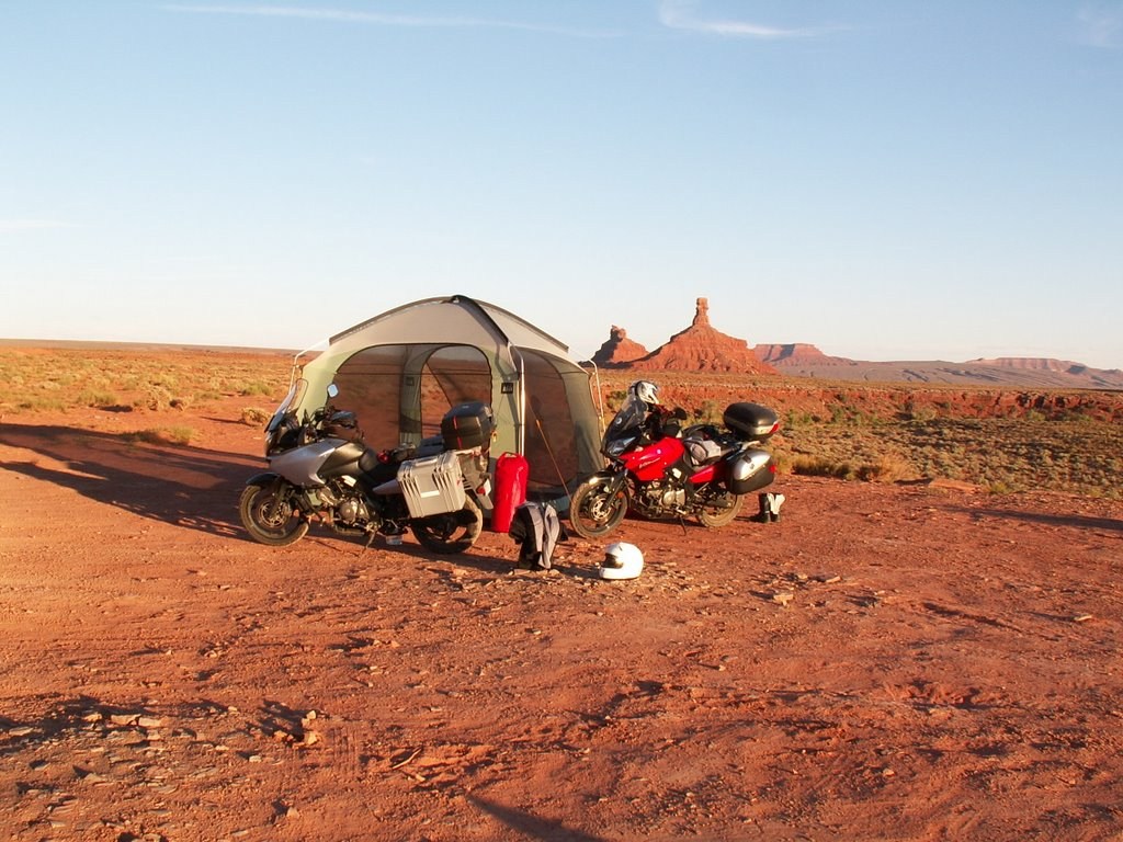
Amazingly, even though we could not see any human development around us, we had a decent cell signal here. We called home and checked in with our wives. As the sun set and the moon rose, we took lots of pictures.
| Mileage | |
| Today | 300.1 |
| Trip Total | 2,409.7 |